Heavy fighting took place along the eastern approach to Atlanta. Wheeler’s Cavalry were engaged with Blair’s XVII Corps along area near Moreland Ave. Cleburne was in a desperate fight with Leggett’s 3rd Division of Blair’s XVII Corps, for control of “Bald Hill”. A prominent hill within artillery range of the city. Now located at Moreland and I-20, most of the hill, now called “Leggett’s Hill”, is gone due to the construction of I-20.
After his defeat at the Battle of Peachtree Creek on the 20th, Hood has started shifting his forces further to the east in an effort to engage McPherson and Schofield. In an attempt to attack McPerson’s left flank and his rear, he sends Hardee on a 16 mile long night march heading south and east to link up with Cleburne and assault the Federal flank east of Atlanta. Hardee begins his marches down Peachtree Street near Peachtree and Spring St. He heads south through Five Points and turn in a south easterly direction and moved to a point near the north side of the South River. Here he turned up the Fayetteville Road and the move onward to Bouldercrest Road. As he turned north on Bouldercrest he reached a fork in the road and divided his forces, with Cleburne’s and Maney’s Divisions taking Bouldercrest to Flat Shoals Road and then Walker and Bate’s Divisions moving up the Fayetteville Road.
Two divisions of Wheeler’s Cavalry, after roughly an hours rest from the days intense fighting, are sent way around the Federal left flank in an attempt to reach the Federal rear in Decatur and destroy the McPherson’s wagon trains.
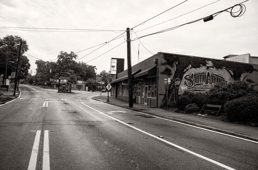
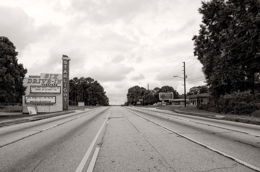
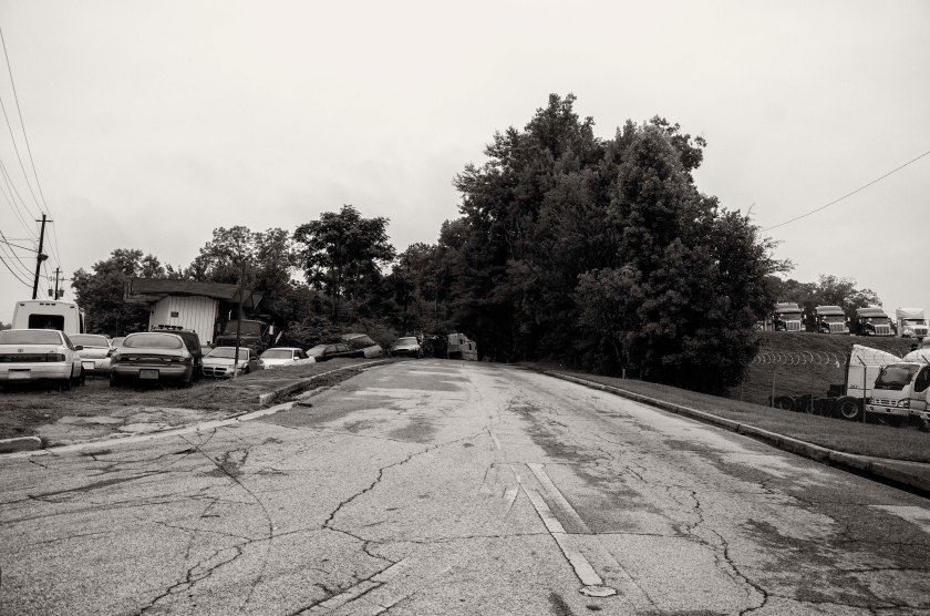
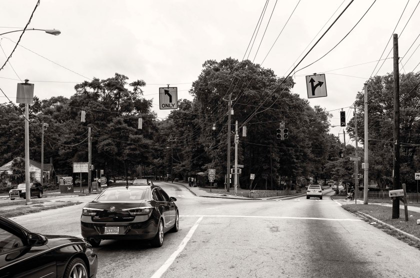
WSB TV, site of Atlanta’s Outer Defenses. After a failed assault at the Battle of Peachtree Creek, Hardee’s Corps fell back to the position where they started their assault and after a hard day of fighting, they moved from their works and mustered a couple hundred yards away near Preachtree St. and Spring St. to being their 16 mile long forced night march.After marching down Peachtree st. and through 5 points, Hardee’s Corps continued to march south down Capitol Ave. and onto what is not Hank Aaron Dr, passing the location of Turner field, were Confederate Artillery batteries were once positioned.Hardee’s Corps continued to march down Hank Aaron Dr, which was then called McDonough Blvd. They would have marched down the road to camera right and made a left turn, then marched toward the camera.McDonough Blvd. at Jonesboro Rd. The march continued down McDonough Blvd. taking the left fork to stay headed east.Hardee continued marching further and further into the night attempting to be in position by dawn, but march, consisting of close to 18,000 soldiers, was painfully slow. They would have passed through the area of the Federal Penitentiary.McDonough Blvd. at Moreland Ave. Hardee’s soldiers marched along this road and turned right on to what is now Moreland Ave and marched south to a point near the south river.The Starlight Drive In, a local landmark, now sits to the side of a road where Hardee’s Corps passed in the late night and early morning hours of July 21st – 22nd.After marching to a point just north of the South River, Hardee turned his troops north up Fayetteville Road. At dawn on the 22nd of July, 1864, Hardee’s Column stopped here at Intrenchment Creek. Here once stood the home and mill of WM Cobb. Hardee needed local guides for the remainder of his march as he and his officers were not familiar with the area. Mr. Cobb and his Miller, named Case Turner, agreed to guide Hardee’s columns to positions for their attack on the Federal left flank. Now a water treatment plant occupies the site.After continuing on from Intrenchment Creek, the column marched on Fayetteville road (now Key Rd) to the intersection with Bouldercrest Road and turned left. They continued up Bouldercrest Road to the fork with Fayetteville Road. With Cleburne’s and Maney’s Divisions taking the left fork (Bouldercrest Rd) and moved up to Flat Shoals Rd where they eventually assaulted the Federals in the area of Bald Hill. The right fork (Fayetteville Rd.) was taken by Walker and Bate’s divisions.
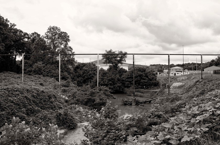
Terry’s Mill Pond. Case Turner guided Walker and Bate’s Divisions up the Fayetteville Rd. to Sugar Creek. At this point, against the advise of Mr. Turner, Walker’s Division turned north and moved off the road to travel up the west side of the creek and Bate’s followed suit moving up the east side of the creek. Mr. Turner warned them of the difficult and swampy terrain around Tom Terry’s Mill pond. Their advance was significantly delayed due to this obstacle. The mill pond is gone now, but one existed in the low ground inside this tree line. A community garden now exist on this site at the intersection of Terry Mill Rd and Glenwood Rd.Glenwood and I-20. The northern end of Terry’s Mill Pond was near this point and in the trees to camera left. The main assault of the Confederates began from this area at 12:15pm. As the assault was to begin, General Walker moved up to the front of his Division to survey the terrain. As he brought his field glasses up to his eyes, he was shot dead by a Federal Sharpshooter.
My name is Clint Brownlee and I am a Photographer in Woodstock, Georgia with over 20 years of photographic experience in many different aspects of photography. I have photographed everything from weddings, special events and portraits to published materials, but my passion has always been Fine Art and Nature Photography. I have had a several shows at the Mason Murer Fine Art Gallery in Atlanta, Georgia and The Roswell Visual Arts Center in Roswell, Georgia. I now sell through my website: www.clintbrownleephotography.com
View all posts by Clint Brownlee