After learning of the flanking movement being conducted by Howard’s Army of the Tennessee, Hood ordered S.D. Lee’s Corps and A. P. Stewart’s Corps to move out the Lickskillet Road in an effort to check the Federal advance and try to roll up their right flank.
Howard began deploying his units on the 27th in an effort to reach the railroad at East Point. He started his line of battle somewhere along what is now Chappell Road south of North Ave. His line followed the high ground along Chappell Road to the south. On the morning of the 28th, Howard began deploying the remainder of his army along the ridge and continuing south down Chappell Road. The Federal line then began to curve to the right (southwest) near the intersection of Ezra Church Drive and Chappell. The line continued its curve through what is now Mozley Park. Ezra Church was located in the park on a grassy hill between MLK Blvd. and the ball fields of the park. Federal units used Church Pews and wood from the church to construct barricades to fire from. The line continued to curve southwest until it reached the point of Laural Ave. and Archer St. This was the salient in the Federal line. From this point it turned in a northwesterly direction. It would have crossed West Lake Ave, passing over part of Anderson and Verbena and ending on the hill where the current Sadie G. Mays Rehab Center (Nursing Home) is located. This would have been the extreme right of the Federal line that surrounded Atlanta as well as Howard’s right. This hill was called Battle Hill.
Lee’s Corps formed up for battle in the area along the front portion of the current Westview Cemetery. Brown’s Division formed up on the left with Brantley’s Brigade forming on the far left. Clayton’s Division formed on the right with Holtzclaw’s Brigade at the right. Stewart’s Corps formed to the rear of Lee along the Lickskillet Road (formerly Gordon Road and now called Ralph David Abernathy Blvd.). An artillery battery was located in what is now the Westview Cemetery on a hill behind the Alms House (poor house). The Alms House was located in the area just south of Westview’s original entry gate.
In the early afternoon the Confederate attack began. Their movement was screened by thick woods in the area and in some locations they were within 50 yards of the Federal line before they were seen. Brantley’s Brigade on the Confederate left attacked Lightburn’s Brigade on the Federal right in the area of Battle Hill. They were successful at first and were able to take the hill for a short time, but were forced to retreat when several regiments from the reserves of the XV and XVI Corps arrived. Sharp’s Brigade, who held the center of Brown’s Division, advanced on the Federal line through the area of what is now the West Lake Marta Station.
Clayton’s Division of Lee’s Corps was advancing on the Federal line just east of the salient and in the area of Ezra Church. Their repeated assaults were constantly repulsed by the Federals who had the high ground and in some locations had begun to dig in and build barricades. Around 2pm, part of Stewart’s Corps began to advance in support of Lee’s Corps. They concentrated their force in the same area of Clayton’s Brigade, but Stewart was also unsuccessful in his attack. Stewart was wounded in the fighting on a hill on the south side of MLK Blvd between Federal Drive and Gordon Terrace. Stewart was about to send additional units into the fight when he was wounded and carried from the field. Walthall, one of Stewart’s Divisional commanders assumed command and instead of sending in more soldiers, he began to withdraw from the area.
After being repulsed by the Federals multiple times and the coming nightfall, the Confederates pulled back to their jumping off point and began to dig in. Some of the works are still visible in a section of Westview Cemetery. This was the third defeat for Hood in his short time as the commander of the Confederate Army of Tennessee. While they did not defeat the Federals, they did prevent their move on East Point, at least for the time being and as fast as the Federals tried to go around the Confederate flank, the Confederates were just a little faster in building earthworks and extending their line.
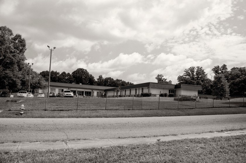
Anderson Ave. between Calloway Dr. and Verbena St. Taken from the high ground looking south toward Verbena St. Federal Soldiers of M.L. Smith’s Division of General Logan’s 15th Corps(US). We are looking in the direction of the on coming Confederate attack of General Brown’s Division, who was positioned on the left of General S. D. Lee’s Corps(CS).Verbena St. looking west toward Penelope Dr. about 75 yards west of Anderson Ave. The Federal lines occupied the high ground here and at this approximate point the Federal line made a sharp turn to the north as to protect their flank. This was the far right of the Federal Lines.Sadie G. Mays Health and Rehabilitation Center. This area, on Anderson Ave. just east of the intersection with Verbena, was known as Battle Hill. This area saw the heaviest fighting and multiple attacks by the Confederates of Brown’s Division. At one point the Federals were pushed back from their works, but soon counter attacked with reinforcements and drove the Confederates and were able to reform their original line and extend the flank. Late in the afternoon, after Brown’s Division had suffered heavy losses from their repeated assaults on the Federals, they were retired and Walthall’s Division of General Stewart’s Corps(CS) was brought forward with fresh troops to continue the assault.Looking west in the area in front of Battle Hill. Anderson Ave.and Verbena St. are to the right side of the image. The Confederates of Brown’s Division and later Walthall’s Division crossed this are in their repeated attempts to take the Federal lines. The Confederates would have been attacking from the left side of the image to the right.Laurel Ave. looking north toward the intersection with Archer St. This high ground was occupied by the Federals of Harrow’s Division of the 15th Corps(US). This spot is as far south as the Federal lines came during the battle and here the line formed a salient angle moving off to the north west (left) and to the north east (right). From this point back to the north east, there was a gap in the Federal line of approximately 100 yards. This gap was due to the heavily wooded terrain at the time. As the attack began, the Federals recognized the vulnerability of the gap in their lines and quickly brought up several regiments of reserves to fill the gap.Looking south down Laurel Ave.between Archer St. (to the rear of the camera position) and Mims St. The Confederate attack came straight at the Federal lines through here. As you look into the distance you can see the terrain begins to take on a upward slope. Clayton’s Division(CS), which was formed up to the right of Brown’s Division(CS), used the low ridge to hide their movements from the Federals. They were able to form up and deploy for battle while using the concealment that was offered by the ridge line. The woods in this area were so thick, that the Confederates were able to get within 50 yards of the Federal lines before they were seen.M.L.K. Jr. Dr. across from the intersection with Federal Dr. General A. P. Stewart was wounded on this high ground here as he was commanding his Corps in the Battle. He was about to send in his General Loring’s Division into the assault, but before he could give the order, General Stewart was struck in the head with a “Spent” bullet and was carried from the field. He was able to return to his about two weeks later. General Walthall then assumed command of the Corps and ordered his Division to retire from battle and did not send Loring’s Division into the attack.Mozley Park, the site of Ezra Church, name sake of the battle. The Federal lines came to this point and started to turn in a generally north eastern direction. Wangelin’s Brigade of Wood’s Division, 15th Corps(US) was positioned here at the church and extended just to the east. Williamson’s Brigade of the same Division was positioned at the church and extended just to the north east. They used the church pews and wood from the church to fortify their position and fend off the attacking Confederates of Clayton’s Division.Ezra Church Drive. The hill top in this image was part of the Federal line. From here the Federal line move south west(left) along the high ground toward Ezra Church and north east along the high ground toward what is now Chappell Road where it turned more in a more northern direction and followed the high ground.Chappell Road at Joseph E. Boone Blvd. Looking south along Chappell Rd you can still recognize some of the high ground that the Federals occupied. The 4th Division of the 17th Corps, commanded by General Giles A. Smith(US), held the Federal line in this area. There was very little, if any, action in this area.Chappell Road at North Ave. The high ground here held the far left end of the Federal lines for the Battle of Ezra Church. This area was occupied by Federal troops of the 3rd Division of the 17th Corps under the command of General Leggett.Overlook Atlanta Apartment Homes, locate where Chappell Rd dead ends into Donald Lee Hollowell Pkwy. At the time this was called Davis hill and was occupied by the 2nd Division, commanded by Brig. General James D. Morgan, of General Palmer’s 14th Corps(US). Prior to the Battle of Ezra Church, General Sherman had ordered the 2nd Division to reinforce the right flank of Howard’s Army of the Tennessee on their movement towards East Point. The 2nd Division became lost in the heavily wooded area and were eventually ordered to return to their works at Davis hill. There was also a gap of about 1000′ in the Federal lines between Davis Hill the left of the lines at Ezra Church near North Ave and Chappell Rd.Westview Cemetery, a marker describes the Battle of Ezra Church. Putnam Darden’s Mississippi Battery was stationed near here on the hill behind the Alms House (poor house) that served as a battlefield landmark. This battery support Brown’s assault on the Federal lines near Battle Hill.The original main entrance, now closed, to Westview Cemetery, sits on the site of what was once the Alms House (poor house). This was a known battlefield landmark and Brown’s Division of S.D. Lee’s Corps, formed their lines of battle in the area as they prepared to assault the right side of the Federal line.Confederate earthworks inside Westview Cemetery. After Confederate forces failed to force the Federals out of the lines, they fell back to this area along high ground in what is now Westview Cemetery. This position was later captured by Federal troops and during the time period called “The Siege of Atlanta”, they place an artillery battery here on the high ground and began shelling the city.The lone headstone near the wood line marks the grave of a Confederate officer named Lt. Edward Clingman who died in the Battle of Ezra Church. There is a small section of Confederate earthworks in the woods behind the headstone.
July 27th, 1864: After the death of General McPherson during the Battle of Atlanta, General Logan assumed command during the battle and retained it for several days while General Sherman decided who should replace McPherson. Sherman, being a graduate of Westpoint, had a certain disdain for political Generals like Logan, and did not trust them to follow orders properly and promptly as they were on the field of battle for political gain. With these thoughts in mind and after consulting with General Thomas of the Army of the Cumberland, Sherman chose General O.O. Howard to command the Army of the Tennessee as McPherson’s successor. General Hooker is so offended and outraged that he was not given command of the Army of the Tennessee, the he resigns his commission and leaves the Army. Howard assumed command on the 27th of July and his order of the day was to shift the Army of the Tennessee from the east side of Atlanta near Decatur, to the west side of Atlanta by moving to the north and around the top of the city. His ultimate objective is to move on Eastpoint and destroy the railroad. Sherman has Cavalry units dismount and fill the lines of Howard’s army as they began to pull out. He also ordered infantry units along the line to skirmish heavily with the Confederates in the cities defensive lines in hopes of screening Howard’s move. Sherman was attempting to flank Hood out of the city and draw him into a fight or cut off Hood’s supply line from the railroad to Macon and the railroad to Westpoint. Stoneman’s and McCook’s Cavalry were sent on a raid to destroy the railroads while the Army of the Tennessee was moving into place. Stoneman went south out of Decatur and McCook moved southwest from Turner’s Ferry. McCook and Stoneman were scheduled to meet at Love Joy’s Station on the 28th to destroy the railroad. McCook went southwest along the west bank of the Chattahoochee and crossing on pontoon bridges at Smiths Ferry, about 6 miles south of Campbellton. He moves on toward the east and in Palmetto he destroys several miles of track, burns the depot and then moves towards the east again in the direction of Fayetteville. Along the Fayetteville road the come across a Confederate wagon train. They take about 300 prisoners and burn nearly 500 wagons. They also kill almost 1000 mules with their sabers to keep the sound of gunfire from giving away their location. By mid to late morning, Hood is aware of the Federals movements. He sends Wheelers Cavalry to intercept and destroy the Union Cavalry. Wheeler surrounds Garrard’s Cavalry at Flat Rock where they skirmish and Garrard falls back towards Lithonia. Hood then learns of McCook’s raid and Wheeler is sent to intercept him. Having detected the movements of Howard’s Army of the Tennesse, Hood sends General Stephen D. Lee’s Corps and A.P. Stewart’s Corps to extend the Confederate left flank out of Atlanta in an attempt to block the Federal move toward East Point. S.D. Lee is now the commander of Hood’s former Corps.