Sherman began to receive reports that General Hood had crossed the Chattahoochee River and were moving toward Marietta. Sherman, unsure of where Hood was moving, began sending messages to all points along his supply line and also sent additional troops to Chattanooga. He thought Hood would do one of two things; attack the supply line between Atlanta and Chattanooga or move toward northern Alabama to meet up with General Forrest to attack the supply depots in Tennessee. Sherman also mobilized his troops in Atlanta in an attempt to chase down and engage Hood. He left the XX Corps to garrison Atlanta and move the remaining troops northwest toward Marietta.
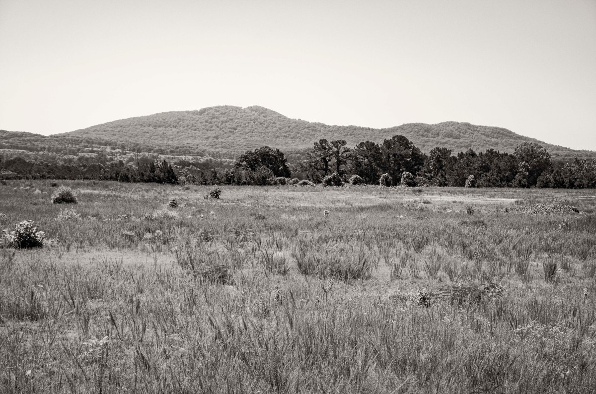
Hood was moving toward the northwest as well. He was not moving on Marietta directly and was making a wide move around it and the formidable Kennesaw Mountain. As the Confederate Army was marching, General Stewart’s Corps was the farthest to the right (east) of the column. They marched throughout the day and Stewart’s Corps made camp a few miles south of Lost Mountain. Hood and the remainder of his army camped in area southeast of Dallas near Flint Hill Church.
On the evening of the October 2nd, Hood sent orders to Stewart. His orders were to move his entire Corps, in the morning, to Big Shanty (now called Kennesaw). Stewart was assigned to capture and destroy as much of the railroad as possible and if he was able to take Big Shanty, he was to send a Division to Acworth to do the same thing there. Hood suggested that he should be back in two days to link up with the remainder of the army. These actions, were to set into motion, all the pieces for the Battle of Allatoona Pass.
With S.D. Lee’s Corps having been sent back to Atlanta, Hardee was left to defend Jonesboro and the railroad with only his single Corps. to defend against the entire Federal Army of the Tennessee. Grossly outnumbered, Hardee deployed is Corps across the line that he had previously occupied with two Corps. Carter’s Division formed the Confederate left, Brown’s Division was placed in the center and Cleburne’s Division placed on the right and formed a salient angle with a refuse at the Warren house to the railroad. The brigade at the very extreme end of the right flank was commanded by States R. Gist. He ordered his men to go out ahead of the line and cut, bend over, and entangle as many trees as possible to try and even the odds with as much “abatis” as possible. This would later prove to be a very wise decision that prevented the Federal IV Corps under Stanley’s command from being able to reach the Confederate flank and turn it.
The attack by the Federals began at 4:00pm. Logan’s XV Corps attacked the Confederates from the west and Davis’s XIV Corps attacked the Salient in the Confederate line from the north west. Stanley’s IV Corps attempted to attack from the north by moving south along the railroad, but was unable to penetrate the abatis of Gist Brigade. Davis’s XIV Corps assaulted and overran the Salient in the Confederate line. This portion of the line was held by Govan’s Arkansas Brigade and Lewis’ Kentucky Orphan Brigade. They were overrun so rapidly that General Govan himself was captured along with 600 men and 8 cannons. Cleburne ordered Magevney’s Brigade to fill the gap and reform the line. They were able to do so and held off the remainder of the Federal assault.
After darkness fell, Hardee ordered a retreat of all his forces. They fell back six miles south to Love Joy’s Station where they entrenched. He sent a dispatch to Hood detailing that Jonesboro had fallen and that the railroad was in Sherman’s hands.
Having lost his supply lines, Hood has no choice but to evacuate Atlanta and attempt to reunite the remainder of his army at Love Joy’s Station. He orders A.P. Stewart’s Corps and the Georgia Militia in the defenses of Atlanta to evacuate the city. S.D. Lee’s Corps, which has marched all night toward Atlanta, after having fought a battle the previous day, is turned around only a mile or so from the city and has to march southward toward Love Joy’s Station. With the railroad destroyed, Hood orders the Cavalry to act as a rearguard and when the Army is out of the city, they are to set fire to and blow up the munitions train at the rolling mill. The rolling mill was at the present day location of Decatur and Boulevard. The explosions last for hours and can be heard all they way to Jonesboro.
After having marched all night and having fought a hard battle the previous day, S.D. Lee’s Corps(CS) met General Stewart’s Corps and the Georgia Militia just on the outskirts of Atlanta. Stewart’s Corps continued theirs towards Love Joy Station and Lee’s Corps stopped and then followed behind them. Both Corps and the militia traveling down the McDonough Rd. then turning south to cross the South River.Stewart’s and Lee’s Corps along with the Georgia Militia marched south towards Love Joy Station and crossed the South River here along what is now Moreland Ave.Looking north along Jonesboro Rd. at Adamson. Cleburne’s Division was deployed across Jonesboro road with the right of his line just across the railroad. The extreme right of the Confederate line was in the distance of this image and crossed the railroad tracks. States R. Gist Brigade held the right and at his orders, his men bent and felled trees in their front to create as many entanglements as possible to help slow the Federal assault. His method worked and the Federal 4th Corps marching south along the railroad from Rough and Ready were not able to break his line.The Warren house, Jonesboro Rd. between Adamson and Mimosa. General Cleburne’s Division held the Confederate line in this area. The half of his Division on his left was facing the Federal assault coming from the west and the remainder of his line formed a salient angle just north west of the Warren House, which allowed him to make a refused line back to the railroad. It was here that the Federal assault broke the line and General Govan was captured. Cleburne was able to rush reinforcements forward to hold the line. The Warren House, built in 1859, was used as a Confederate Hospital during the battle and after the Confederate lines were overrun, it became a Federal headquarters and a hospital.The Carnes House built in the 1850’s, was the home of Stephen Carnes who manufactured wagons and caskets for the Confederacy. The Johnson – Blalock House was built in 184o and was used as a commissary by the Confederates and during the Battle of Jonesboro, it functioned as a hospital.The Gayden House, built in the 1850’s, was home to Confederate Captain and Dr. Frances Gayden. He served as the chief medical officer during the two days of battle at Jonesboro.The Allen – Carnes Plantation, located a few miles from town, was built in 1820 and is known to be the oldest home in Clayton County. During the two days of combat around Jonesboro, many of the residents fled town and came here and to the Camp Plantation seeking refuge. Stately Oaks was built in 1839 and was originally located about four miles from town. It was moved to current spot in Jonesboro and restored to be used as a museum. The original detached kitchen is on site as well as many other exhibits the demonstrate what life was like in the 1800’s. The home at it’s original location was noted on military maps and used as a landmark for troop movements.
The first of Sherman’s troops reach Camp Creek on the morning of the 27th. The Federal IV Corps is moving toward Camp Creek from the area around Utoy Creek. Hood, is increasingly concerned about the possibility of Sherman attempting a flanking movement to attack the railroad at Rough and Read (now called Mountain View, which is directly east of the Atlanta airport between I-75 and I-285) or possibly at Jonesboro. Hood has received word from some Cavalry scouts that the Federals are massing at Camp Creek. Hood has dispatched French on a reconnaissance to the north and west of Atlanta and he has found the Federal XX corp entrenched in the are of the railroad bridge across the Chattahoochee River. Stewart’s and Lee’s Corps move into the empty Federal trenches and begin to reap the rewards of all the items an army leaves behind. They find everything from food to blankets. Hood sends Sthal’s Brigade to reinforce Hardee at East Point and instructs Jackson to have Armstrong’s Brigade of Cavalry ready to block and delay the Federals if they attempt to cross Camp Creek and move on Rough and Ready. From the south side of Camp Creek all the way to Joneboro, Confederate Cavalry skirmished with the Federals as they advanced. Their efforts did little to stop or slow the Federals.
This crossroads, just east of where “Sandtown” was, was a military landmark during the Civil War. This is the Intersection of Boat Rock Road, New Hope Road, and Campbellton Road. From here the Federal 15th Corps marched southeast and the 16th and 17th Corps marched south crossing Camp Creek and making their way to Shadnor Church (in present day Union City) and to Fairburn.Camp Creek at Stonewall Tell Road. Federal forces crossed this creek on their way towards Shadnor Church and Fairburn.Camp Creek at Enon Rd. Federal forces crossed this creek on their way to Shadnor Church and Fairburn.Owl Rock Church. This historic church was founded in 1828 and was a military landmark for Confederate and Federal forces during the battles around Atlanta. The Federals passed by here on their march south and east toward the Atlanta – West Point Railroad.Owl Rock, the church’s name sake.
After learning of the flanking movement being conducted by Howard’s Army of the Tennessee, Hood ordered S.D. Lee’s Corps and A. P. Stewart’s Corps to move out the Lickskillet Road in an effort to check the Federal advance and try to roll up their right flank.
Howard began deploying his units on the 27th in an effort to reach the railroad at East Point. He started his line of battle somewhere along what is now Chappell Road south of North Ave. His line followed the high ground along Chappell Road to the south. On the morning of the 28th, Howard began deploying the remainder of his army along the ridge and continuing south down Chappell Road. The Federal line then began to curve to the right (southwest) near the intersection of Ezra Church Drive and Chappell. The line continued its curve through what is now Mozley Park. Ezra Church was located in the park on a grassy hill between MLK Blvd. and the ball fields of the park. Federal units used Church Pews and wood from the church to construct barricades to fire from. The line continued to curve southwest until it reached the point of Laural Ave. and Archer St. This was the salient in the Federal line. From this point it turned in a northwesterly direction. It would have crossed West Lake Ave, passing over part of Anderson and Verbena and ending on the hill where the current Sadie G. Mays Rehab Center (Nursing Home) is located. This would have been the extreme right of the Federal line that surrounded Atlanta as well as Howard’s right. This hill was called Battle Hill.
Lee’s Corps formed up for battle in the area along the front portion of the current Westview Cemetery. Brown’s Division formed up on the left with Brantley’s Brigade forming on the far left. Clayton’s Division formed on the right with Holtzclaw’s Brigade at the right. Stewart’s Corps formed to the rear of Lee along the Lickskillet Road (formerly Gordon Road and now called Ralph David Abernathy Blvd.). An artillery battery was located in what is now the Westview Cemetery on a hill behind the Alms House (poor house). The Alms House was located in the area just south of Westview’s original entry gate.
In the early afternoon the Confederate attack began. Their movement was screened by thick woods in the area and in some locations they were within 50 yards of the Federal line before they were seen. Brantley’s Brigade on the Confederate left attacked Lightburn’s Brigade on the Federal right in the area of Battle Hill. They were successful at first and were able to take the hill for a short time, but were forced to retreat when several regiments from the reserves of the XV and XVI Corps arrived. Sharp’s Brigade, who held the center of Brown’s Division, advanced on the Federal line through the area of what is now the West Lake Marta Station.
Clayton’s Division of Lee’s Corps was advancing on the Federal line just east of the salient and in the area of Ezra Church. Their repeated assaults were constantly repulsed by the Federals who had the high ground and in some locations had begun to dig in and build barricades. Around 2pm, part of Stewart’s Corps began to advance in support of Lee’s Corps. They concentrated their force in the same area of Clayton’s Brigade, but Stewart was also unsuccessful in his attack. Stewart was wounded in the fighting on a hill on the south side of MLK Blvd between Federal Drive and Gordon Terrace. Stewart was about to send additional units into the fight when he was wounded and carried from the field. Walthall, one of Stewart’s Divisional commanders assumed command and instead of sending in more soldiers, he began to withdraw from the area.
After being repulsed by the Federals multiple times and the coming nightfall, the Confederates pulled back to their jumping off point and began to dig in. Some of the works are still visible in a section of Westview Cemetery. This was the third defeat for Hood in his short time as the commander of the Confederate Army of Tennessee. While they did not defeat the Federals, they did prevent their move on East Point, at least for the time being and as fast as the Federals tried to go around the Confederate flank, the Confederates were just a little faster in building earthworks and extending their line.
Anderson Ave. between Calloway Dr. and Verbena St. Taken from the high ground looking south toward Verbena St. Federal Soldiers of M.L. Smith’s Division of General Logan’s 15th Corps(US). We are looking in the direction of the on coming Confederate attack of General Brown’s Division, who was positioned on the left of General S. D. Lee’s Corps(CS).Verbena St. looking west toward Penelope Dr. about 75 yards west of Anderson Ave. The Federal lines occupied the high ground here and at this approximate point the Federal line made a sharp turn to the north as to protect their flank. This was the far right of the Federal Lines.Sadie G. Mays Health and Rehabilitation Center. This area, on Anderson Ave. just east of the intersection with Verbena, was known as Battle Hill. This area saw the heaviest fighting and multiple attacks by the Confederates of Brown’s Division. At one point the Federals were pushed back from their works, but soon counter attacked with reinforcements and drove the Confederates and were able to reform their original line and extend the flank. Late in the afternoon, after Brown’s Division had suffered heavy losses from their repeated assaults on the Federals, they were retired and Walthall’s Division of General Stewart’s Corps(CS) was brought forward with fresh troops to continue the assault.Looking west in the area in front of Battle Hill. Anderson Ave.and Verbena St. are to the right side of the image. The Confederates of Brown’s Division and later Walthall’s Division crossed this are in their repeated attempts to take the Federal lines. The Confederates would have been attacking from the left side of the image to the right.Laurel Ave. looking north toward the intersection with Archer St. This high ground was occupied by the Federals of Harrow’s Division of the 15th Corps(US). This spot is as far south as the Federal lines came during the battle and here the line formed a salient angle moving off to the north west (left) and to the north east (right). From this point back to the north east, there was a gap in the Federal line of approximately 100 yards. This gap was due to the heavily wooded terrain at the time. As the attack began, the Federals recognized the vulnerability of the gap in their lines and quickly brought up several regiments of reserves to fill the gap.Looking south down Laurel Ave.between Archer St. (to the rear of the camera position) and Mims St. The Confederate attack came straight at the Federal lines through here. As you look into the distance you can see the terrain begins to take on a upward slope. Clayton’s Division(CS), which was formed up to the right of Brown’s Division(CS), used the low ridge to hide their movements from the Federals. They were able to form up and deploy for battle while using the concealment that was offered by the ridge line. The woods in this area were so thick, that the Confederates were able to get within 50 yards of the Federal lines before they were seen.M.L.K. Jr. Dr. across from the intersection with Federal Dr. General A. P. Stewart was wounded on this high ground here as he was commanding his Corps in the Battle. He was about to send in his General Loring’s Division into the assault, but before he could give the order, General Stewart was struck in the head with a “Spent” bullet and was carried from the field. He was able to return to his about two weeks later. General Walthall then assumed command of the Corps and ordered his Division to retire from battle and did not send Loring’s Division into the attack.Mozley Park, the site of Ezra Church, name sake of the battle. The Federal lines came to this point and started to turn in a generally north eastern direction. Wangelin’s Brigade of Wood’s Division, 15th Corps(US) was positioned here at the church and extended just to the east. Williamson’s Brigade of the same Division was positioned at the church and extended just to the north east. They used the church pews and wood from the church to fortify their position and fend off the attacking Confederates of Clayton’s Division.Ezra Church Drive. The hill top in this image was part of the Federal line. From here the Federal line move south west(left) along the high ground toward Ezra Church and north east along the high ground toward what is now Chappell Road where it turned more in a more northern direction and followed the high ground.Chappell Road at Joseph E. Boone Blvd. Looking south along Chappell Rd you can still recognize some of the high ground that the Federals occupied. The 4th Division of the 17th Corps, commanded by General Giles A. Smith(US), held the Federal line in this area. There was very little, if any, action in this area.Chappell Road at North Ave. The high ground here held the far left end of the Federal lines for the Battle of Ezra Church. This area was occupied by Federal troops of the 3rd Division of the 17th Corps under the command of General Leggett.Overlook Atlanta Apartment Homes, locate where Chappell Rd dead ends into Donald Lee Hollowell Pkwy. At the time this was called Davis hill and was occupied by the 2nd Division, commanded by Brig. General James D. Morgan, of General Palmer’s 14th Corps(US). Prior to the Battle of Ezra Church, General Sherman had ordered the 2nd Division to reinforce the right flank of Howard’s Army of the Tennessee on their movement towards East Point. The 2nd Division became lost in the heavily wooded area and were eventually ordered to return to their works at Davis hill. There was also a gap of about 1000′ in the Federal lines between Davis Hill the left of the lines at Ezra Church near North Ave and Chappell Rd.Westview Cemetery, a marker describes the Battle of Ezra Church. Putnam Darden’s Mississippi Battery was stationed near here on the hill behind the Alms House (poor house) that served as a battlefield landmark. This battery support Brown’s assault on the Federal lines near Battle Hill.The original main entrance, now closed, to Westview Cemetery, sits on the site of what was once the Alms House (poor house). This was a known battlefield landmark and Brown’s Division of S.D. Lee’s Corps, formed their lines of battle in the area as they prepared to assault the right side of the Federal line.Confederate earthworks inside Westview Cemetery. After Confederate forces failed to force the Federals out of the lines, they fell back to this area along high ground in what is now Westview Cemetery. This position was later captured by Federal troops and during the time period called “The Siege of Atlanta”, they place an artillery battery here on the high ground and began shelling the city.The lone headstone near the wood line marks the grave of a Confederate officer named Lt. Edward Clingman who died in the Battle of Ezra Church. There is a small section of Confederate earthworks in the woods behind the headstone.
As Hood prepares for his first tactical engagement since taking command of the Confederate Army of Tennessee, he is hoping that General Thomas’s Army of the Cumberland has been unable to prepare any earthworks since crossing Peachtree Creek. Hood is also having to keep an eye on McPherson and Schofield as they advance from Decatur toward Atlanta. The attack is planned for 1:00pm, but for various reasons it does not commence until 4:00pm.
Hood has deployed Stewart’s Corps (formerly commanded by the late Lt. Gen. L. Polk) to his left. Stewart’s Corps consist of French’s Division on the far left connecting to the Western and Atlantic Railroad near Casey’s Hill in the current Crestlawn Cemetery and extending east and connecting to Walthall’s Division, which sits astride Howell Mill Road. Walthall’s right extends toward the east and connects with Loring’s Division between Howell Mill and Northside Drive. Hood had deployed Hardee’s Corps to the center. Hardee had placed Maney’s Division to the left of his line followed by Walker’s Division in the center and Bate’s Division to the right. Hardee held Cleburne’s Division in reserve. Hood, fearing an attack by McPherson on the east side of Atlanta, placed Cheatham on the far right of the Confederate line. Cheatham is commanding Hood’s former Corps. Hood’s plan is to attack “en echelon”. Starting with Bate’s Division on the right attacking first and then each subsequent Division attacking one after the other. This was done in an effort to turn the enemy flank and push them back to Peachtree Creek and the Chattahoochee River.
Thomas had most of his army across the creek by noon. Palmer’s XIV Corps had been placed on the right and had been able to entrench as they had been across the creek earlier. Hooker’s XX Corps was forming up in the center and Howard’s IV Corps was forming on the left. Newton’s Division of Howard’s Corps held the far left.
Late in the morning Hood received word from Wheeler, who commanded the cavalry attempting to hold the east side of Atlanta, that he was out numbered by McPherson and Schofiled who were moving toward the Atlanta from Decatur. Hood decided to shift his entire army to the east by a mile in order to support Wheeler should he need it. The orders were given and the movements were made, but through miscommunication and human error the shift to the right (east) was nearly two miles. This cost the Confederates time and delayed their attack until 4pm.
When the attack finally began, Bate’s Division was the first to move forward and should have been the first to make contact, but the terrain in their front had not been reconnoitered prior to the assault. Because of this they did not know where they were going and did not know where the enemy was. They ran into a heavy thicket and swampy area that greatly hindered their progress as they were attempting to find Newton’s Division.
By 4:30pm the “en echelon” advance had made its way down the line to Loring’s Division. In the area between present day Northside Drive and Walthall Street, Scott’s Brigade of Loring’s Division made one of the most successful assaults of the day. They captured the colors of the 33rd New Jersey as well as part of the regiment. They continued pressing their assault and nearly turn Geary’s flank, but the lack of support on either of Scott’s flanks, forced him to fall back.
The day was filled with heavy, fierce fighting on both sides. By late afternoon, Loring believed he could exploit a gap in the Federal lines between Newton and Geary. He asked Hardee for reinforcements and as Hardee was about to send Cleburne’s Division to assist Loring, he received an order from Hood to send a Division to the east of the city to support Wheeler. Hardee sent Cleburne’s Division to Wheeler, thus preventing another push forward to the Federal lines. The day ended with many dead, dying and wounded still on the battlefield. The high priced neighborhoods of the area now stand in stark contrast to the harsh reality of the battle that took place there 152 years ago today.
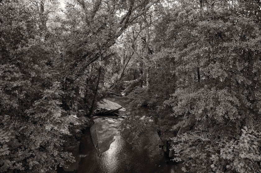
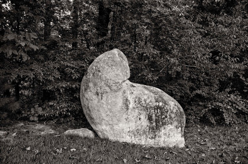
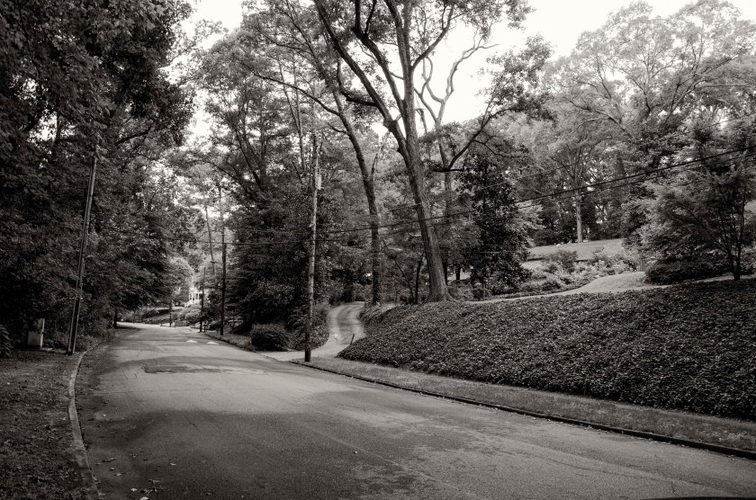
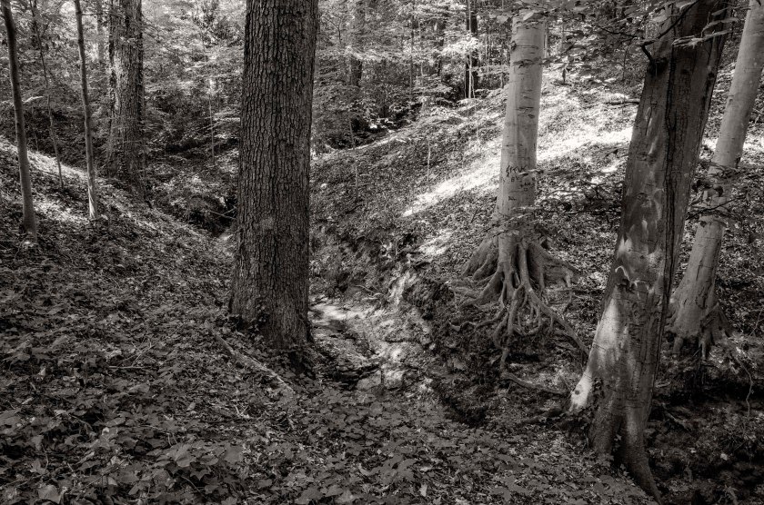
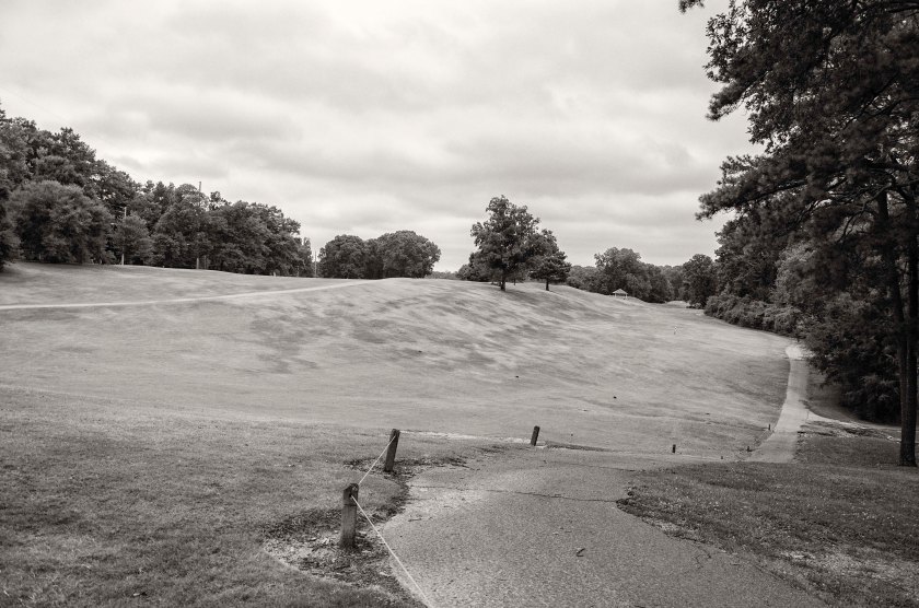
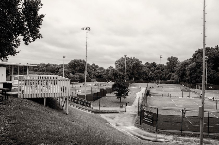
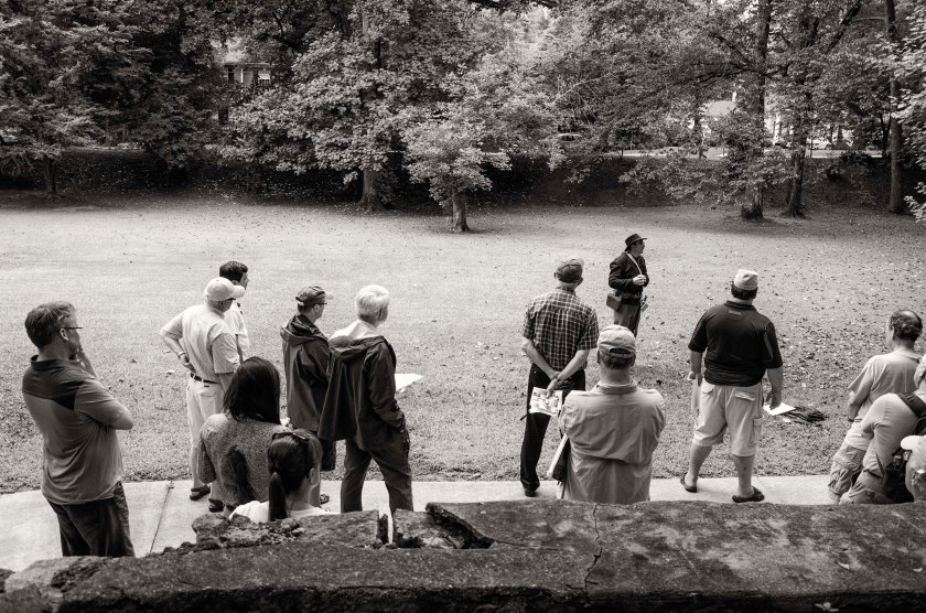
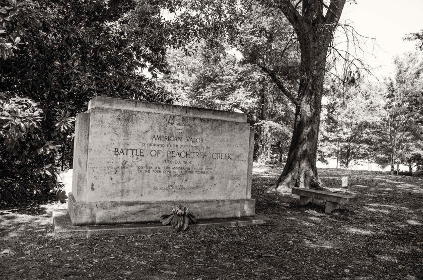
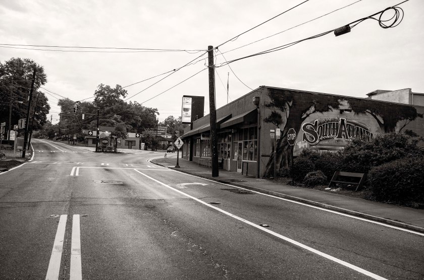
Knipe’s and Robinson’s Brigades of William’s Division of Hooker’s 20th Corps, were positioned along the high ground to the right of this image taken along Norfleet Rd. To the left of the image is a deep ravine that had to be traversed by the attacking Confederates. This area was the western most portion of the Federal line that came under direct assault during the Battle of Peachtree Creek.This deep ravine now sits between Norfleet Rd. to the right, where the Federals were positioned on high ground, and Springlake Dr. Reynold’s Brigade of Walthall’s Division of Stewart’s Corp(CS) attacked through this deep ravine and pushed forward attempting to push Knipe’s and Robinson’s Brigades back. After a failed second attempt under enfilading artillery fire and with only the support part of Selden’s Alabama Battery, Reynold’s was forced to withdraw from the assault.Near the intersection of Collier Road and Howell Mill, at the south western end of the ravine, the Selden’s Alabama Battery was placed in support of Reynold’s assault. While directing the placement of the battery Major William C. Preston was killed in action by Federal fire. Major Preston is the “Willie” Preston featured in Mary Chestnut’s “A Diary From Dixie”Bobby Jones Golf Course at the Bittsy Grant Tennis Center. The right of Geary’s Division of Hooker’s 20th Corps was positioned along the high ground of this ridge on the golf course. O’Neal’s Brigade of Wathall’s Division(CS) was on the right of Reynold’s Brigade and pushed through at shallower portion of the ravine and attempted to exploit a gap between Williams and Geary. Geary’s line was pushed back until his right met Williams left forming a re-entrant angle in the Federal line. O’Neal split the Brigade with half swinging left to attack Williams and the other half swinging right to turn Geary’s right flank. Fierce fighting ensued and with lack of numbers and artillery support, O’Neal eventually withdrew.Bittsy Grant Tennis Center. Looking toward the Confederate lines. O’Neal’s Brigade would have crossed this area in their assault on Geary’s and Williams lines.Tanyard Creek Park, a historian and reenactor gives a lecture to a tour group on the 150th anniversary of the Battle of Peachtree Creek. General Loring’s Division of Stewarts Corps(CS), came across this ground moving from the background toward the camera position to attack elements of Geary’s and Ward’s Divisions (US), which were positioned behind the camera on the high ground near present day Collier Rd.Tanyard Branch in Tanyard Branch Park. Heavy fighting ensued here as Loring’s Division(CS) pushed hard in their attack on elements of Geary’s and Ward’s Division’s(US).Eastern portion of Tanyard Creek Park. Portions of Featherston’s Brigade, Loring’s Division (CS), advanced through this area, crossing the creek (camera right),under heavy fire from Geary’s (US) artillery and moving towards the high ground along present day Collier Road. Ardmore Road looking toward Collier Road. The right of Featherston’s Brigade advanced down the slope for their trenches nearly a mile behind the camera position, to attack Coburn’s and Wood’s Brigades of Ward’s Divison (US). Featherston’s Brigade drove back the Federal skirmishers and pushed passed the barricades the skirmishers used to assault the main line. They gained some ground but were forced back to the abandoned barricades as they were counter attacked along their front and flank.28th St. at Wycliff Rd. looking toward’s Peachtree Street. 28th St. dead ends into Ardmore where the previous image was made. The Old Montgomery Ferry Road crossed through this spot and intersected Peachtree Road slightly south of Palisades Rd. Brig. General Clement H. Stevens (CS) was killed in action here as he ordered the withdraw of his Brigade. Steven’s Brigade was part of Walker’s Division of Hardee’s Corps.Battle of Peachtree Creek memorial. This memorial, shaded by Oaks and Magnolias, rest on a small knoll between Peachtree Road and Piedmont Hospital. Kimball’s Brigade of Newton’s Division, Howard’s 4th Corps (US) was positioned here on this high ground astride Peachtree Road. They were assaulted by Walker’s Divisions of Hardee’s Corps (CS).Dale Way Park now sits on the battlefield once crossed by Bate’s Division of Hardee’s Corps (CS). Bate’s Division was the far right of the Confederate assault on the Federal lines at Peachtree Creek. Bate’s was the first to move from his works to begin the assault with each successive Division move forward one after the other. Bate’s assault was delayed as the whole Confederate line had been shifted to the right by nearly two miles. Initially, the line was supposed to move only a mile to the right in order to be in position to reinforce Wheeler’s Cavalry east of Atlanta should McPherson and Schofield attack. Miscommunication lead to shift of two miles and as such, when Bate’s made his advance on two Brigades of Newton’s Division (US), he did so across terrain that had not been reconnoitered. Bate’s advance was slow due to heavy thickets and swampy areas in the Clear Creek Valley.WSB TV, West Peachtree St. near Inwood Cir. The Confederates outer defensive line of Atlanta was placed on the high ground here and extended westward along various hills and ridges to present day Crest Lawn Cemetery where it terminated at Casey’s Hill along the Western Atlantic Railroad. Walker and Bate’s Divisions both started their assault on the Federals from this defensive line. This view is looking south toward the Confederate line.West Peachtree at Inwood Cir. WSB TV. Looking north toward Federal Positions from the Confederates outer defensive line of Atlanta. Walker’s and Bate’s Divisions(CS) would have advanced down this slope crossing the area that is now Buford Hwy and I-85 and then moving up through what is now the Brookwood Hills neighborhood, to assault part of Newton’s Division (US) that were positioned along the high ground in the area of present day Brighton Road.
October 2, 1864 Sherman began to receive reports that General Hood had crossed the Chattahoochee River and were moving toward Marietta. Sherman, unsure of where Hood was moving, began send messages to all points along his supply line and also sent additional troops to Chattanooga. He thought Hood would do one of two things; attack the supply line between Atlanta and Chattanooga or move toward northern Alabama to meet up with General Forrest to attack the supply depots in Tennessee. Sherman also mobilized his troops in Atlanta in an attempt to chase down and engage Hood. He left the XX Corps to garrison Atlanta and move the remaining troops northwest toward Marietta. Hood was moving toward the northwest as well. He was not moving on Marietta directly and was making a wide move around it and the formidable Kennesaw Mountain. As the Confederate Army was marching, General Stewart’s Corps was the farthest to the right (east) of the column. They marched throughout the day and Stewart’s Corps made camp a few miles south of Lost Mountain. Hood and the remainder of his army camped in area southeast of Dallas near Flint Hill Church. On the evening of the October 2nd, Hood sent orders to Stewart. His orders were to move his entire Corps, in the morning, to Big Shanty (now called Kennesaw). Stewart was assigned to capture and destroy as much of the railroad as possible and if he was able to take Big Shanty, he was to send a Division to Acworth to do the same thing there. Hood suggested that he should be back in two days to link up with the remainder of the army. These actions, were to set into motion, all the pieces for the Battle of Allatoona Pass.
July 20th, 1864: As Hood prepares for his first tactical engagement since taking command of the Confederate Army of Tennessee, he is hoping that General Thomas’s Army of the Cumberland has been unable to prepare any earthworks since crossing Peachtree Creek. Hood is also having to keep an eye on McPherson and Schofield as they advance from Decatur toward Atlanta. The attack is planned for 1:00pm, but for various reasons it does not commence until 4:00pm. Hood has deployed Stewart’s Corps (formerly commanded by the late Lt. Gen. L. Polk) to his left. Stewart’s Corps consist of French’s Division on the far left connecting to the Western and Atlantic Railroad near Casey’s Hill in the current Crestlawn Cemetery and extending east and connecting to Walthall’s Division, which sits astride Howell Mill Road. Walthall’s right extends toward the east and connects with Loring’s Division between Howell Mill and Northside Drive. Hood had deployed Hardee’s Corps to the center. Hardee had placed Maney’s Division to the left of his line followed by Walker’s Division in the center and Bate’s Division to the right. Hardee held Cleburne’s Division in reserve. Hood, fearing an attack by McPherson on the east side of Atlanta, placed Cheatham on the far right of the Confederate line. Cheatham is commanding Hood’s former Corps. Hood’s plan is to attack “en echelon”. Starting with Bate’s Division on the right attacking first and then each subsequent Division attacking one after the other. This was done in an effort to turn the enemy flank and push them back to Peachtree Creek and the Chattahoochee River. Thomas had most of his army across the creek by noon. Palmer’s XIV Corps had been placed on the right and had been able to entrench as they had been across the creek earlier. Hooker’s XX Corps was forming up in the center and Howard’s IV Corps was forming on the left. Newton’s Division of Howard’s Corps held the far left. Late in the morning Hood received word from Wheeler, who commanded the cavalry attempting to hold the east side of Atlanta, that he was out numbered by McPherson and Schofiled who were moving toward the city from Decatur. Hood decided to shift his entire army to the east by a mile in order to support Wheeler should he need it. The orders were given and the movements were made, but through miscommunication and human error the shift to the right (east) was nearly two miles. This cost the Confederates time and delayed their attack until 4pm. When the attack finally began, Bate’s Division was the first to move forward and should have been the first to make contact, but the terrain in their front had not been reconnoitered prior to the assault. Because of this they did not know where they were going and did not know where the enemy was. They ran into a heavy thicket and swampy area the greatly hindered their progress as they were attempting to find Newton’s Division. By 4:30pm the “en echelon” advance had made its way down the line to Loring’s Division. In the area between present day Northside Drive and Walthall Street, Scott’s Brigade of Loring’s Division made one of the most successful assaults of the day. They captured the colors of the 33rd New Jersey as well as part of the regiment. They continued pressing their assault and nearly turn Geary’s flank, but the lack of support on either of Scott’s flanks, forced him to fall back. The day was filled with heavy, fierce fighting on both sides. By late afternoon, Loring believed he could exploit a gap in the Federal lines between Newton and Geary. He asked Hardee for reinforcements and as Hardee was about to send Cleburne’s Division to assist Loring, he received an order from Hood to send a Division to the east of the city to support Wheeler. Hardee sent Cleburne’s Division to Wheeler, thus preventing another push forward to the Federal lines. The day ended with many dead, dying and wounded still on the battlefield. The high priced neighborhoods of the area now stand in stark contrast to the harsh reality of the battle that took place there 150 years ago today.