This morning, Sherman has accepted the resignation of Palmer, who will be on a train back to Chattanooga by the afternoon, and the Federals had formed up their lines and everyone was in place to attempt an advance across Utoy Creek towards the railroad in East Point. With Palmer’s resignation, Robert W. Johnson, a division commander within the XIV Corps, was appointed Commander of the XIV Corps and placed under the command of Schofield. Displeased with the performance of the XIV Corps on the previous day, Schofield had moved his XXIII Corps to the right of the XIV Corps. The XXIII Corps is now the Federal right flank and the XIV Corps is the left flank with Logan’s XV Corps in support to their left. Palmer’s Corp was fanned out in an arch following the current Beecher Road south to Benjamin E. Mays and making a slight turn to the west, just north of Cascade Road. Palmer’s right ended near Willis Mill Road. Schofield’s left was adjacent to Palmer’s right with Cox’s Division along Cascade Road and stretching out west. Hascall’s Division of Schofield’s Corps turn south making a 90 degree turn to the east and was facing the end of the Confederate line at the Confederate left flank. Just west of Cascade Springs Nature Preserve.
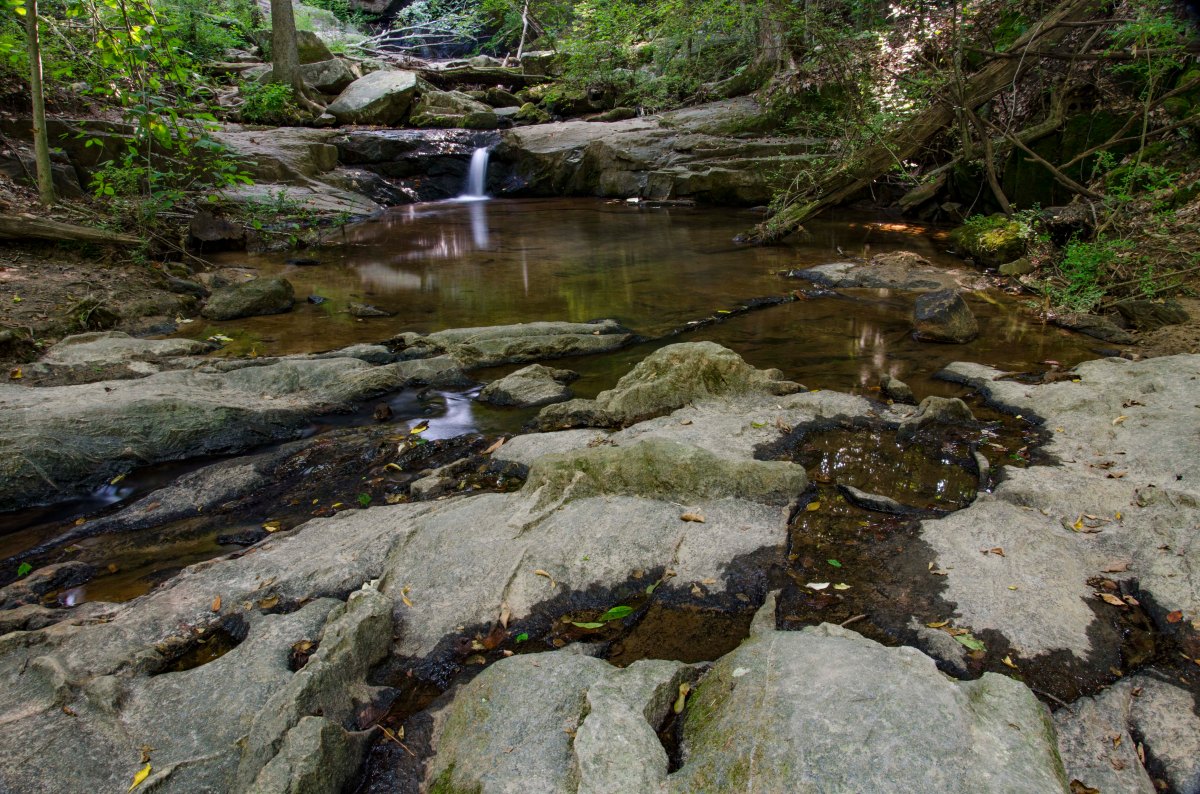
The battle began when Cox’s Division moved south and Hascall’s Division moved east to press the Confederate flank. The 11th Kentucky Regiment (Federal) of Cox’s Division was at the front of the advancing line and made first contact with the 4th Kentucky (CS), who were posted as skirmishers in front the famed Kentucky Orphan Brigade. This action happened in the area of the waterfall in what is now Cascade Springs Nature Preserve. Cox’s attack was repulsed and he suffered a severe loss. He reformed for another attempt, but was repulsed a second time after which he withdrew from the assault. Hascall was hindered by the South Fork of Utoy Creek and made minimal gains in his assault. He did reach the rear of an artillery battery, which withdrew to the east to another position on high ground from which they still had a commanding view.
The XIV Corps, now commanded by Johnson, has sat idle most of the day and did not make an attempt to attack until late afternoon and he only attacked with one division. He gained no headway and retired before anything larger than a skirmish developed.
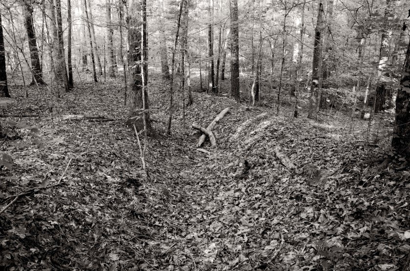
The Confederate left flank was manned by Bate’s Division along a ridge line just south of Sandtown Road (Cascade Road). S. D. Lee’s Division connected to Bate’s right at the Sandtown Road east of what is now Beecher road. Bate’s left flank was open and vulnerable to attack and on the night of the 6th, Hood ordered Bate’s Division to withdraw from the area back to the Confederate main defensive line.
The Federal assault cost them approximately 800 lives and numerous wounded, while the Confederates lost only 18 soldiers while defending their heavily entrenched and fortified lines.
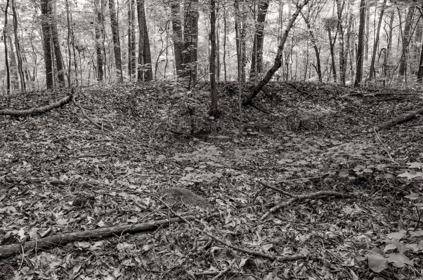
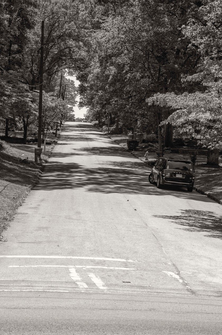
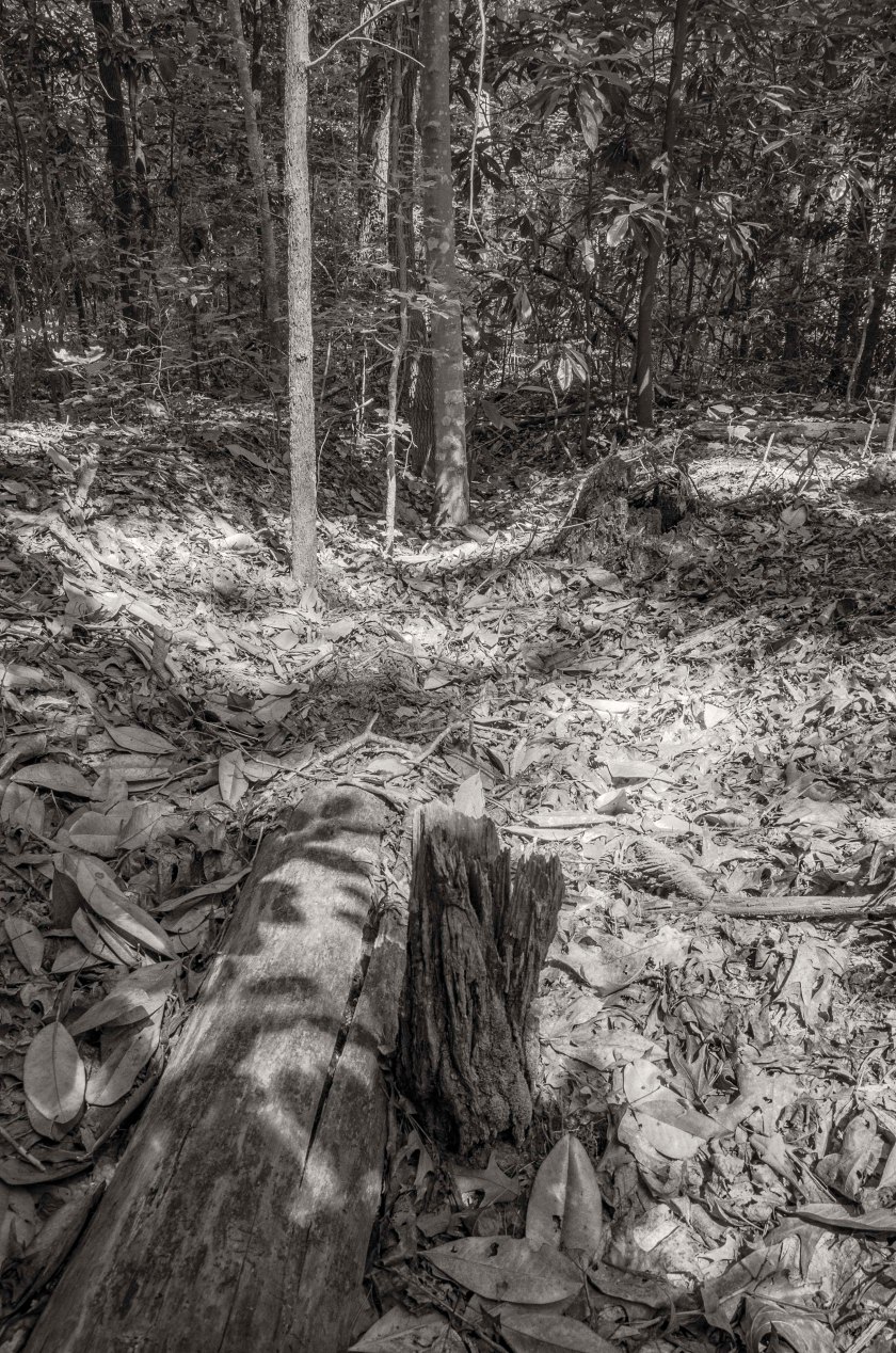
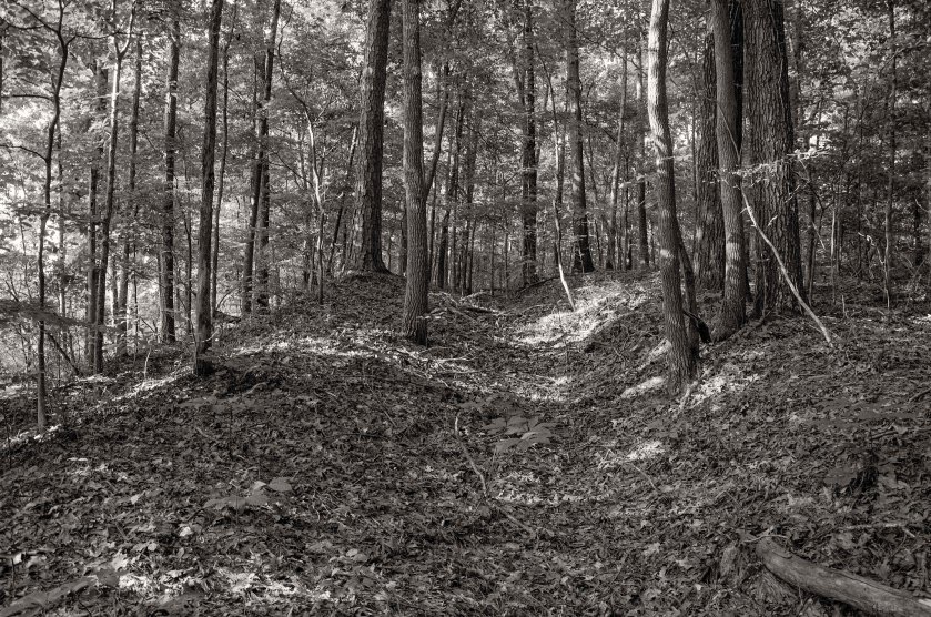
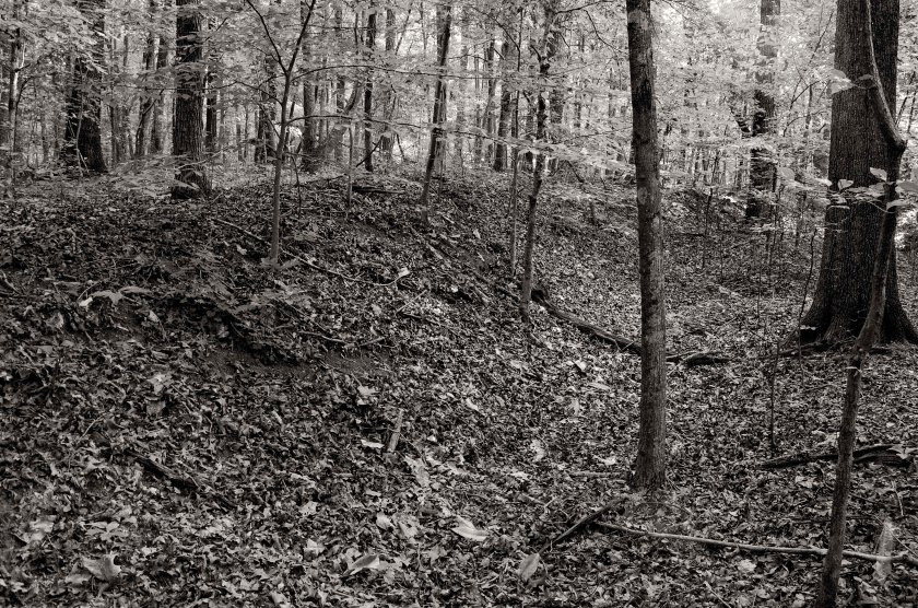
Remnants of Federal earthworks manned by Cox’s Division of Schofield’s 23rd Corps(US). This was near the far left of Cox’s Division as well as the left of the 23rd Corps before it abutted the right of the 14th Corps(US) commanded by Johnson. Byrd’s Brigade of Cox’s Division held this area.Utoy Creek at the bike path inside Lionel Hampton – Beecher Hills Park. When Cox’s Division(US) advanced on Bate’s Division(CS), which held the ridge just south of the Sandtown Road (Cascade Road), they crossed in this area. The earthworks the stepped off from were in the previous image and are located a few hundred yards north (right of frame) of the creek on the ridge.Utoy Creek at Peyton Road. The right of Cox’s Division(US) crossed the creek in this area as they advanced on the Bate’s Division(CS) which held the Confederate left flank.Hascall’s Division of Schofield’s 23rd Corps(US) advanced south and then made a 90 degree to the east to attack the end of the Confederate left flank which was exposed and vulnerable. Hascall’s Division was greatly hampered by the thickets of woods and underbrush on the South Fork of Utoy Creek. Hascall eventually reached the Confederate line with minimal affect, but did cause an artillery battery to withdraw to another position.A small water fall inside Cascade Springs Nature Preserve. It was in this area that the first contact of the Battle of Utoy Creek happened. The skirmishers of the Federal 11th Kentucky Reg.(US) engaged the the pickets of the 4th Kentucky Reg.(CS) of the famed Confederate Kentucky Orphan Brigade commanded by General Joseph Lewis. There are several accounts in diaries or letters of soldiers bathing in the creek the day before the battle.A Confederate artillery battery inside the Cascade Springs Nature Preserve. The battery here was commanded by Capt. Houston King and was named the Missouri Horse Artillery Battery. As Hascall’s Division advanced across the South Fork of Utoy Creek, he forced the battery to withdraw to another position that was more defensible. Confederate earthworks inside the Cascade Springs Nature Preserve. Lewis’s Kentucky Orphan Brigade of Bate’s Division(CS) held the position on the left end of the Confederate line. As Cox’s Division(US) attacked the strong entrenchments of the Confederates, they were quickly repulsed. Cox’s formed his lines for another assault which was subsequently repulsed with heavy losses. After the second attempt failed to take the Confederate line, Cox withdrew his Division back to their starting point.A dead tree across the top of Confederate earthworks gives scale to their current depth. These works work manned by Lewis’s Kentucky Orphan Brigade of Bate’s Division (CS). Realizing the fault of the exposed left flank, General Hood ordered the Corps commander, General S. D. Lee to withdraw Bate’s Division back to the main Confederate line on the night of the 6th.Smith’s Brigade of Bate’s Division held this ridge line here south of the Sandtown Road, now Cascade Road. This view is looking from Cascade Rd. (formerly Sandtown Rd.) to the south and up at the ridge line on Woodland Terrace. Byrd’s Brigade of Cox’s Division(US), which constituted the left of Cox’s Division, attacked Smith’s Division along this ridge line where they met stiff resistance from the heavily fortified Confederate positions.Looking west along Cascade Road, formerly Sandtown Road. The Confederates of Bate’s Division(CS) held the high ground south(left) of the road and in this area Byrd’s Brigade of Cox’s Division(US) crossed the road to attack Smith’s Brigade of Cox’s Division(CS).Known as Cascade Mansion, this home, now a special events facility, was built by Dr. William Poole, who later became a Confederate surgeon in the 57th Ga. Infantry. Construction began in 1860, but due to the war, it was not completed until 1870. During the Battle of Utoy Creek, General Bate’s(CS) used the partially finished home as his headquarters while commanding his troops. After the Battle of Utoy Creek and during the “Siege” of Atlanta, it was used a Union hospital.Utoy Church, now known as Temple of Christ Pentecostal Church, is one of the oldest Churches in Fulton Co. as is its cemetery. It was established in 1824 and moved to this location in 1828. Heavily remodeled and with multiple additions, it still stands where it did in 1828. During the battles that took place around Atlanta, it was used as a hospital. During the Battle of Utoy Creek it was again used as a hospital and the Confederate defensive lines crossed the property in the north west corner.When I visited the Church and Cemetery on the 150th anniversary of the Battle of Utoy Creek, I found that someone had placed new Confederate flags at the headstones of the unknown soldiers that had died here during the battle. Being such an old cemetery, there are grave markers indicating the graves of soldiers who served as far back as the Revolutionary war and the Spanish American War.While I am sure there were other Jewish Confederate soldiers, this was the only Jewish Confederate grave stone that I came across in my nearly year long journey following Sherman through Georgia. I have been in a great many cemeteries along the way and seen many Confederate graves, but this was a first.Greenwood Cemetery. The Confederate lines that extended south west of the Atlanta’s inner defensive line, crossed through the high ground and hills inside what is now Greenwood Cemetery. Clayton’s Division of General S. D. Lee’s Corps(CS) was positioned along this line. They were located to the right of Bate’s Division and were engaged in skirmishing with the Federal 14th Corps(US) Commanded by General Johnson.Just inside the wood line of the western part of Greenwood Cemetery you can find remnants of the Confederate earthworks that were manned by Clayton’s Division(CS) and who repulsed a halfhearted attack by the Federal 14th Corps(US). My ancestors who were in the 42nd Ga. in Stovall’s Brigade were positioned in this area. Remains of the Confederate line the extended south and west from Atlanta’s inner defensive line to protect the railroad in East Point. These works are located in a wooded part of John A. White Park.
The conflict between General’s Sherman, Palmer and Schofield continued throughout the day. Palmer sent multiple letters arguing back and forth with Sherman. Palmer’s final letter said “I will call upon you tomorrow morning and present a formal application to be relieved.” While they bickered back and forth, Federal units were still trying to get in line for the move toward East Point. For the remainder of the day Palmer agrees to relay orders from Schofield to his XIV Corps. Baird’s Division advances south toward Utoy Creek and encounter the Confederate skirmishers. They take about 140 prisoners. They then turn towards the east and encounter an artillery barrage. They decide not to advance and assault the Confederate works as they assume they will be repulsed. Davis brings his division up along side Baird’s and comes to halt as well. Schofield is not happy about the assault coming to a halt. He orders Johnson’s Division of Palmer’s Corps to swing around the right and attack the Confederate left flank. Johnson waits until early evening to begin his movement, which he calls a “reconnaissance”. He moved a short distance and then calls it off since it is too late in the day to do much good. He falls back to the rear of Davis. Schofield and Sherman are both displeased with the performance of Palmer’s XIV Corps. Palmer will resign in the morning and for a time Johnson will command the XIV Corps.
During the night of the 5th, Hood orders the defensive lines extended further south and west to protect the railroad in East Point. The line extended about 1.25 miles from the existing defensive lines, down a ridge line the paralleled the Sandtown Road (Cascade Road), and overlooked the North Fork of Utoy Creek. The far left of the line ended in the area of the current Cascade Springs Nature Preserve.
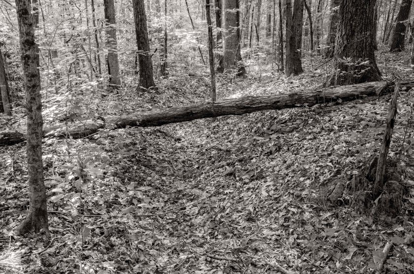
Looking north along the bike path in Lionel Hampton – Beecher Hills Park. Cox’s Division of Schofield’s 23rd Corps (US) established their lines on the ridge line at the top of the hill in the distance.Portion of Federal earthworks manned by Cox’s Division.A fairly long stretch of earthworks occupied by Cox’s Division of Schofield’s 23rd Corps (US) inside Lionel Hampton – Beecher Hills Park.A dead tree lies across the remnants of Federal earthworks of Cox’s Division. The log helps demonstrate the depth of the remaining earthworks that are tucked away in the forest of Lionel Hampton – Beecher Hills Park.
After learning of the flanking movement being conducted by Howard’s Army of the Tennessee, Hood ordered S.D. Lee’s Corps and A. P. Stewart’s Corps to move out the Lickskillet Road in an effort to check the Federal advance and try to roll up their right flank.
Howard began deploying his units on the 27th in an effort to reach the railroad at East Point. He started his line of battle somewhere along what is now Chappell Road south of North Ave. His line followed the high ground along Chappell Road to the south. On the morning of the 28th, Howard began deploying the remainder of his army along the ridge and continuing south down Chappell Road. The Federal line then began to curve to the right (southwest) near the intersection of Ezra Church Drive and Chappell. The line continued its curve through what is now Mozley Park. Ezra Church was located in the park on a grassy hill between MLK Blvd. and the ball fields of the park. Federal units used Church Pews and wood from the church to construct barricades to fire from. The line continued to curve southwest until it reached the point of Laural Ave. and Archer St. This was the salient in the Federal line. From this point it turned in a northwesterly direction. It would have crossed West Lake Ave, passing over part of Anderson and Verbena and ending on the hill where the current Sadie G. Mays Rehab Center (Nursing Home) is located. This would have been the extreme right of the Federal line that surrounded Atlanta as well as Howard’s right. This hill was called Battle Hill.
Lee’s Corps formed up for battle in the area along the front portion of the current Westview Cemetery. Brown’s Division formed up on the left with Brantley’s Brigade forming on the far left. Clayton’s Division formed on the right with Holtzclaw’s Brigade at the right. Stewart’s Corps formed to the rear of Lee along the Lickskillet Road (formerly Gordon Road and now called Ralph David Abernathy Blvd.). An artillery battery was located in what is now the Westview Cemetery on a hill behind the Alms House (poor house). The Alms House was located in the area just south of Westview’s original entry gate.
In the early afternoon the Confederate attack began. Their movement was screened by thick woods in the area and in some locations they were within 50 yards of the Federal line before they were seen. Brantley’s Brigade on the Confederate left attacked Lightburn’s Brigade on the Federal right in the area of Battle Hill. They were successful at first and were able to take the hill for a short time, but were forced to retreat when several regiments from the reserves of the XV and XVI Corps arrived. Sharp’s Brigade, who held the center of Brown’s Division, advanced on the Federal line through the area of what is now the West Lake Marta Station.
Clayton’s Division of Lee’s Corps was advancing on the Federal line just east of the salient and in the area of Ezra Church. Their repeated assaults were constantly repulsed by the Federals who had the high ground and in some locations had begun to dig in and build barricades. Around 2pm, part of Stewart’s Corps began to advance in support of Lee’s Corps. They concentrated their force in the same area of Clayton’s Brigade, but Stewart was also unsuccessful in his attack. Stewart was wounded in the fighting on a hill on the south side of MLK Blvd between Federal Drive and Gordon Terrace. Stewart was about to send additional units into the fight when he was wounded and carried from the field. Walthall, one of Stewart’s Divisional commanders assumed command and instead of sending in more soldiers, he began to withdraw from the area.
After being repulsed by the Federals multiple times and the coming nightfall, the Confederates pulled back to their jumping off point and began to dig in. Some of the works are still visible in a section of Westview Cemetery. This was the third defeat for Hood in his short time as the commander of the Confederate Army of Tennessee. While they did not defeat the Federals, they did prevent their move on East Point, at least for the time being and as fast as the Federals tried to go around the Confederate flank, the Confederates were just a little faster in building earthworks and extending their line.
Anderson Ave. between Calloway Dr. and Verbena St. Taken from the high ground looking south toward Verbena St. Federal Soldiers of M.L. Smith’s Division of General Logan’s 15th Corps(US). We are looking in the direction of the on coming Confederate attack of General Brown’s Division, who was positioned on the left of General S. D. Lee’s Corps(CS).Verbena St. looking west toward Penelope Dr. about 75 yards west of Anderson Ave. The Federal lines occupied the high ground here and at this approximate point the Federal line made a sharp turn to the north as to protect their flank. This was the far right of the Federal Lines.Sadie G. Mays Health and Rehabilitation Center. This area, on Anderson Ave. just east of the intersection with Verbena, was known as Battle Hill. This area saw the heaviest fighting and multiple attacks by the Confederates of Brown’s Division. At one point the Federals were pushed back from their works, but soon counter attacked with reinforcements and drove the Confederates and were able to reform their original line and extend the flank. Late in the afternoon, after Brown’s Division had suffered heavy losses from their repeated assaults on the Federals, they were retired and Walthall’s Division of General Stewart’s Corps(CS) was brought forward with fresh troops to continue the assault.Looking west in the area in front of Battle Hill. Anderson Ave.and Verbena St. are to the right side of the image. The Confederates of Brown’s Division and later Walthall’s Division crossed this are in their repeated attempts to take the Federal lines. The Confederates would have been attacking from the left side of the image to the right.Laurel Ave. looking north toward the intersection with Archer St. This high ground was occupied by the Federals of Harrow’s Division of the 15th Corps(US). This spot is as far south as the Federal lines came during the battle and here the line formed a salient angle moving off to the north west (left) and to the north east (right). From this point back to the north east, there was a gap in the Federal line of approximately 100 yards. This gap was due to the heavily wooded terrain at the time. As the attack began, the Federals recognized the vulnerability of the gap in their lines and quickly brought up several regiments of reserves to fill the gap.Looking south down Laurel Ave.between Archer St. (to the rear of the camera position) and Mims St. The Confederate attack came straight at the Federal lines through here. As you look into the distance you can see the terrain begins to take on a upward slope. Clayton’s Division(CS), which was formed up to the right of Brown’s Division(CS), used the low ridge to hide their movements from the Federals. They were able to form up and deploy for battle while using the concealment that was offered by the ridge line. The woods in this area were so thick, that the Confederates were able to get within 50 yards of the Federal lines before they were seen.M.L.K. Jr. Dr. across from the intersection with Federal Dr. General A. P. Stewart was wounded on this high ground here as he was commanding his Corps in the Battle. He was about to send in his General Loring’s Division into the assault, but before he could give the order, General Stewart was struck in the head with a “Spent” bullet and was carried from the field. He was able to return to his about two weeks later. General Walthall then assumed command of the Corps and ordered his Division to retire from battle and did not send Loring’s Division into the attack.Mozley Park, the site of Ezra Church, name sake of the battle. The Federal lines came to this point and started to turn in a generally north eastern direction. Wangelin’s Brigade of Wood’s Division, 15th Corps(US) was positioned here at the church and extended just to the east. Williamson’s Brigade of the same Division was positioned at the church and extended just to the north east. They used the church pews and wood from the church to fortify their position and fend off the attacking Confederates of Clayton’s Division.Ezra Church Drive. The hill top in this image was part of the Federal line. From here the Federal line move south west(left) along the high ground toward Ezra Church and north east along the high ground toward what is now Chappell Road where it turned more in a more northern direction and followed the high ground.Chappell Road at Joseph E. Boone Blvd. Looking south along Chappell Rd you can still recognize some of the high ground that the Federals occupied. The 4th Division of the 17th Corps, commanded by General Giles A. Smith(US), held the Federal line in this area. There was very little, if any, action in this area.Chappell Road at North Ave. The high ground here held the far left end of the Federal lines for the Battle of Ezra Church. This area was occupied by Federal troops of the 3rd Division of the 17th Corps under the command of General Leggett.Overlook Atlanta Apartment Homes, locate where Chappell Rd dead ends into Donald Lee Hollowell Pkwy. At the time this was called Davis hill and was occupied by the 2nd Division, commanded by Brig. General James D. Morgan, of General Palmer’s 14th Corps(US). Prior to the Battle of Ezra Church, General Sherman had ordered the 2nd Division to reinforce the right flank of Howard’s Army of the Tennessee on their movement towards East Point. The 2nd Division became lost in the heavily wooded area and were eventually ordered to return to their works at Davis hill. There was also a gap of about 1000′ in the Federal lines between Davis Hill the left of the lines at Ezra Church near North Ave and Chappell Rd.Westview Cemetery, a marker describes the Battle of Ezra Church. Putnam Darden’s Mississippi Battery was stationed near here on the hill behind the Alms House (poor house) that served as a battlefield landmark. This battery support Brown’s assault on the Federal lines near Battle Hill.The original main entrance, now closed, to Westview Cemetery, sits on the site of what was once the Alms House (poor house). This was a known battlefield landmark and Brown’s Division of S.D. Lee’s Corps, formed their lines of battle in the area as they prepared to assault the right side of the Federal line.Confederate earthworks inside Westview Cemetery. After Confederate forces failed to force the Federals out of the lines, they fell back to this area along high ground in what is now Westview Cemetery. This position was later captured by Federal troops and during the time period called “The Siege of Atlanta”, they place an artillery battery here on the high ground and began shelling the city.The lone headstone near the wood line marks the grave of a Confederate officer named Lt. Edward Clingman who died in the Battle of Ezra Church. There is a small section of Confederate earthworks in the woods behind the headstone.
August 6th, 1864: The Battle of Utoy Creek This morning, Sherman has accepted the resignation of Palmer, who will be on a train back to Chattanooga by the afternoon, and the Federals had formed up their lines and everyone was in place to attempt an advance across Utoy Creek towards the railroad in East Point. With Palmer’s resignation, Robert W. Johnson, a division commander within the XIV Corps, was appointed Commander of the XIV Corps and placed under the command of Schofield. Displeased with the performance of the XIV Corps on the previous day, Schofield had moved his XXIII Corps to the right of the XIV Corps. The XXIII Corps is now the Federal right flank and the XIV Corps is the left flank with Logan’s XV Corps in support to their left. Palmer’s Corp was fanned out in an arch following the current Beecher Road south to Benjamin E. Mays and making a slight turn to the west, just north of Cascade Road. Palmer’s right ended near Willis Mill Road. Schofield’s left was adjacent to Palmer’s right with Cox’s Division along Cascade Road and stretching out west. Hascall’s Division of Schofield’s Corps turn south making a 90 degree turn to the south and was facing the end of the Confederate line at the Confederate left flank. The battle began when Cox’s Division moved south and Hascall’s Division moved east to press the Confederate flank. The 11th Kentucky Regiment (Federal) of Cox’s Division was at the front of the advancing line and made first contact with the 4th Kentucky (CSA), who were posted as skirmishers in front the famed Kentucky Orphan Brigade. This action happened in the area of the waterfall in what is now Cascade Springs Nature Preserve. Cox’s attack was repulsed and a severe loss. He reformed for another attempt, but was repulsed a second time after which he withdrew from the assault. Hascall was hindered by the South Fork of Utoy Creek and made minimal gains in his assault. He did reach the rear of an artillery battery, which withdrew to the east to another position on high ground from which they still had a commanding view. Palmer’s Corps, now commanded by Johnson, has sat idle most of the day and did not make an attempt to attack until late afternoon and he only attacked with one division. He gained no headway and retired before anything larger than a skirmish developed. The Confederate left flank was manned by Bate’s Division along a ridge line just south of Sandtown Road (Cascade Road). S. D. Lee’s Division connected to Bate’s right at the Sandtown Road east of what is now Beecher road. Bate’s left flank was open and vulnerable to attack and on the night of the 6th, Hood ordered Bate’s Division to withdraw from the area back to the Confederate main defensive line.
August 5th, 1864: The conflict between General’s Sherman, Palmer and Schofield continued throughout the day. Palmer sent multiple letters arguing back and forth with Sherman. Palmer’s final letter said “I will call upon you tomorrow morning and present a formal application to be relieved.” While they bickered back and forth, Federal units were still trying to get in line for the move toward East Point. For the remainder of the day Palmer agrees to relay orders from Schofield to his XIV Corps. Baird’s Division advances south toward Utoy Creek and encounter the Confederate skirmishers. They take about 140 prisoners. They then turn towards the east and encounter an artillery barrage. They decide not to advance and assault the Confederate works as they assume they will be repulsed. Davis brings his division up along side Baird’s and comes to halt as well. Schofield is not happy about the assault coming to a halt. He orders Johnson’s Division of Palmer’s Corps to swing around the right and attack the Confederate left flank. Johnson waits until early evening to begin his movement, which he calls a “reconnaissance”. He move a very little distance and then calls it off since it is too late in the day to do much good. He falls back to the rear of Davis. Schofield and Sherman are both displeased with the performance of Palmer’s XIV Corps. Palmer will resign in the morning and for a time Johnson will command the XIV Corps. During the night of the 5th, Hood orders the defensive lines extended further south and west to protect the railroad in East Point. The line extended about 1.25 miles from the existing defensive lines, down a ridge line the paralleled the Sandtown Road (Cascade Road), and overlooked the North Fork of Utoy Creek. The far left of the line ended in the area of the current Cascade Springs Nature Preserve.
August 4th, 1864: With the failure of Sherman’s plan to use Cavalry to destroy the railroad south of Atlanta and cut off the Confederate supply line, Sherman has decided to begin moving a portion of his forces toward the railroad junction at East Point. This is where the railroad from Macon and the railroad from West Point, which leads into Alabama, meet and form a single line coming into Atlanta. If Sherman’s forces can destroy this junction and control it, they will be able to cut off the supplies flowing into Atlanta. With this in mind, Sherman has sent Schofield and his Army of the Ohio and advance on East Point via the Sandtown Road (Cascade Road). Sherman has attached Palmer’s XIV Corps of the Army of the Cumberland to Schofield and has ordered Palmer to report to and follow the commands of Schofield. The advance was delayed for nearly the entire day as Palmer refused to report to or follow the commands of Schofield. He felt the he was senior to Schofield. They advanced no further than the North Fork of Utoy Creek. The day was wasted through bickering between the Generals and nothing of real tactical importance was accomplished other than a few probes of the Confederate lines, which had be extended as fast as the Union could attempt to turn their flank.