The Confederates are entrenched on the Kennesaw Mountain line and have multiple artillery pieces to the top of Little Kennesaw and Big Kennesaw. It took 100 soldiers to move each cannon up the mountain. Skirmishing continues all along the line, Federal and Confederate Artillery Batteries begin dueling back and forth. General Sherman has ordered General Schofield’s Army of The Ohio to move from Lost Mountain, via the Sandtown Road, thus swinging the Federal right over Mud Creek and toward the south western portion of Kennesaw Mountain. On the evening of the 19th, Schofield reaches Nose’s Creek, about half way between Mud Creek and Kennesaw Mountain.
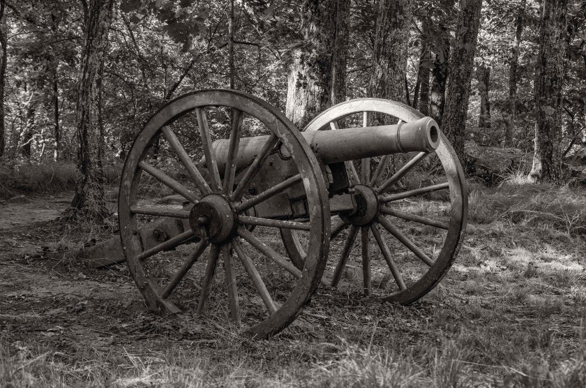
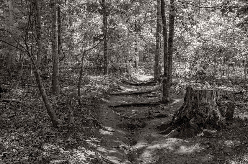
A cannon now sitting silently atop Big Kennesaw Mountain in the original earthworks. The park service has protected the artillery pieces and earthworks here with a split rail fence.Remnant of the period road that soldiers used to drag the cannons up to the top of Kennesaw Mountain. It took 100 soldiers to drag each cannon to the top.An artillery piece sits atop Little Kennesaw Mountain in what is called “Fort McBride”.Earthworks and cannon at Fort McBride, Little Kennesaw Mountain.Looking down the barrel of a big gun. Ft. McBride, Little Kennesaw Mountain.Part of Kennesaw Mountains extensive trail system snake behind the parapets and cannons where Confederate soldiers once fought bitterly against the attacking Union Army.
Heavy fighting happened today around the Latimer Farm portion of the Brushy Mountain – Mud Creek Line. The Marietta Country Club now sits on the former site of the Latimer Farm. The Confederate lines around the Latimer Farm formed a Salient angle, often called Hardee’s Salient, it was vulnerable to enfilading fire. Confederate positions were under near constant bombardment from Federal artillery positions no more than 1200 yards away. Three Federal Divisions, under the command of General Thomas, attacked the three Confederate Brigades at the Salient. The Union troops pushed the Confederate skirmishers back to their main lines and Federal troops soon occupied a trench line in front of the Salient. Once this line was occupied by the Federal troops, General Johnston realized the chances of the being overrun were high. On the night of the 18th, he ordered the evacuation of the line and the Confederate line then moved back to the famous Kennesaw Mountain Line.
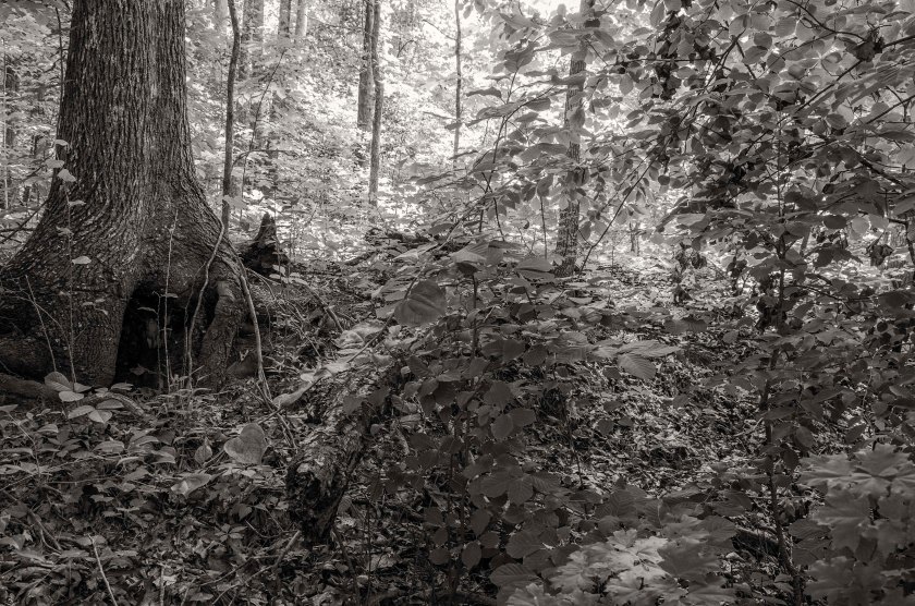
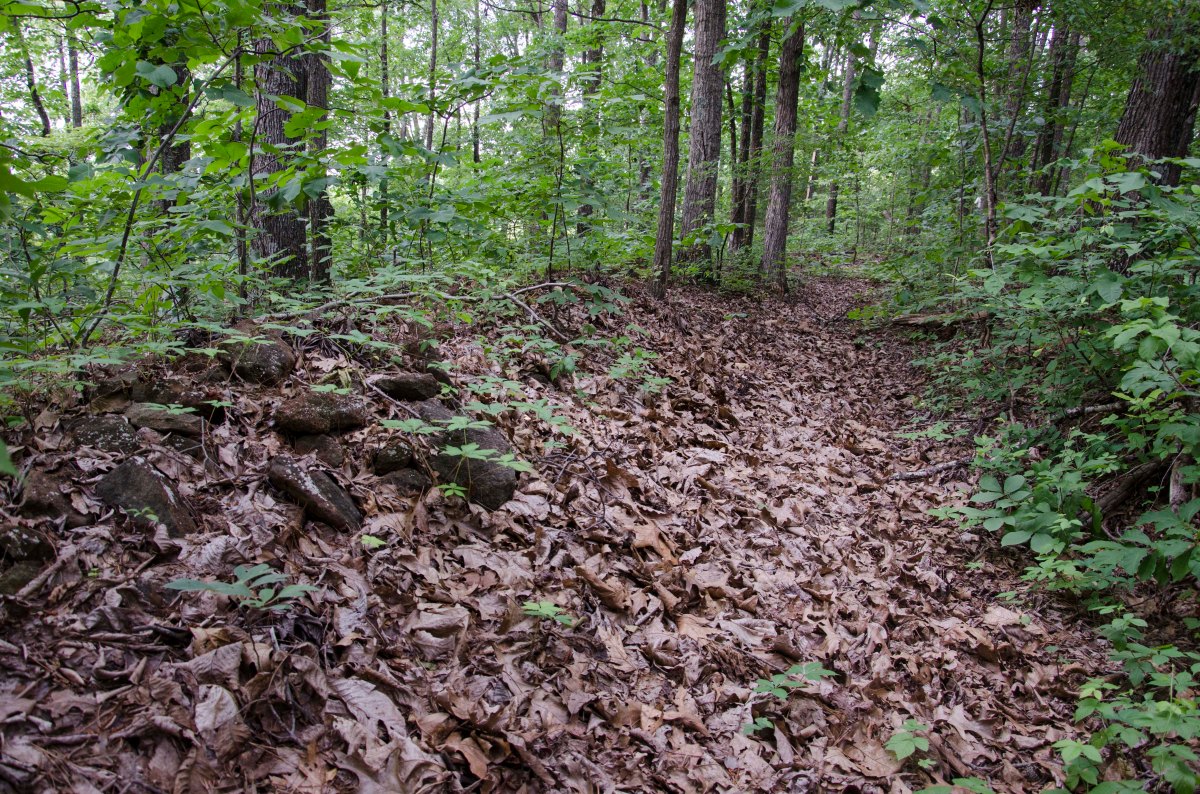
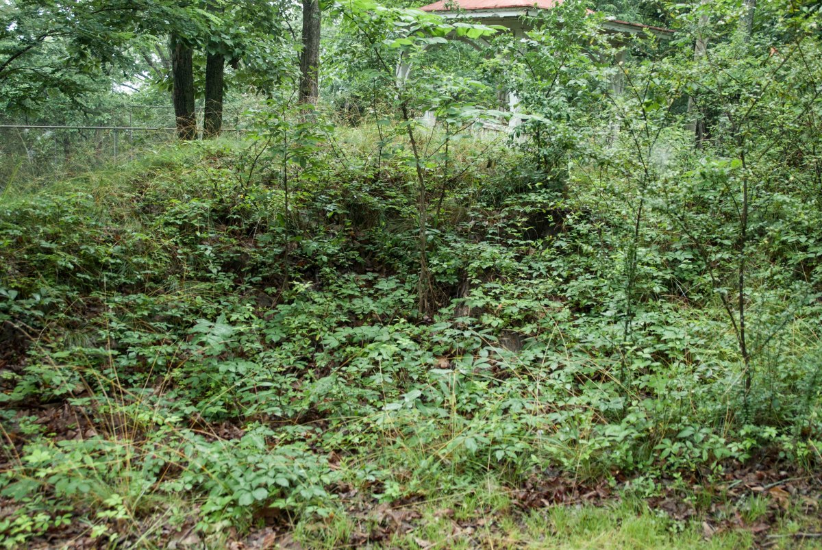
Remnants of Confederate earthworks that were used during the Battle of Latimer’s Farm. Now located within the Barrett’s Green Subdivision, they were preserved in the local SCV Camp McDonald in conjunction with the builder. This area was under a near constant artillery bombardment.While hard to discern due to the undergrowth, this images shows a line of several Federal artillery positions. The are called Lunettes. It is rare to have some so well preserved and these have been protected on private property. The property is now being developed into a subdivision and the Lunettes are being protected through the work of the local SCV Camp McDonald and the developer.Remnants of Federal earthworks located on the same property as the Lunettes above. Efforts by the local SCV Camp McDonald and the developer to prevent the destruction of the remaining earthworks.This shallow depression is all that remains of this section of Confederate earthworks in the area of Hardee’s Salient. They are located on private property that has been farmed for sometime.The small collection of minie balls found on the property of a farmer who owns the property where the previous image was taken. He grew up on the family farm and still lives there today and as a teenager he claimed to have found a 55 gallon drums worth of minie balls in the fields which he sold to collectors. Look close and you may see one with teeth marks… Now covered with trees and thick underbrush, these remnants of Confederate earthworks, that were part of Hardee’s Salient, now sit quietly behind a local church.
Heavy skirmishing continued along the Lost Mountain, Mud Creek, Brushy Mountain Line. Heavy engagements happened in the area of Latimer’s Farm, now the Marietta Country Club. Calvary actions were also happening continuously on both flanks. General Johnston begins planning to move to his next defensive position at Kennesaw Mountain. General Sherman, who has become frustrated, begins to contemplate a direct assault on the Confederate lines as opposed to a flanking movement.
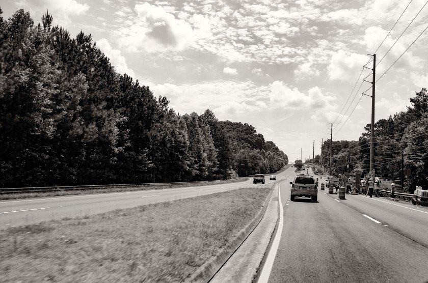
Looking south east along Hwy 120 where it crosses Mud Creek. The Confederates dug in atop the low rise in the distance in an attempt to stall the Federal advance as it crossed Mud Creek. Many, if not all, of the earthworks are now gone and are covered my subdivisions and shopping centers.Confederate earthworks at the far left (west end) of the Brushy Mountain Lost Mountain line. These works were manned by Jackson’s Calvary. These works were preserved by the local SCV Camp McDonald in conjunction with the Subdivisions builder and HOA. They are now preserved as a small park for the subdivision. Earthworks on the extreme right (East side) of the Brushy Mountain Lost Mountain line. These works are located on Brushy Mountain in a small subdivision. They are protected as a small park with historical information signs.“Hoods Fort” on Brushy Mountain stands a large earthwork fortification along with several thousand feet of preserved trenches. The exact purpose of the large fortification is unknown, but many speculate it was used as a ammunition bunker. You can get a sense of the scale from this image as you can look down the slope to the base of the fortification. A section of trenches curves its way around the base of the site known as “Hood’s Fort”
After the fighting at Gilgal Church on the 15th and continued fighting on the 16th, the Union Army has figured out that lines in the area form a salient and begin to pour in enfilading fire on the Confederates. Other Union forces move against the thin line of southern soldiers west of Gilgal Church towards Lost Mountain. Schofield’s XXIII Corps is now in a position to turn Johnston’s left flank, Schofield may or may not realize that he is in such an advantageous position, but Johnston does and orders Hardee’s Corp to pull back at dark, to the far side of Mud Creek and establish a new line. During this retrograde movement, a Union artillery shell explodes near Brigadier General Lucius Polk. He is the nephew of Lt. Gen. Leonidas Polk and only two days after the death of his Uncle, Lucius Polk is wounded and loses his leg.
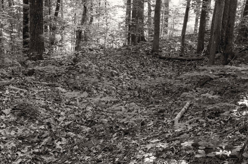
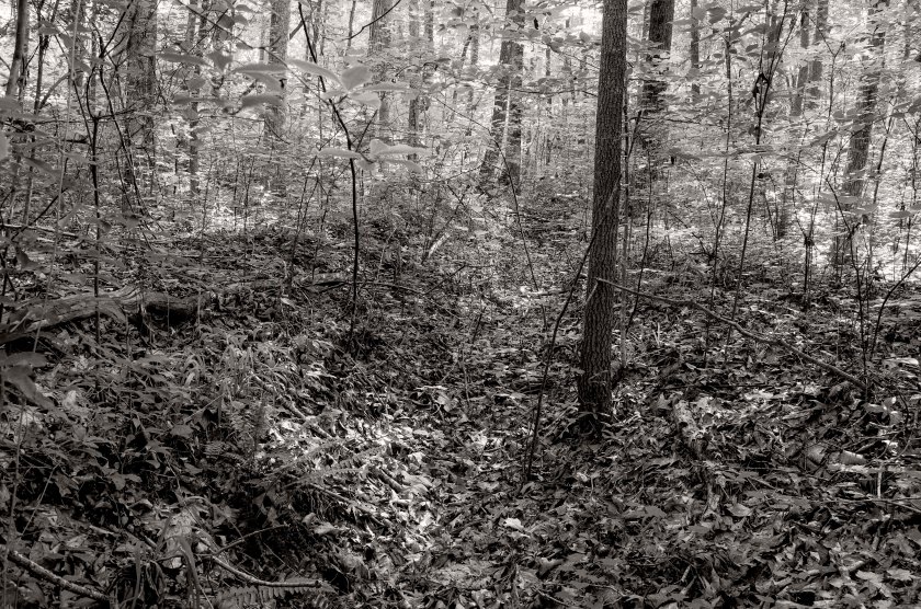
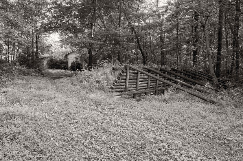
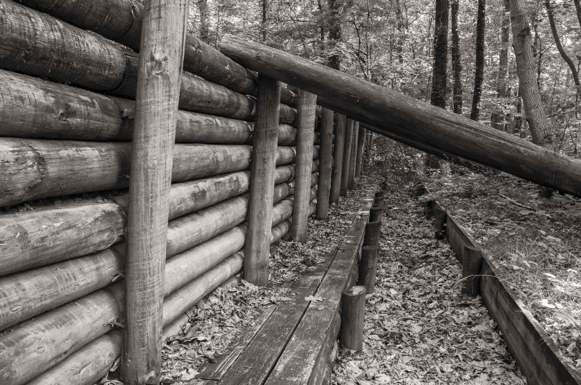
Recreation of what Confederate earthworks may have looked like. Remnants of Confederate earthworks at the site of the Battle of Gilgal Church.
In the mid afternoon of June 15th, Federal troops of the XX Corps under the command of General Hooker, attacked the Confederates of Cleburne’s Division. The attack came from the north as the Federals moved down both sides of the Sandtown Road. Cleburne’s Division was well entrenched and was backed up by artillery. They were able to repel the Federal advance and eventually the Federals withdrew as they began to run low on ammunition.
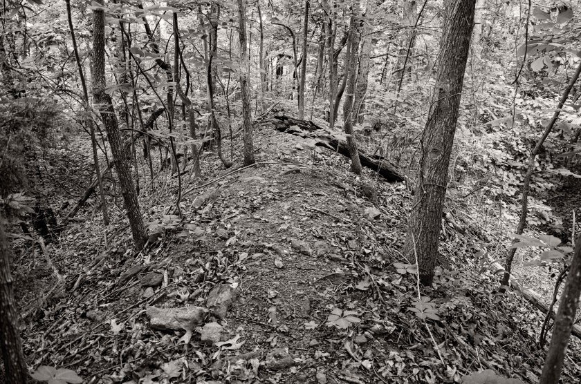
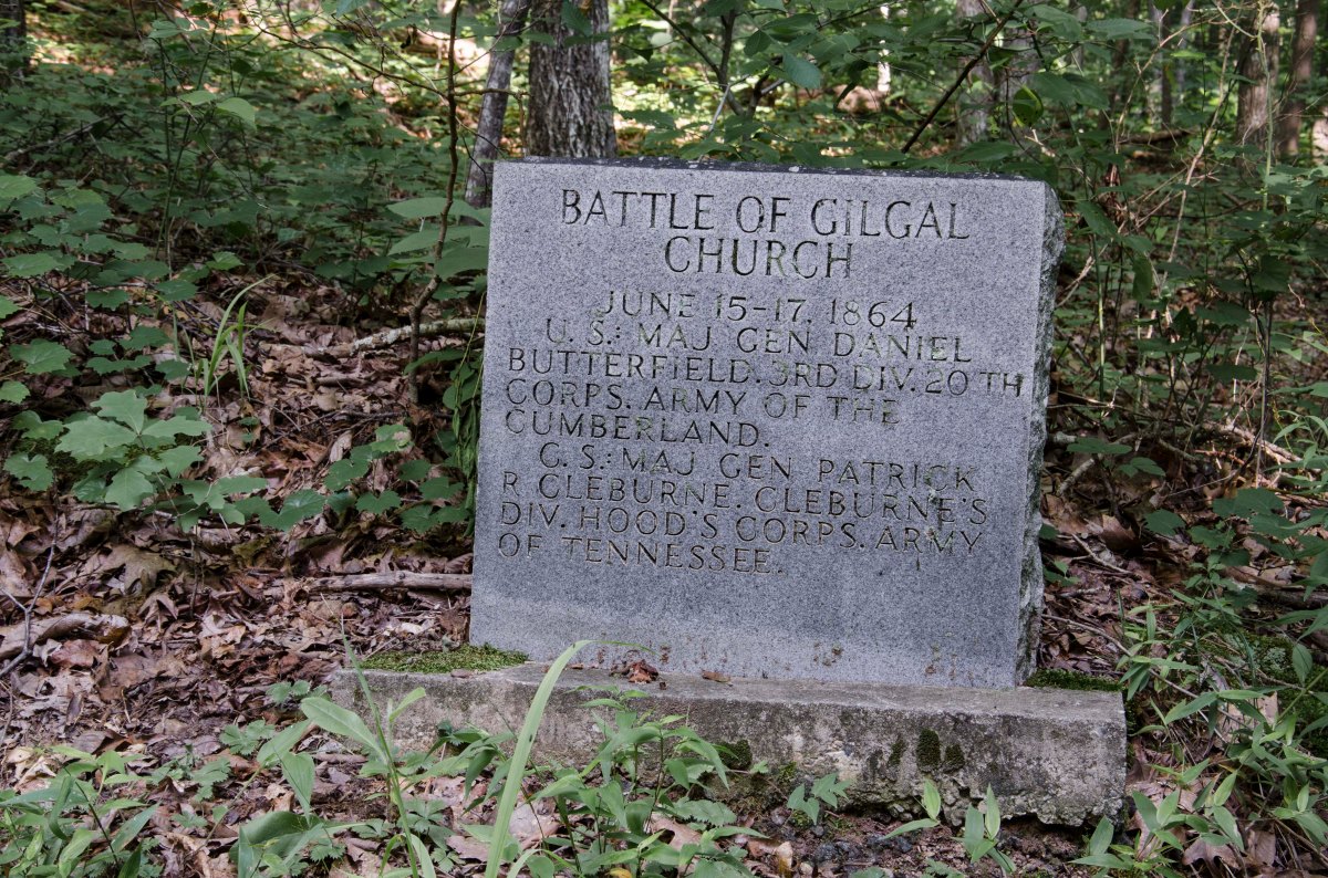
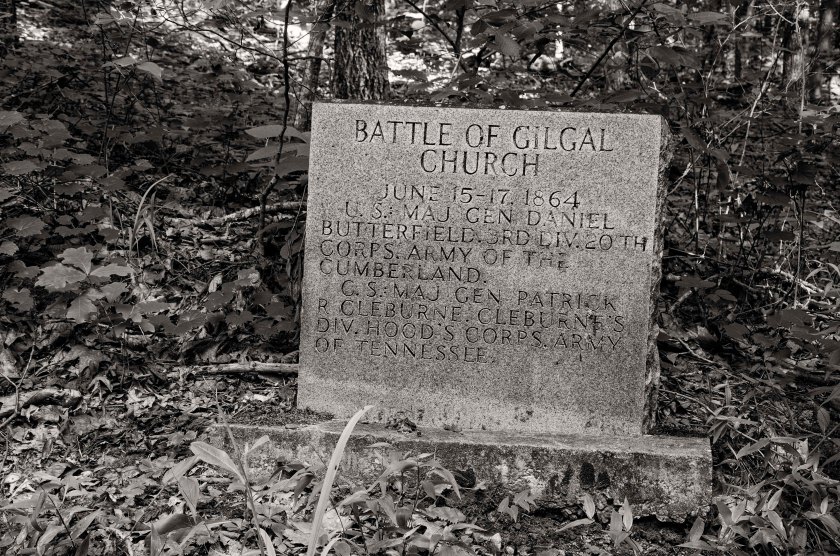
The angle logs were to keep the “head log” from being blown into the trench as well as to keep other debris that may fall from an artillery bombardment.Remnant of Confederate earthworks at Gilgal Church. Stone monument at the site of the Battle of Gilgal Church. The monument sits next to the existing remnants of Confederate trenches.
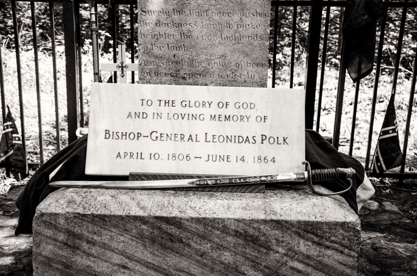
Being concerned that the position of Bate’s Division on Pine Mountain was quickly becoming compromised, Confederate Generals Johnston, Polk and Hardee, rode to the top of the mountain on the morning of the 14th. As the Generals were inspecting the position, they were observed by members of a Federal artillery battery located about a mile to the north east of the mountain. This was the 5th Indiana Battery. They observed what appeared to be officers on the mountain and opened fire. The first round buried it’s self in the parapet of the Confederate position and the second round struck General Leonidas Polk in the chest killing him instantly. Polk, also called the Bishop General was the Episcopal Bishop of Louisiana and was greatly revered by his men. His death struck a serious blow to the Confederacy.
Later on the 14th, Federal forces attacked Pine Mountain in an attempt to cut it off from the main Brushy Mountain Lost Mountain line. Pine Mountain formed a salient in the Confederate lines and was just over a mile to the north of the main line. The Federals pushed hard to cut Pine Mountain off from their main line, but were repeatedly repulsed by the well entrenched and fortified positions of the Confederates of Bate’s Division. General Johnston ordered Bate’s Division to with draw from the position on the night of the 14th under the cover of darkness.
Location on top of Pine Mountain were General Leonidas Polk was fatal struck by an artillery round from the 5th Indiana BatteryRemnants of the parapet the took the first round from the 5th Indiana Battery. Earthworks atop Pine Mountain. These were manned by Bate’s Division.
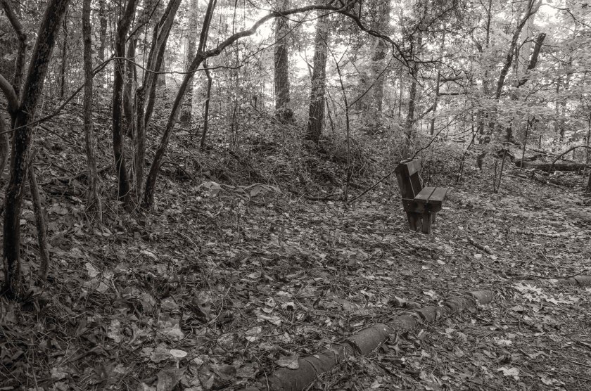
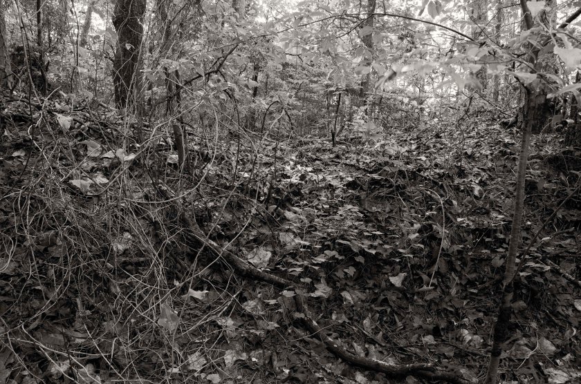
Now located behind a church, this is the position of the 5th Indiana Battery that fired the fatal shot killing General Leonidas Polk. It has been turned into a small nature trail for the church.Looking through the notch in the parapet wall of the 5th Indiana. One of the artillery pieces would have fired through this notch in the wall.From the 150th anniversary memorial ceremony held on Pine Mountain, June 14th 2014.F.D.Polk IV, 3rd Great Grandson of the General Leonidas Polk was present at the memorial service.During the memorial service a reenactor was portraying a Reverend and presided over the memorial service.Surviving Confederate earthworks of Bate’s Division where they repulsed the Federal attack on June 14th along the base and slopes of Pine Mountain.
Surviving Confederate earthworks of Bate’s Division where they repulsed the Federal attack on June 14th along the base and slopes of Pine Mountain.
Surviving Confederate earthworks of Bate’s Division where they repulsed the Federal attack on June 14th along the base and slopes of Pine Mountain.
Both armies have endured nine straight days of rain. It slows down General Sherman’s advance to a snail like pace as the wagons are mired down in the mud. General Johnston’s troops are nearly swimming in their trenches.
On this day, Sherman’s armies have located the Confederate line about two miles south of Big Shanty. It stretches from Brushy Mountain on the Confederate right, across the Western & Atlantic Railroad, all the way to Lost Mountain on the Confederate left. The line is 10 miles long and is stretched pretty thin. The Confederate Army has also fortified Pine Mountain, which sits in advance of the main line at roughly the center.
The railroad bridge over the Etowah River has been repaired and the first train, a railroad repair train, pulls into Big Shanty. This is welcome news to General Sherman, his supply line is now up and running and he will no longer be so dependent on wagon trains traveling muddy roads for his supplies.
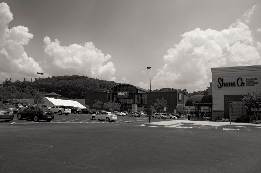
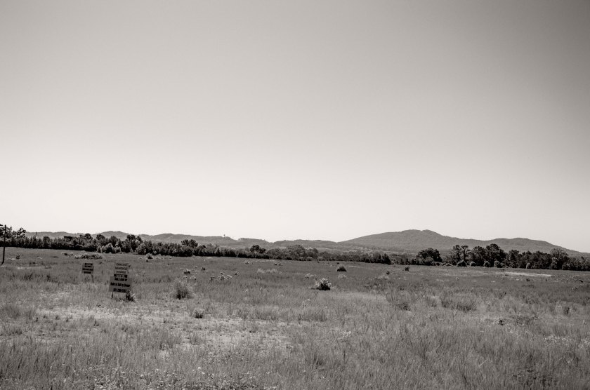
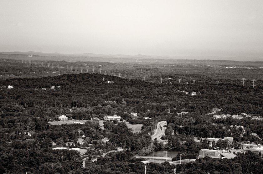
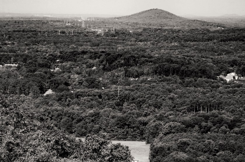
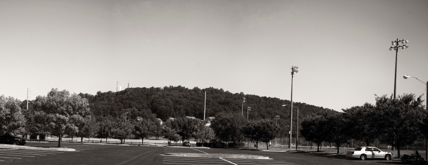
The base of Brushy Mountain is no longer war torn, the only fighting that happens here is over sale items on Black Friday. The ridge behind these stores still contains several thousand feet of intact earthworks.View of Brushy Mountain from Kennesaw Due West Road near Hwy. 41. Earthworks, as well as a large fortification with an ammo bunker still remain on the ridge.From left to right, the low ridge is Brushy Mountain, followed by Kennesaw Mountain and then Little Kennesaw Mountain. This high ground formed a strong line against the approaching Federals and repulsed multiple attacks. It was later abandoned after the Confederates were out flanked.Pine Mountain as seen from Kennesaw Mountain. The mountain is now covered with houses and two large water tanks. There are still remnants of earthworks that home owners have protected on their private property as well as the memorial to General Polk.Lost Mountain as seen from Little Kennesaw Mountain. This formed the western anchor of the Brushy Mountain line with Brushy Mountain forming the eastern anchor. Pine Mountain was a detached salient point near the center of the line. South side of Lost Mountain as seen from Lost Mountain park in Cobb County. The mountain is now covered with home that start in the high $500,000.00 range. I was not able to gain access to any of the mountain, but I have been told that there are still some visible earthworks on the mountain.
General Sherman is informed by Colonel Wright, head of the Railroad Construction and Repair Corps, that the bridge over the Etowah will be completed and operational by June 12. Upon hearing this, Sherman orders Generals McPherson, Thomas, and Schofield to begin moving forward the next morning and begin to find the Confederate positions.
General Sherman receives welcome reinforcements in the form of the XVII Corp, commanded by Major General Francis Blair. They have traveled from Illinois and have arrived at the front with 9,000 additional soldiers, after leaving 2,000 to garrison Rome, Ga. and 1,500 at Allatoona Pass.
General McPherson, with his Army of the Tennessee, established a line just south of Acworth at Proctors Creek. General Sherman joins him there. It has been one month since the start of the campaign. Massive amounts of men and material have been moved a great many miles over the last month. The Union Army now controls the railroad from Acworth on up to Chattanooga and beyond. As soon as the bridge over the Etowah is repaired, the flow of desperately needed supplies will resume.