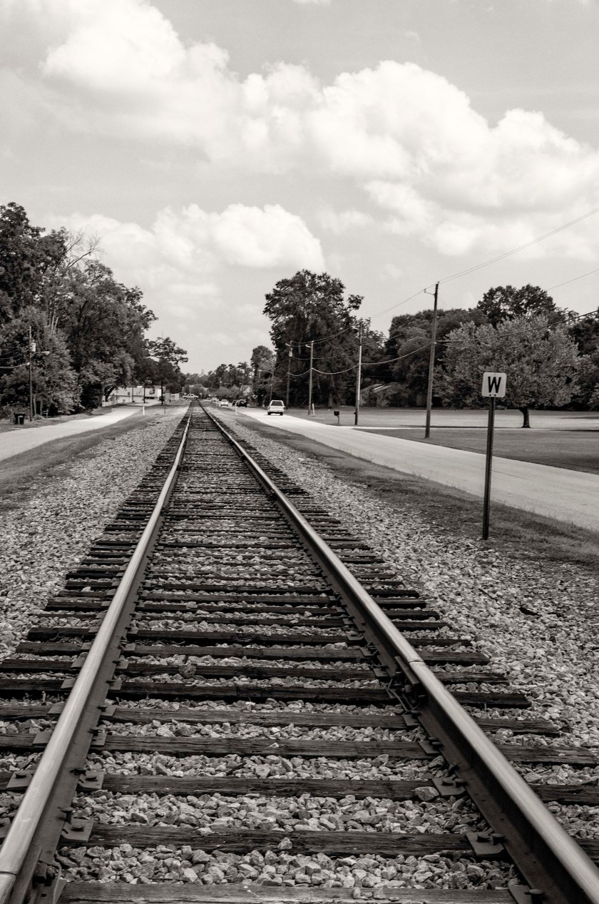
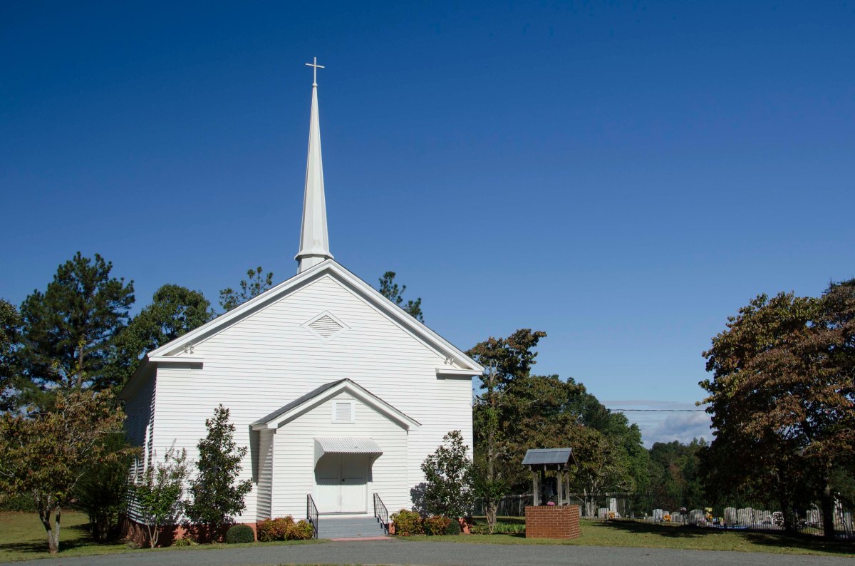
After leaving from Fairburn on the 19th, Kilpatrick moved his column towards Jonesboro. He once again met resistance from Ross’s Texas Brigade, first to his rear and then after Ross moved south below Kilpatrick and made it across the Flint River before Kilpatrick, he was then in Kilpatrick’s front. Ross’s Brigade removed the planks on the bridge over the Flint River and formed a line of battle on the high ground on the east side of the river. Kilpatrick had his artillery open open up on the Confederates and then had his Cavalry dismount and cross the bridge on its stringers. They were able to force Ross’s Brigade, which was a smaller force, back towards and eventually through Jonesboro. Kilpatrick reached Jonesboro around 5:00pm on the 19th and began to destroy the tracks and was able to burn the Railroad Station and other structures. Heavy rain prevented the Federals from making fires to heat the railroad tracks for bending so they removed it from the railroad bed and tossed it to the side.
On the 20th, after learning that a Confederate force of unknown strength was approaching, Kilpatrick decided to abandon his efforts in Jonesboro and move towards Love Joy’s Station. As he approached Love Joy’s Station he did not know the strength of the Confederate forces there. They Rebels had hidden themselves in a railroad cut and waited. When the Federal Cavalry dismounted and approached the railroad, the Confederates waited until they were within about 50 yards before making themselves known and opening fire on the Federals. The Federals were quickly repulsed and soon they were attacked from the rear by Ross’s Texans. Kilpatrick had limited options. He quickly decided to fight his way out and formed his units into several tight and compact columns and made a counter attack on the Confederate forces to his rear. Minty’s Brigade lead Kilpatricks column and as they approached the Rebels across an open field, they drew their sabers and charged. They were able to cut their way through and Kilpatrick’s column was able to escape and make for the Federal lines east of Atlanta. They moved north east from Love Joy’s Station toward McDonough and from there they made for the South River, which they crossed and the went through Lithonia and form there to Decatur.
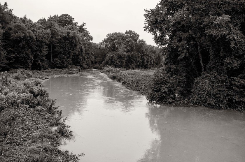
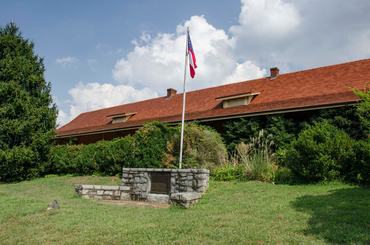
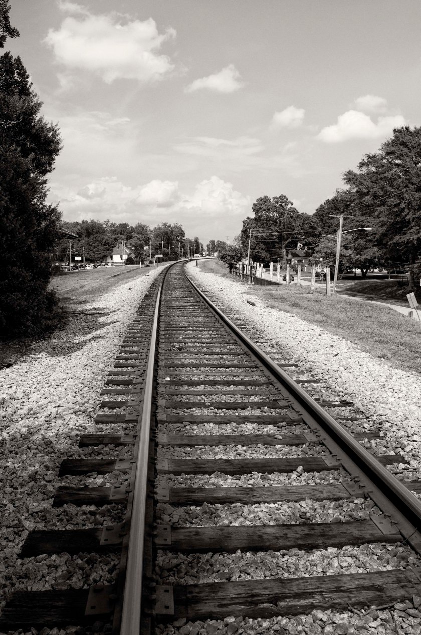
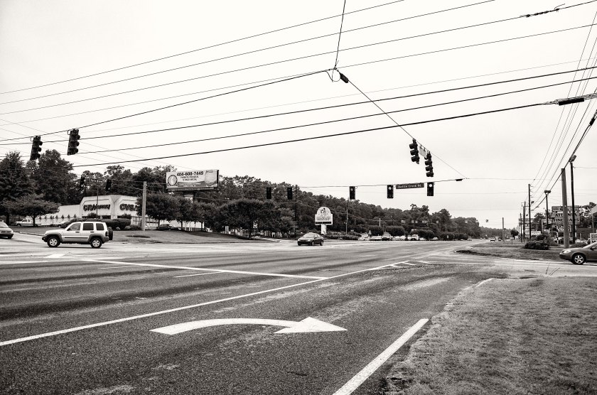
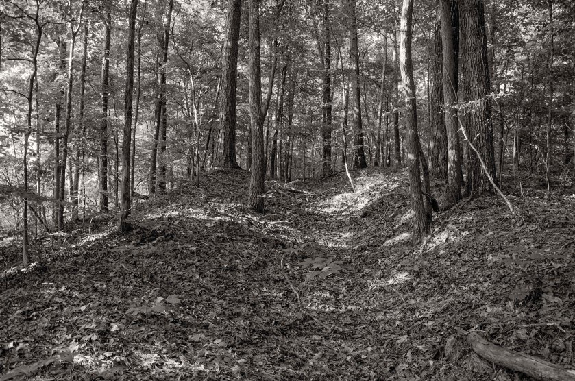
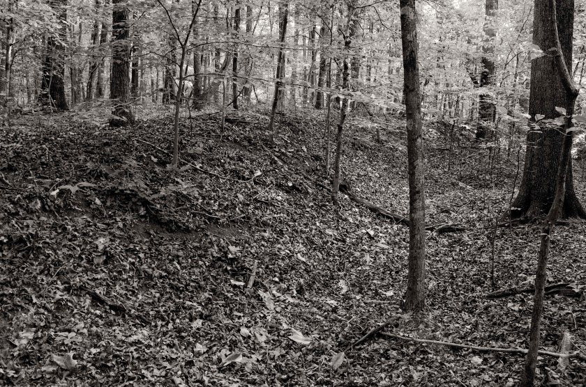
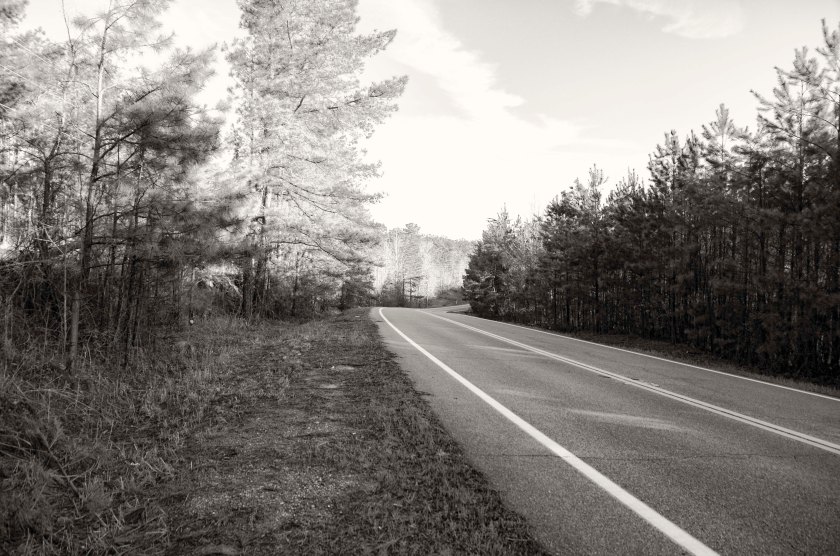
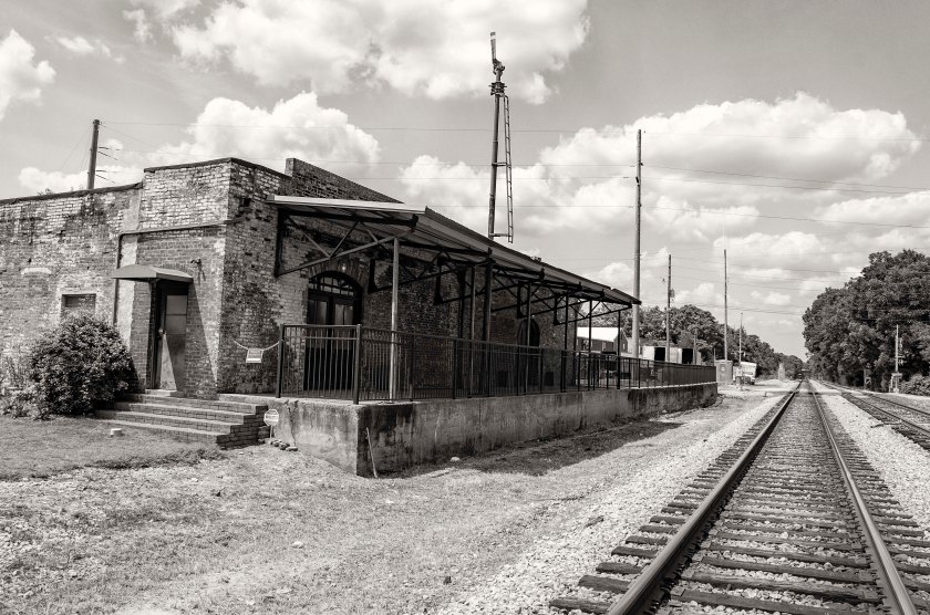
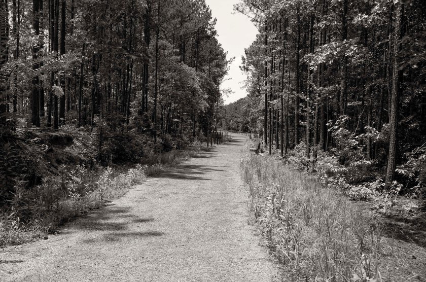
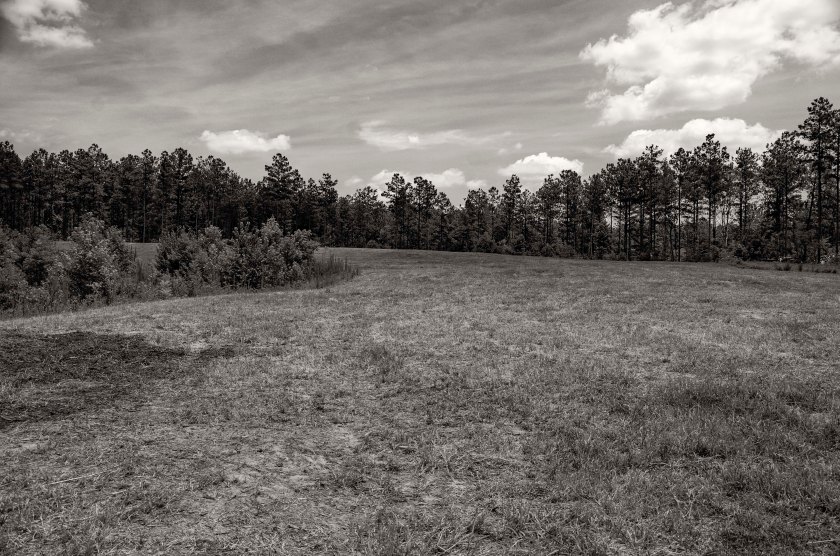
Looking west on Hwy 138 at the Flint River. Kilpatrick’s Cavalry rode from Fairburn to Jonesboro along this road. On the high ground in the distance, the Chicago Board of Trade Battery, unlimbered their field pieces and began to shell the Confederates of Ross’s Texans on the ridge on the east side of the river. This artillery bombardment covered portions of Kilpatrick’s Cavalry as they dismounted and crossed the Flint river on the stringers of the damaged bridge.The rain swollen Flint River at Hwy 138, 150 years after Kilpatrick’s raid.Looking east from the Flint River Bridge on Hwy 138. Ross’s Texans established a line on the low ridge in the distance. After being shelled by the Chicago Board of Trade Battery and being outnumbered by Kilpatrick’s advancing cavalry, Ross’s Texans fell back to and were eventually pushed out of Jonesboro.Downtown Jonesboro. This depot, built in 1867 to replace the original depot destroyed by Kilpatrick’s Cavalry, is located roughly half a mile south of location of the wartime depot. After destroying the depot and other structures, Kilpatrick’s men destroyed the railroad tracks. Heavy rain prevented the Federals from building large fires of cross ties to heat the tracks for bending into “neckties”, but they still did their best to dismantle the tracks.After leaving Jonesboro, Kilpatrick’s Cavalry rides to Love Joy Station with Ross’s Texans skirmishing with their rear guard nearly the entire way. As Kilpatrick’s troopers dismounted and started to destroy the railroad, Confederates allowed them to approach withing 50 yards before opening fire on them. Kilpatrick’s Cavalry was forced east from the railroad along the McDonough Rd. In the area of the Nash farm they encountered Ross’s Texans deployed across the road.Nash Farm Battlefield. Kilpatrick formed his cavalry into tight columns and charged in the direction of the camera, moving to break through Ross’s Texans.Ross’s Texans were deployed on this high ground at the Nash Farm Battlefield. They were astride the road with an artillery batter on the north side of the McDonough Rd. Kilpatrick’s Cavalry would have road across this ground into the distance to break through Ross’s Texans.
August 18th, 1864: Several days earlier, General Hood dispatched General Wheeler and his Confederate Cavalry to the north in an effort to disrupt Sherman’s supply lines coming from Chattanooga. Sherman, who has quickly become restless during the siege, has started planning the movement of his entire army to the the south of Atlanta to destroy the Confederate supply line coming up from Macon.
Sherman has also learned that Wheeler’s Cavalry has made it to Tennessee and is therefore to far to offer any support to Hood or oppose Kilpatrick and his Cavalry. Sherman decides to delay the movement of his army around Atlanta and instead he orders Kilpatrick to move on the railroad in Jonesboro with his three Brigades and two more attached to him from Garrard’s Cavalry.
On the night of the 18th, Kilpatrick and five Brigades of Federal Cavalry, begin their move towards Jonesboro. They leave from Sandtown and head towards Fairburn. They are opposed by only one Confederate Brigade. Ross’s Texas Brigade spends the night of the 18th harassing and slowing down the Federal Cavalry. These actions slow down the Federal Cavalry considerably and delay the raids time table.
Downtown Fairburn 150 years after Kilpatrick’s Cavalry came through. They returned here after their previous recon and at Sherman’s orders, attempted to destroy the railroad here and in Jonesboro. They crossed the Chattahoochee River in Sandtown and traveled south east to Fairburn and skirmished with Ross’s Texans along the way.
Sherman has sent Kilpatrick’s Cavalry to the south of Atlanta on a reconnaissance mission. On the morning of the 16th, Kilpatrick reaches Fairburn, where he destroys three miles of railroad track and the depot. He has been operating without any real opposition from Jackson’s Cavalry. Sherman begins to think that Kilpatrick, along with a couple Brigades of Garrad’s Cavalry, could swing far south of Atlanta and destroy the railroad without needing to move the entire army. Sherman ask Kilpatrick if he thinks it is possible, to which he replies that it would be possible to damage the tracks bad enough to be out of service and not put his command in any danger.
Fairburn, Georgia. Located south west of Atlanta along the railroad lines. As Kilpatrick came through on his raid he destroyed the original Depot. The marker here is for the raising of the first Confederate flag in Georgia. Wives of men that had been at the Confederate Congress, stopped on their home in Grantville to purchase fabric and by the time they made it to Fairburn, they had created the flag.Looking north towards East Point along the railroad that leads to Atlanta. This one of the vital supply lines the fed the city while it was under siege. Kilpatrick destroyed roughly three miles of track here.
After the Battle of Atlanta on July 22nd, the Federal Artillery began to shell the city of Atlanta, sometimes it was light and random and at other times there were “duels” with the Confederate Artillery in the inner defensive perimeter.
On the first of August, Sherman learned of the failure of the Cavalry raid to destroy the railroads south of the city. He then sent the following order to General Schofield “You may fire ten to fifteen shots from every gun you have in position into Atlanta that will reach any of its houses. Fire slowly and with deliberation between 4:00pm and dark. Thomas and Howard will do the same.” (O.R. 38, V, 324, Sherman to Schofield).
On the 7th of August, after the failure of the Federal forces to take the railroad junction at East Point. Sherman request two more large siege guns to be sent from Chattanooga by rail. Those guns could shoot a 4.5 inch diameter round weighing 30 pounds.
As the shelling of the city became more intense, more and more damage was done. The Federal artillery was using the church spires of town as land marks for sighting their guns. Homes and businesses alike were damaged or destroyed. Sherman was targeting the city itself and wanting nothing more than to break Hood’s resolve and force the Confederate army from their stronghold. At one point, Hood sent a message to Sherman requesting that he stop shelling the noncombatants in the city and pointed out that the cities defensive line was a full mile outside the city. Sherman replied that Atlanta was a military target and an arsenal. Sherman continued the siege unchanged. The first civilian casualty of the siege was small girl in the area of Peachtree St. and Ellis Street. Solomon Luckie, a free black man who owned a barber shop in town, was killed by a shell near what is now the Five Points Marta Station. There is an original gas lamp on the corner at the marta station and local legend says that the hole in the base was caused by the same shell that killed Solomon Luckie.
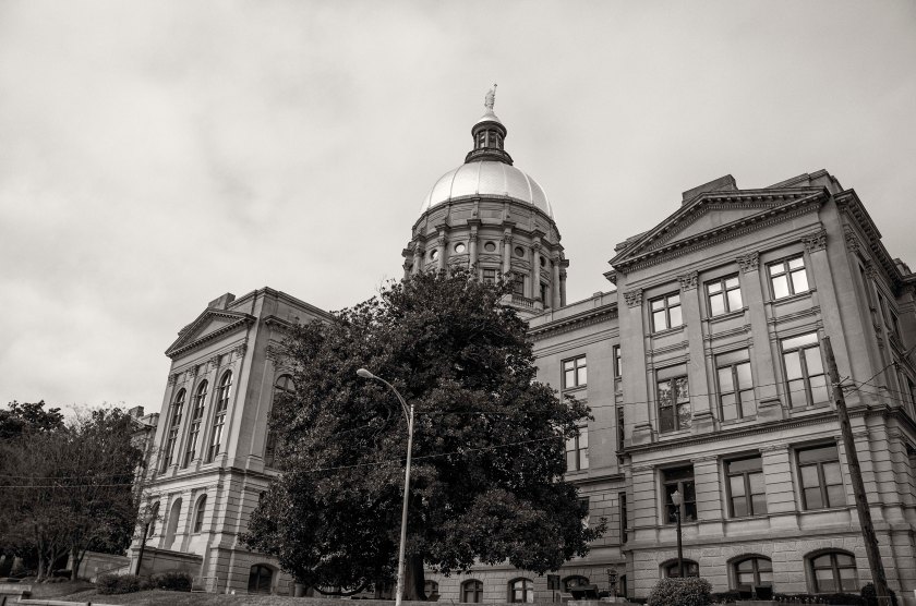
Part of the Federal siege line was located across this portion for 8th Street, between Penn Ave. and Argonne Ave. From this point and many others around the city, the Federal army fired round after round of artillery on the Confederates as well as the civilian population of Atlanta.The Georgia Pacific building now sits in the general area of where the first civilian casualty of the siege occurred. Peachtree Street (formerly Whitehall St.) at Luckie Street, name sake of the Free Black man Solomon Luckie who was wounded and eventually died from a wound received during the siege of Atlanta.Shrine of the Immaculate Conception Catholic Church. Father Thomas O’Reilly was the pastor at the time and was able to convince the Federals to spare his church and several others in the city during the occupation. The original structure was a wood frame building that sat on this site until the construction of this structure was started in 1869. The Federals used the church spires of the city as landmarks to aim their siege guns toward the city.Looking across Underground Atlanta towards the Georgia State Capitol. Much of the historic parts of this area have been built over.Underground Atlanta was home to much of the cities commercial district during the war. The railroad came through the city here and the passenger and freight depots were located in the area as well as a nearby round house. During reconstruction much of the area was rebuilt, but eventually as the city grew, traffic, a never ending issue in Atlanta, became a problem. With the number of trains coming and going, a series of viaducts, or bridges were built over the area to allow traffic to pass. As such, many storefronts were moved up to the level of the new streets leaving spaces available down below the viaducts as well.The railroad was single supply route for the City of Atlanta during the siege by Federal forces. The number of tracks through town have grown and include Marta tracks as well at Freight and Passenger train tracks which still continue to supply Atlanta with goods from around the world.Atlanta’s Zero Milepost is located in a security office for Georgia State University under the Central Ave. viaduct. The milepost is on the lowest level of this parking deck in the office. This milepost is the one that was used to measure all the railroad distances from. A corner of the old Freight Depot, built in 1869, sits adjacent to the Zero Milepost at Underground Atlanta. The Georgia State Capitol stands in the background. Most if not all of the wounded from the battles around the city, were laid out here along the railroad track where they were tended to as they waited for trains to evacuate them to hospitals south of AtlantaThe Georgia State Capital now sits on the site of the wartime Atlanta City Hall. The Atlanta City Hall also served at the court house for Fulton County at the time. After the fall of Atlanta and during the occupation, the 2nd Mass. Regiment camped here and served as the Armies Provost Guard.
On the morning of the seventh, the Federals again began to advance on the entrenched Confederates south of Utoy Creek. They encountered no resistance and found the Confederate works empty. Bate’s Division was withdrawn from the lines overnight and took their place in the line of defensive works, that stretched from the defensive perimeter around Atlanta, to the southwest in order to protect the railroads in East Point. Bate’s takes his place between Clayton’s Division on his right (north) and Clerburne’s Division to his left (south).
Sherman, who is displeased with the failure of the movement toward East Point, decides to lay siege to Atlanta and will do his best to run the Confederates out of the city. He begins to shell the city and considers the city itself as a military target even though there are still civilians within the city. Many have evacuated, but several thousand have no where to go or have decided to wait it out.
During the night of August the 6th, Bate(CS), withdrew his Division back to the original lines that had been established to block the Federal movement on East Point. Bate was aligned with Clayton’s Division(CS) on his right and Cleburne’s Division(CS) on his left. Here, along this low ridge split by Connally Road, was the far left of the Confederate line manned by elements of Cleburne’s Division(CS). This ridge line overlooks one of the many forks on the southern side of Utoy Creek.Remains of a Confederate trench lie beneath these fallen trees in the woods of Greenwood Cemetery. As Bate(CS) retired back to the original lines, Clayton’s Division9CS) was here on his right with his lines moving north and east back to Atlanta’s inner defenses.English Ivy covers part of the Confederate works that remain in John A. White Park. These works were staffed by Clayton’s Division(CS).
This morning, Sherman has accepted the resignation of Palmer, who will be on a train back to Chattanooga by the afternoon, and the Federals had formed up their lines and everyone was in place to attempt an advance across Utoy Creek towards the railroad in East Point. With Palmer’s resignation, Robert W. Johnson, a division commander within the XIV Corps, was appointed Commander of the XIV Corps and placed under the command of Schofield. Displeased with the performance of the XIV Corps on the previous day, Schofield had moved his XXIII Corps to the right of the XIV Corps. The XXIII Corps is now the Federal right flank and the XIV Corps is the left flank with Logan’s XV Corps in support to their left. Palmer’s Corp was fanned out in an arch following the current Beecher Road south to Benjamin E. Mays and making a slight turn to the west, just north of Cascade Road. Palmer’s right ended near Willis Mill Road. Schofield’s left was adjacent to Palmer’s right with Cox’s Division along Cascade Road and stretching out west. Hascall’s Division of Schofield’s Corps turn south making a 90 degree turn to the east and was facing the end of the Confederate line at the Confederate left flank. Just west of Cascade Springs Nature Preserve.
The battle began when Cox’s Division moved south and Hascall’s Division moved east to press the Confederate flank. The 11th Kentucky Regiment (Federal) of Cox’s Division was at the front of the advancing line and made first contact with the 4th Kentucky (CS), who were posted as skirmishers in front the famed Kentucky Orphan Brigade. This action happened in the area of the waterfall in what is now Cascade Springs Nature Preserve. Cox’s attack was repulsed and he suffered a severe loss. He reformed for another attempt, but was repulsed a second time after which he withdrew from the assault. Hascall was hindered by the South Fork of Utoy Creek and made minimal gains in his assault. He did reach the rear of an artillery battery, which withdrew to the east to another position on high ground from which they still had a commanding view.
The XIV Corps, now commanded by Johnson, has sat idle most of the day and did not make an attempt to attack until late afternoon and he only attacked with one division. He gained no headway and retired before anything larger than a skirmish developed.
The Confederate left flank was manned by Bate’s Division along a ridge line just south of Sandtown Road (Cascade Road). S. D. Lee’s Division connected to Bate’s right at the Sandtown Road east of what is now Beecher road. Bate’s left flank was open and vulnerable to attack and on the night of the 6th, Hood ordered Bate’s Division to withdraw from the area back to the Confederate main defensive line.
The Federal assault cost them approximately 800 lives and numerous wounded, while the Confederates lost only 18 soldiers while defending their heavily entrenched and fortified lines.
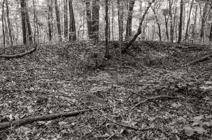
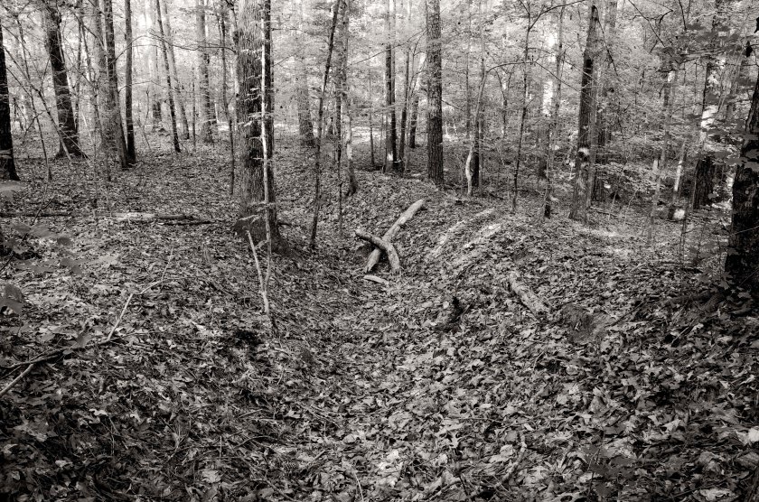
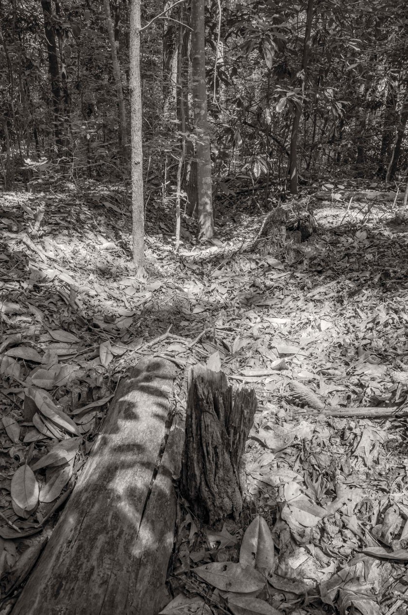
Remnants of Federal earthworks manned by Cox’s Division of Schofield’s 23rd Corps(US). This was near the far left of Cox’s Division as well as the left of the 23rd Corps before it abutted the right of the 14th Corps(US) commanded by Johnson. Byrd’s Brigade of Cox’s Division held this area.Utoy Creek at the bike path inside Lionel Hampton – Beecher Hills Park. When Cox’s Division(US) advanced on Bate’s Division(CS), which held the ridge just south of the Sandtown Road (Cascade Road), they crossed in this area. The earthworks the stepped off from were in the previous image and are located a few hundred yards north (right of frame) of the creek on the ridge.Utoy Creek at Peyton Road. The right of Cox’s Division(US) crossed the creek in this area as they advanced on the Bate’s Division(CS) which held the Confederate left flank.Hascall’s Division of Schofield’s 23rd Corps(US) advanced south and then made a 90 degree to the east to attack the end of the Confederate left flank which was exposed and vulnerable. Hascall’s Division was greatly hampered by the thickets of woods and underbrush on the South Fork of Utoy Creek. Hascall eventually reached the Confederate line with minimal affect, but did cause an artillery battery to withdraw to another position.A small water fall inside Cascade Springs Nature Preserve. It was in this area that the first contact of the Battle of Utoy Creek happened. The skirmishers of the Federal 11th Kentucky Reg.(US) engaged the the pickets of the 4th Kentucky Reg.(CS) of the famed Confederate Kentucky Orphan Brigade commanded by General Joseph Lewis. There are several accounts in diaries or letters of soldiers bathing in the creek the day before the battle.A Confederate artillery battery inside the Cascade Springs Nature Preserve. The battery here was commanded by Capt. Houston King and was named the Missouri Horse Artillery Battery. As Hascall’s Division advanced across the South Fork of Utoy Creek, he forced the battery to withdraw to another position that was more defensible. Confederate earthworks inside the Cascade Springs Nature Preserve. Lewis’s Kentucky Orphan Brigade of Bate’s Division(CS) held the position on the left end of the Confederate line. As Cox’s Division(US) attacked the strong entrenchments of the Confederates, they were quickly repulsed. Cox’s formed his lines for another assault which was subsequently repulsed with heavy losses. After the second attempt failed to take the Confederate line, Cox withdrew his Division back to their starting point.A dead tree across the top of Confederate earthworks gives scale to their current depth. These works work manned by Lewis’s Kentucky Orphan Brigade of Bate’s Division (CS). Realizing the fault of the exposed left flank, General Hood ordered the Corps commander, General S. D. Lee to withdraw Bate’s Division back to the main Confederate line on the night of the 6th.Smith’s Brigade of Bate’s Division held this ridge line here south of the Sandtown Road, now Cascade Road. This view is looking from Cascade Rd. (formerly Sandtown Rd.) to the south and up at the ridge line on Woodland Terrace. Byrd’s Brigade of Cox’s Division(US), which constituted the left of Cox’s Division, attacked Smith’s Division along this ridge line where they met stiff resistance from the heavily fortified Confederate positions.Looking west along Cascade Road, formerly Sandtown Road. The Confederates of Bate’s Division(CS) held the high ground south(left) of the road and in this area Byrd’s Brigade of Cox’s Division(US) crossed the road to attack Smith’s Brigade of Cox’s Division(CS).Known as Cascade Mansion, this home, now a special events facility, was built by Dr. William Poole, who later became a Confederate surgeon in the 57th Ga. Infantry. Construction began in 1860, but due to the war, it was not completed until 1870. During the Battle of Utoy Creek, General Bate’s(CS) used the partially finished home as his headquarters while commanding his troops. After the Battle of Utoy Creek and during the “Siege” of Atlanta, it was used a Union hospital.Utoy Church, now known as Temple of Christ Pentecostal Church, is one of the oldest Churches in Fulton Co. as is its cemetery. It was established in 1824 and moved to this location in 1828. Heavily remodeled and with multiple additions, it still stands where it did in 1828. During the battles that took place around Atlanta, it was used as a hospital. During the Battle of Utoy Creek it was again used as a hospital and the Confederate defensive lines crossed the property in the north west corner.When I visited the Church and Cemetery on the 150th anniversary of the Battle of Utoy Creek, I found that someone had placed new Confederate flags at the headstones of the unknown soldiers that had died here during the battle. Being such an old cemetery, there are grave markers indicating the graves of soldiers who served as far back as the Revolutionary war and the Spanish American War.While I am sure there were other Jewish Confederate soldiers, this was the only Jewish Confederate grave stone that I came across in my nearly year long journey following Sherman through Georgia. I have been in a great many cemeteries along the way and seen many Confederate graves, but this was a first.Greenwood Cemetery. The Confederate lines that extended south west of the Atlanta’s inner defensive line, crossed through the high ground and hills inside what is now Greenwood Cemetery. Clayton’s Division of General S. D. Lee’s Corps(CS) was positioned along this line. They were located to the right of Bate’s Division and were engaged in skirmishing with the Federal 14th Corps(US) Commanded by General Johnson.Just inside the wood line of the western part of Greenwood Cemetery you can find remnants of the Confederate earthworks that were manned by Clayton’s Division(CS) and who repulsed a halfhearted attack by the Federal 14th Corps(US). My ancestors who were in the 42nd Ga. in Stovall’s Brigade were positioned in this area. Remains of the Confederate line the extended south and west from Atlanta’s inner defensive line to protect the railroad in East Point. These works are located in a wooded part of John A. White Park.
The conflict between General’s Sherman, Palmer and Schofield continued throughout the day. Palmer sent multiple letters arguing back and forth with Sherman. Palmer’s final letter said “I will call upon you tomorrow morning and present a formal application to be relieved.” While they bickered back and forth, Federal units were still trying to get in line for the move toward East Point. For the remainder of the day Palmer agrees to relay orders from Schofield to his XIV Corps. Baird’s Division advances south toward Utoy Creek and encounter the Confederate skirmishers. They take about 140 prisoners. They then turn towards the east and encounter an artillery barrage. They decide not to advance and assault the Confederate works as they assume they will be repulsed. Davis brings his division up along side Baird’s and comes to halt as well. Schofield is not happy about the assault coming to a halt. He orders Johnson’s Division of Palmer’s Corps to swing around the right and attack the Confederate left flank. Johnson waits until early evening to begin his movement, which he calls a “reconnaissance”. He moved a short distance and then calls it off since it is too late in the day to do much good. He falls back to the rear of Davis. Schofield and Sherman are both displeased with the performance of Palmer’s XIV Corps. Palmer will resign in the morning and for a time Johnson will command the XIV Corps.
During the night of the 5th, Hood orders the defensive lines extended further south and west to protect the railroad in East Point. The line extended about 1.25 miles from the existing defensive lines, down a ridge line the paralleled the Sandtown Road (Cascade Road), and overlooked the North Fork of Utoy Creek. The far left of the line ended in the area of the current Cascade Springs Nature Preserve.
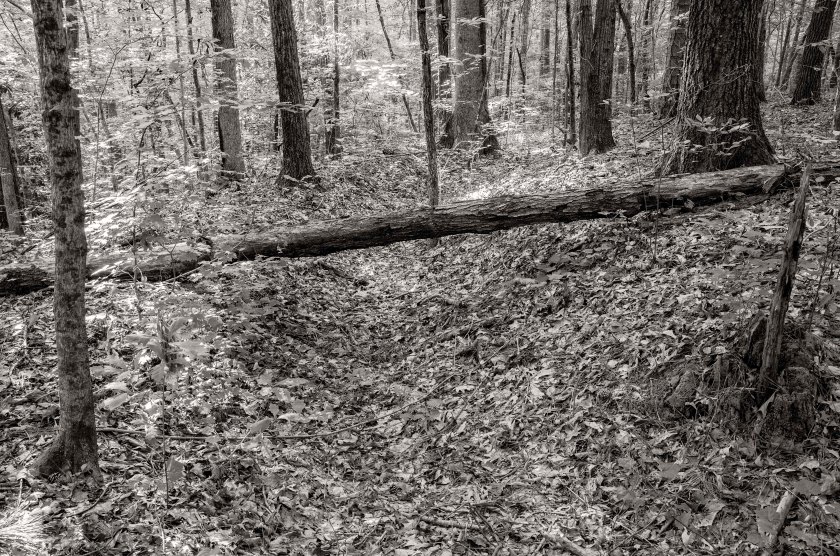
Looking north along the bike path in Lionel Hampton – Beecher Hills Park. Cox’s Division of Schofield’s 23rd Corps (US) established their lines on the ridge line at the top of the hill in the distance.Portion of Federal earthworks manned by Cox’s Division.A fairly long stretch of earthworks occupied by Cox’s Division of Schofield’s 23rd Corps (US) inside Lionel Hampton – Beecher Hills Park.A dead tree lies across the remnants of Federal earthworks of Cox’s Division. The log helps demonstrate the depth of the remaining earthworks that are tucked away in the forest of Lionel Hampton – Beecher Hills Park.
With the failure of Sherman’s plan to use Cavalry to destroy the railroad south of Atlanta and cut off the Confederate supply line, Sherman has decided to begin moving a portion of his forces toward the railroad junction at East Point. This is where the railroad from Macon and the railroad from West Point, which leads into Alabama, meet and form a single line coming into Atlanta. If Sherman’s forces can destroy this junction and control it, they will be able to cut off the supplies flowing into Atlanta.
With this in mind, Sherman has sent Schofield and his Army of the Ohio to advance on East Point via the Sandtown Road (Cascade Road). Sherman has attached Palmer’s XIV Corps of the Army of the Cumberland under Schofield and has ordered Palmer to report to and follow the commands of Schofield. The advance was delayed for nearly the entire day as Palmer refused to report to or follow the commands of Schofield. He felt that he was senior to Schofield. They advanced no further than the North Fork of Utoy Creek. The day was wasted through bickering between the Generals and nothing of real tactical importance was accomplished other than a few probes of the Confederate lines, which had be extended as fast as the Union could attempt to turn their flank.
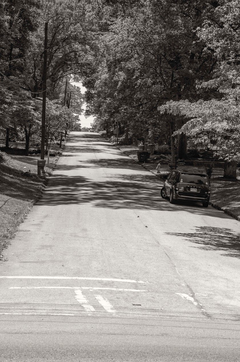
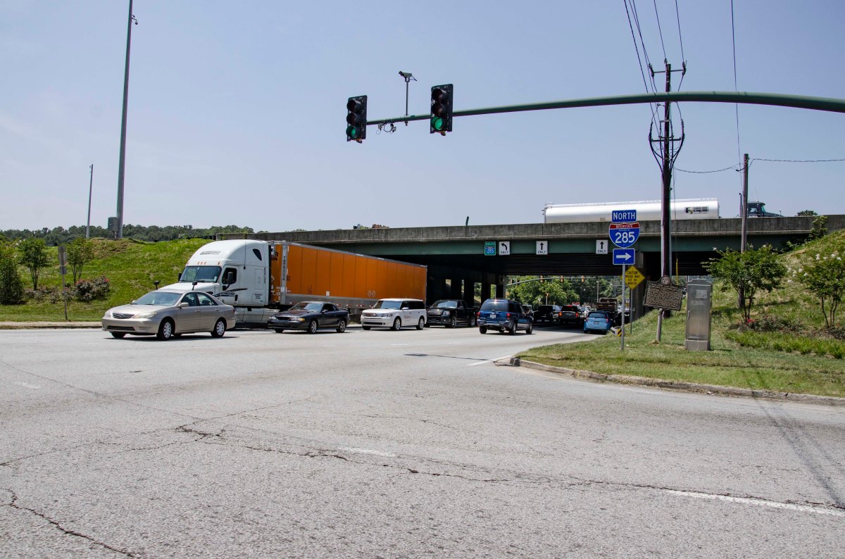
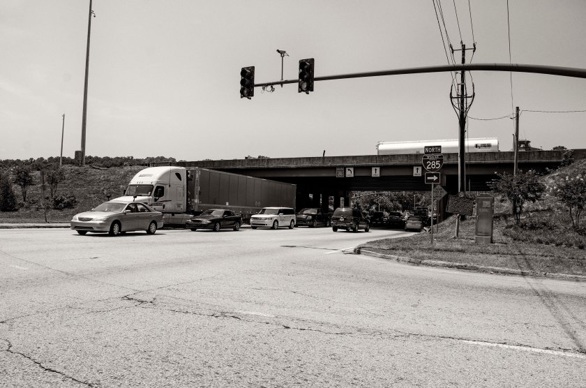
Cascade Rd. at I-285. Cascade Road is a historic road formerly called the Sandtown Road and saw extensive use by both the Confederates and Federals during the Atlanta Campaign. This site was the location of the Utoy Post Office and was used on maps as a landmark.
Since General Stoneman decided not to meet up with McCook at Love Joy’s Station, he continued on toward Macon in an attempt to rescue prisoners being held there. On his way into Macon, Stoneman’s Cavalry destroyed several miles of track along with several bridges and depots. He then moved on Macon in an attempt to take the city. He established his headquarters at the Dunlap House, located in what is now Ocmulgee National Monument. He used his two pieces of light artillery to begin shelling the city and was quickly forced to retreat by Confederates guarding the city.
Sunshine Church:
With Stoneman retreating from Macon, Confederate Cavalry under the command of Brig. Gen. Alfred Iverson Jr., gave chase. Iverson had been born and raised in the area and his knowledge of the area allowed him to get ahead of Stoneman near Sunshine Church (near Round Oak, Ga.). The Confederates place a cannon in the middle of the road and as soon as Stoneman was in range, the began to fire on him. A sharp skirmish ensued and Iverson was able to deceive Stoneman into thinking he was surrounded. Stoneman surrendered himself and 700 troops to Iverson. They were then imprisoned in the very prisons they were trying to reach in an effort to rescue their comrades.
The Battle of Sunshine Church started in this area along Monticello Hwy just north of Otis Redding Rd. Stoneman’s Cavalry moved north on both sides of the road and fought a sharp engagement with Iverson’s troops, who were positioned just north of this point near Pippin Road. Near the end of the battle, fearing that he was completely surround, Stoneman surrendered along with nearly 600 of his troopers.Looking south on Monticello Hwy at Pippin Road. Iverson(CS) positioned his forces across the road facing the approach of Stoneman’s Cavalry. They fashioned a barricade across the road and place an artillery piece in the middle of the road.Sunshine Church II, built in 1880 to replace the original church that was burned by Sherman’s right wing on their March to the Sea. This newer church is now located in Round Oak about two miles north of the site of the original Sunshine Church. In 1890, a Union Veteran named B.F. Morris who had been cared for by a local family after he was wounded in the battle, was invited to return to the church and deliver a sermon.The Cabaniss-Hunt House, recently rebuilt and remodeled, was used as a makeshift hospital during the Battle of Sunshine Church. The mistress of the house, Betty Hunt, nursed many wounded Federal soldiers here after the battle. She earned the nickname “The Angle of Sunshine Church” from the wounded men, some of whom returned to the area after the war and settle here, one of them was a pallbearer at her funeral.
On the 29th, McCook’s Cavalry made it to Love Joy’s Station where they were supposed to meet General Stoneman and destroy as much of the railroad as possible. When McCook arrived, Stoneman was not there, so McCook began to destroy the tracks. Stoneman had been given permission by Sherman to head south towards Macon and Andersonville after destroying the tracks, in an effort to free the Union Prisoners. Stoneman, who was looking to pull off some heroic venture to improve his reputation, decided that McCook could handle the detail at Love Joy’s Station and went straight for Macon.
McCook ended up fighting a fairly heated skirmish at Love Joy’s Station and the began to retreat back towards the west in an attempt to cross the Chattahoochee and return to the safety of the Federal lines. General Wheeler and his Confederate Cavalry were hot on his trail and were engaged in a running skirmish with McCook’s rear guard.
On the morning of the 30th, the front of McCook’s column came into Newnan along what is now E. Broad St. near the train depot. Their path was blocked by a train load of Confederate soldiers that were waiting for the tracks in Palmetto to be repaired. The same tracks that McCook had destroyed a couple of days before. Both sides were surprised by the appearance of the other and a small firefight ensued. Being blocked in the front by the train and having Wheeler coming up on his rear, McCook began moving south of town looking for a clear path to the river where he could avoid a fight. Wheeler’s forces entered town and split up in an effort to hit McCook from the front and rear.
The two forces finally met about three miles south of Newnan near Brown’s Mill along the Millard Farm Road and what is now Old Corinth Road. McCook’s troopers were driven from the road and into the woods where they dismounted and fought on foot. There was a fair amount of back and forth with Wheeler’s troopers pushing the Federal back and then McCook’s troopers counter attacking and pushing the Confederates back. At one point the 8th Iowa even captured the lead elements of Ross’s Texans(CS) as they had just dismounted to assault the Federal line. The 3rd Texas was able to cut their way through the 8th Iowa and rescue General Ross and the others that had been captured. The fighting was intense and Wheeler soon received about 1400 reinforcements that had marched out of Newnan. McCook, thinking he was surrounded, shouted “Every man for himself!” McCook suffered heavy casualties and lost several officers and Brigade Commanders. He decided to split his forces and they cut their way out of Wheelers trap and made off for the river in different directions. A large number of his troopers were captured over the next few days as the Confederate Cavalry continued their pursuit. McCook, lost about 100 troopers to the fight and another 1300 were captured and sent to prison camps. Wheeler lost about 50 troopers.
The Newnan Depot was built in 1850 and was recently renovated into a special events facility after spend many years as an abandoned decaying structure. Confederate soldiers bound for Atlanta as replacements, were stranded here in Newnan while waiting for the railroad tracks in Palmetto to be repaired. When McCook’s troopers rode into town they rode straight into these stranded soldiers and small firefight ensued.General McCook(US) skirted his column of cavalry around to the south of Newnan in an attempt to make a crossing at the Chattahoochee River, but General Wheeler(CS) was closing in quickly. Here, at Brown’s Mill Battle Field Historic Site, a park with historical markers and walking path has been created to preserve the remains of the battlefield. In this image the Confederates under Wheeler’s command would have attacked from the north (right of frame) toward the south (left of frame). The Federal line was along the right side of the image just out of frame. When Wheeler attacked they pushed the Federals back to the left of the image.Looking east across a portion of the battlefield. The Confederates pushed McCook back from the through this area. This area is preserved as part of the park. After Wheeler received reinforcements of Infantry from the stranded soldiers at the train depot, he was able to surround McCook on three sides.A small branch of Sandy Creek winds through the battlefield. Brown’s Mill was located on a larger portion of the creek south of this point. For the most part the terrain was mixed with open areas and heavily wooded areas. The 4th Indiana was positioned here moving up to the right towards Millard Farm Road to hold the Federal Left Flank.Buena Vista, Newnan Ga. After the Battle of Brown’s Mill, General Wheeler retired to this home for the evening and established his Headquarters here while he directed the continued pursuit of the fleeing Federals.75 College St. Know as College Temple, was originally part of school that was started in 1853. The school was comprised of seven buildings and as the raged on, it was pressed into service as a hospital for thousand of soldiers both Union and Confederate, that found their way to Newnan.
73 College St. Know as College Temple, was originally part of school that was started in 1853. The school was comprised of seven buildings and as the raged on, it was pressed into service as a hospital for thousand of soldiers both Union and Confederate, that found their way to Newnan.