July 13th, 1864

July 13th, 1864:

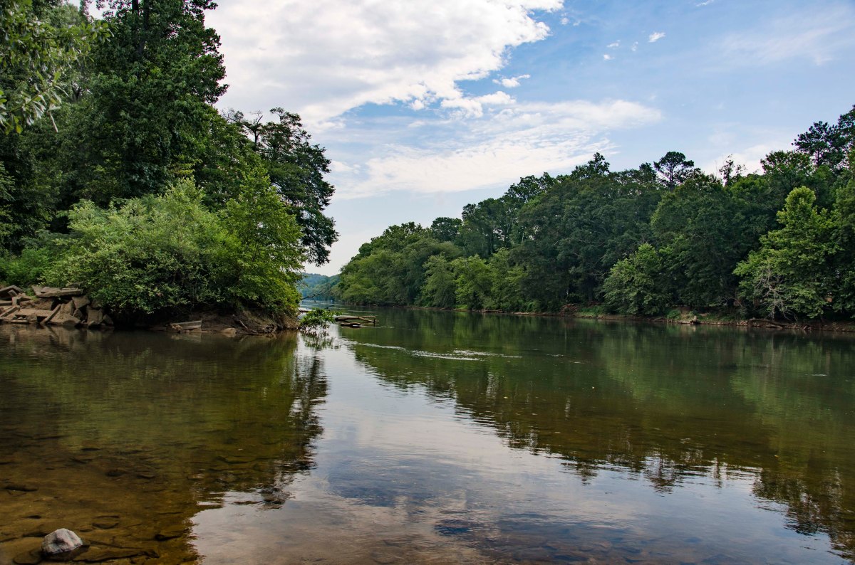
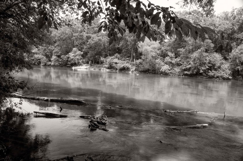
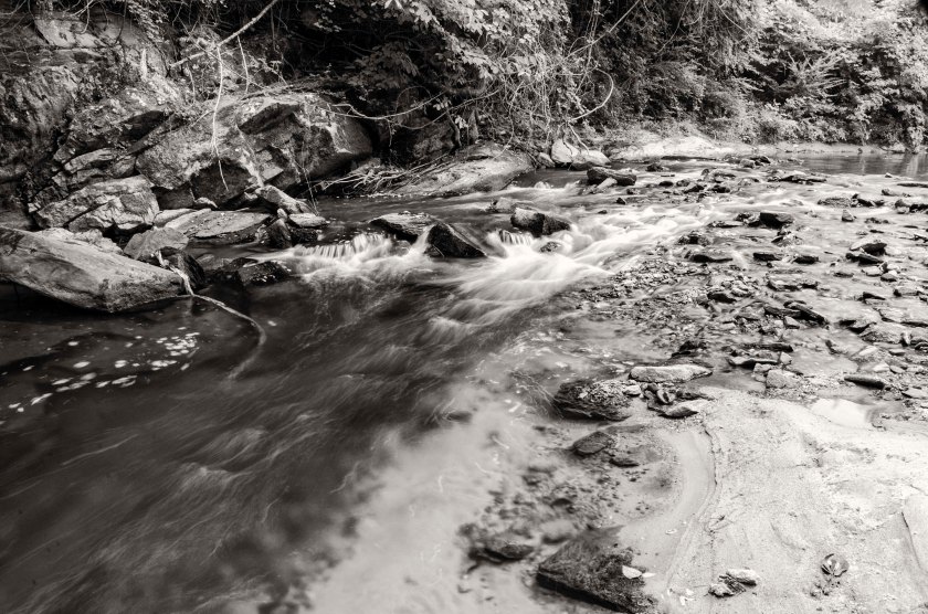
Over the last several days and continuing into the next several days, General Sherman is resting his troops and changing their positions in preparation for an assault on Atlanta.  He is trying to deceive General Johnston into believing the attack will come from the west.  To do this, he has sent Stoneman’s Cavalry on a raid towards Newnan to destroy the Railroad that connects Atlanta with Alabama.  Stoneman’s Cavalry cross the Chattahoochee near Campbelton and skirmish with Confederates along the way.  They are unsuccessful and fall back to Villa Rica before returning to the Federal lines along the Chattahoochee.  During this time, Sherman is shifting several Corps from his right flank to the left flank at the river crossing in Roswell.  The Federal soldiers crossing at Roswell will be shifted to the east of Atlanta.  While both armies rest from the rigors of the campaign, there is a great deal of fraternization between the soldiers stationed along the Chattahoochee.  There are many documented accounts of trading, usually the Confederates trading tobacco for coffee, as well as other goods and small items.  There are accounts of Regimental bands on both sides having competitions and serenading the troops on the opposite side of the river.  For some soldiers, this is the first time the have been able to have a bath in weeks.  Even General Sherman himself, takes a bath in the river.

For General Johnston, this is a time of uncertainty, President Davis has sent Braxton Bragg, former Commander of The Army of Tennessee, to ascertain the tactical situation in Atlanta and to find out what Johnston plans to do.  Davis is considering replacing Johnston and is relying on advice from Bragg as to who the replacement of Johnston should be.  This decision would have great bearing on the outcome of the campaign.  They met at Johnston’s Headquarters which was established at the Dexter Niles house along the Atlanta road between the Chattahoochee river and the city.

_DSC0153.bw
Well preserved Federal earthworks near Roswell, Ga.  These were part of the bridge head established by General McPherson’s Army of the Tennessee (US).  These works were manned by the 2nd Division of the XV Army Corps.
_DSC0175.bw
Stones,stacked by Federal soldiers fortifying their positions, are still in place 150 years later at their bridge head near Roswell.
_DSC0061.bw
Remnants of a Federal trench located on a ridge overlooking the Chattahoochee river near Cochran Shoals.  This site is located with an office park.
_DSC0521.bw
After crossing the Chattahoochee at Powers Ferry, the IV AC (US), established a bridgehead on the high ground above the river.  Northside Drive now runs along this same ridge and several home owners have the remains of Federal earthworks in their front yards.
_DSC0544.bw
Remains of a Federal trench along Northside Drive, manned by the IV AC(US), after crossing the Chattahoochee River.
_DSC0496.bw
Remnants of an artillery battery that was maned by elements of the IV Army Corps (US).  Now located near the intersection of Northside Drive and River View Drive in the side yard of private residence.
_DSC0564.bw
Site of the Cagle house where General O.O. Howard established his Headquarters and along with General Sherman and other officers, had a meeting to plan their next moves in the campaign.  That meeting was depicted in the sketch below that appeared in Harper’s Weekly in September of 1864.
Sherman._Conseil_de_guerre
Sketch of General Sherman and other officers at the Cagle house, this sketch appeared in a September issue of Harper’s Weekly.
_DSC0158.bw
Site of the Dexter Niles house where General Johnston (CS) established his headquarters after retreating across the Chattahoochee River upon learning of Federal crossing north of his River Line position.  It was here that he would be relieved of command and General John Bell Hood would be command of the Army of Tennessee.

July 9th, 1864

July 9th, 1864:

After the first Federal crossing of the Chattahoochee at Sope Creek on the afternoon of the 8th, Garrard’s Cavalry crosses at Roswell.  At dawn on the 9th, a Federal Battery provides covering fire as several companies of dismounted cavalry begin wading across the Chattahoochee at what is called the “Shallow Ford”.  It was the ford used by the Hightower Trail which was a prehistoric trading route.  They engage a small Confederate force across the river.  The Confederates are out numbered and out gunned and they quickly retreat and some surrender.  The Federals are armed with Spencer repeating rifles and are able to move and shoot quickly without stopping while they cross the river.  The battery that is providing cover fire is the Chicago Board of Trade Battery.  When Sherman learns of Garrard’s crossing of the river, he immediately dispatches Newton’s Division from its camp near Rottenwood Creek, to Roswell “double time”, to reenforce Garrard.  He also sends Dodge’s Corps to reenforce Garrard and establish a strong bridgehead for subsequent crossings.  A detachment of General McCook’s Cavalry, the 1st Tennesse Regiment (US), under the command of Colonel Brownlow, dismounted and crossed the river enforce wearing only their hats and carrying their rifle and cartridge box.

After receiving information about these crossings and size of the forces at each crossing, General Johnston orders the fall back from the River Line.  The Confederate army begins to retreat from the River Line at dusk and in the early morning hours of the 10th, they are across the river and begin to burn the Railroad bridge and the wagon bridge next to it.  They also take up their pontoon bridges and at Pace’s Ferry they cut the pontoon bridge loose hoping it will swing across the river or down stream where they can recover it.  It becomes stuck and is recovered by the Federals, but not put into use.

General Johnston establishes his Headquarters 3 miles from Atlanta, at the abandoned Dexter Niles house.  He orders that the river crossings at Pace’s Ferry and Turner’s Ferry, be heavily guarded.


_DSC0051.bw
The first crossing of the Chattahoochee River by Federal troops happened here at the confluence of Sope Creek and the river.  The neighborhood pool on the southern shore is the location of the Ferry landing where the Federal troops made their assault. 
_DSC0023.bw
“Shallow Ford” in Roswell was the site of the Federal crossing by several companies of Garrard’s Cavalry dismounted and with their new Spencer rifles and supporting fire from the Chicago Board of Trade Battery, they fought their way across the river.
_DSC0002.bw
What is now a Cul-de-sac was once the location of the Chicago Board of Trade Battery that support Garrard’s crossing of the river at Shallow Ford.


_DSC0606.bw
Col. Brownlow and his dismounted Cavalry crossed the river just about Powers Ferry at Cochran’s Ford.  They crossed wearing only their hats and carried their rifle and cartridge box.

_DSC0356.bw

Rottenwood Creek:  When General Sherman learned of Garrard’s crossing at Roswell he dispatched Newton’s Division double time to Roswell to reinforce Garrard.  Newton’s Division was camped near the area of present day Cumberland Blvd, I-75 and I 285.  They crossed Rottenwood Creek on a wooden bridge just above this small cascade.


July 5th, 1864

July 5th, 1864

In the early morning hours, General Johnston and the Army of Tennessee, retreat from the Smyrna Line and fell back to the last line of previously prepared fortifications before the Chattahoochee River.  Known as the River Line, it was conceived and constructed by Brigadier General Francis Asbury Shoup, Chief of Artillery for the Army of Tennessee.  The River Line had a new style of fortification in the line, they were called a Shoupade.  They were diamond shaped forts built with two of the angles sticking out ahead of the line.  The Shoupades were placed anywhere from 60 to 175 yards apart depending on the terrain and were connected by earthworks that intersected the Shoupade roughly in the center.  The angled section in front of the line from two adjoining Shoupades, allowed for a crossfire on an advancing enemy.  Each Shoupade could hold 80 soldiers shoulder to shoulder.  They were also constructed to withstand an extended artillery barrage.  The Confederates occupied this line until the night of July the 9th, when the retreated across the river.

These images are from the northern half of the river line.  Tomorrow I will post images from the southern half of the river line.

_DSC0112.bw
Looking at the inside of one of the best preserved of the remaining Shoupades.  This one now sits hidden in the woods and covered with English Ivy just a stones through away from a major expressway.


_DSC0077.bw
Shoupade Park, Cobb County.  Remnants of one of two Shoupades in the park.  There are also remnants of an artillery battery.
_DSC0061.bw
The second Shoupade at Shoupade park fenced off and covered with brush, but you can still see its size and shape.
_DSC0180.bw
A child’s tree house now stands guard over the remains of a large Confederate artillery battery located near the northern end of the River Line.
_DSC0182.bw
The crossed the Atlanta Road at this point.  Atlanta road, the road passing from the left to right of the image, is a period road that is still in use today.
_DSC0227.bw
The Confederates River Line crossed the railroad tracks here along the high ground at this railroad cut.
_DSC0019.bw
River Line Park, Cobb County.  The remains of a Shoupade are fenced off and still visible and protected in this park with ball fields and walking trails.

Photography Day 22 is done!

I spent the day doing a very detailed study of the Chattahoochee River Line and the Shoupades.  I was able to visit 5 of the Shoupades that are left as well as a seven gun battery.  After covering the River Line I moved a little to the North West and made images of the Smyrna Line and the areas around the Battle of Smyrna and the Battle of Ruff’s Mill, including the Concord Covered Bridge.  Part of the original mill is still standing as well.  It was a grist mill and was spared by the Federal troops.  The covered bridge was built after the war to replace the one that was burned by the Federals on the July 4th, 1864.  From there I went to the Lovette School and made some images of the Earthworks there and also made some images of the “trading rock” in the river at Pace’s Ferry.  On the way home I stopped in Vinings and photographed the Pace house and the railroad tracks.  I will be back in that same general area tomorrow to photograph some other locations.  A good day, even though it was hot and humid.  I had about 29 gigs of data which works out to about 1800 images.  I have so much editing to do.  I even had someone come up and speak to me, sort  of, I was fairly deep in the woods and I was the only living soul around, but I did hear a voice right behind me and I turned to answer them and saw no one there.  Creeped me out a little.  I have a digital voice recorder that I attach to my tripod for taking notes, it’s faster than pulling out pen and paper, I will have to go back and listen to it see if I can here the voice on there.

150 Years Ago Today: July 1st, 1864

Since the Federal assault on the Kennesaw line on June 27th, General Schofield has continued to push south toward Nickajack Creek.  He has pushed past the Confederat right and is being reinforced by General McPherson’s Army of the Tennessee.   Schofield is soon far to the rear of Johnstons left flank.  Johnston realizes he is vulnerable and will have to retreat from the Kennesaw Line.  General Johnston begins to make plans for his retreat from the line and sets a time line to have his troops begin their movement on the next night.