It is General Hood’s first full day in command of the Confederate Army of Tennessee. He is working to get a grip on the tactical situation and is making plans for a fight near Atlanta. He plans to attack the Federal Army of the Cumberland, commanded by General Thomas, after it crosses Peachtree Creek and before they can entrench. Once the Army of the Cumberland is pushed back to the Chattahoochee River and has surrendered or been crushed, he plans to turn the Confederate Army toward the east and attack the Federals east of Atlanta.
At General Sherman’s urging, General Thomas has sped up his southward movement and has the majority of the army across Peachtree Creek. Sherman has also ordered him to send Howard’s Corps to the east to reinforce Schofield and McPherson should the Confederate Army turn on them.
Unbeknownst to General Hood, McPherson is already in Decatur and has begun to destroy the railroad tracks and occupy the city. Garrard’s Cavalry has been sent as far east as he deems prudent to destroy as much of the railroad towards Augusta as he can. General Schofield an his Army of the Ohio are linking up with McPherson in Decatur.
Nearly continuous skirmishing takes place all along the Federal advance.
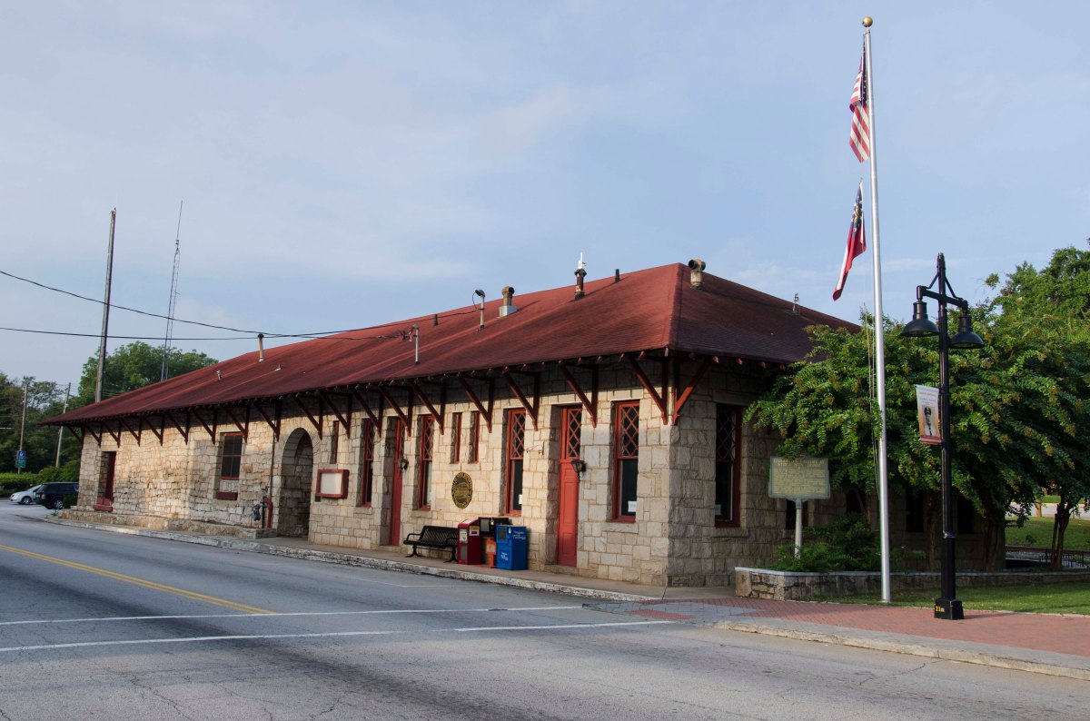
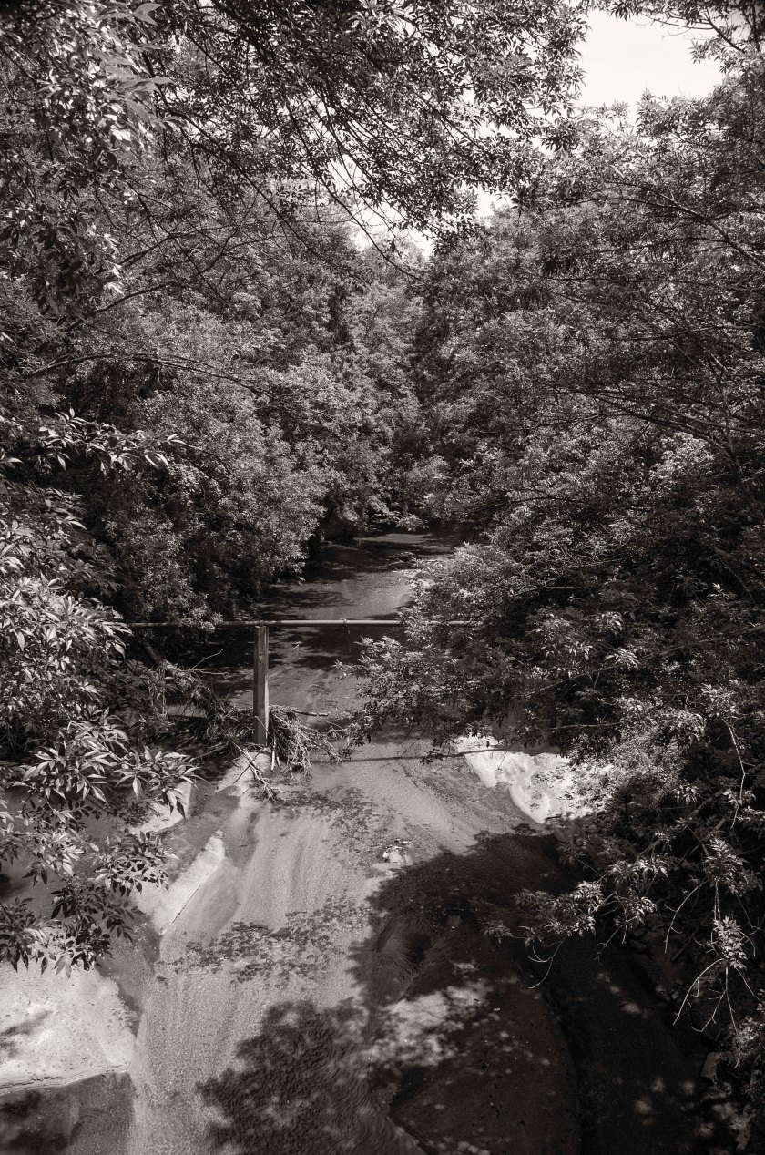
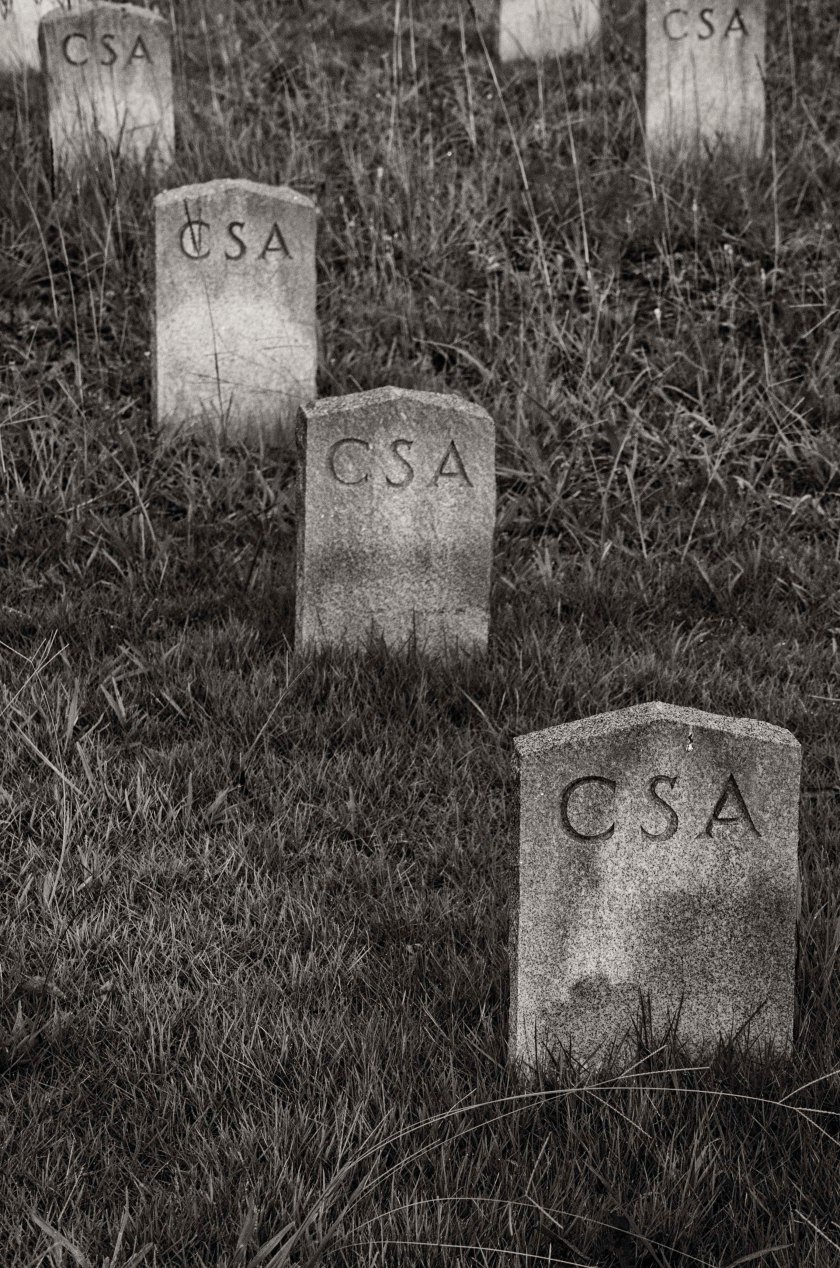
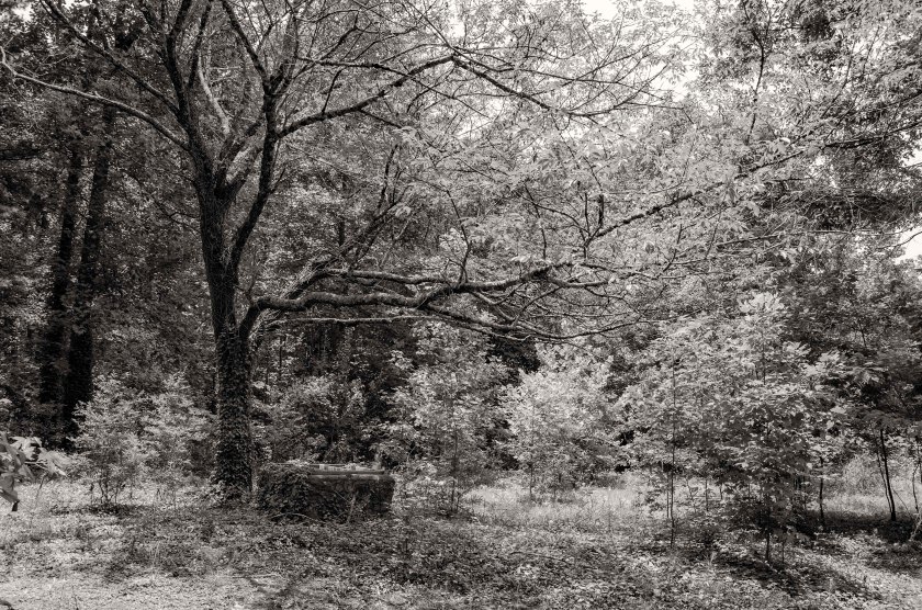
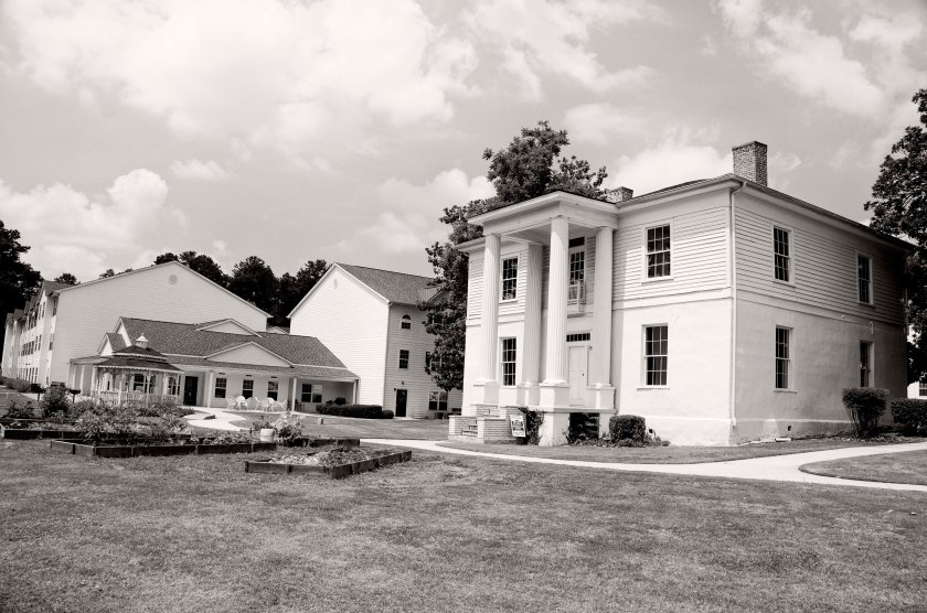
During the day of July 19th, General Geary’s 2nd Division of the 20th Corps, Army of the Cumberland (US), crossed Peachtree Creek in this area via foot bridges. They were support by a dozen pieces of artillery and heavy infantry support. Logs that had been prepared earlier were brought forward and several foot bridges were built under fire. The 3rd Brigade crossed under fire a seized the ridge south of the creek and held the bridgehead until the remaining two Brigades could cross. By daybreak on the 20th, two more bridges had been built with freshly cut wagon roads to bring supplies forward.Atlanta Memorial Park now sits in the area the Geary’s Division crossed under fire to establish their bridgehead. They would have crossed here from right to left and worked their way up to the low ridge line.Two Brigades of General Palmer’s 14th Corps, Army of the Cumberland(US), crossed Peachtree Creek about a half mile west of Howell’s Mill after two days of heavy skirmishing. On the night of the 19th, Two Brigades of General Baird’s 3rd Division of the 14th Corps, Army of the Cumberland(US), made a night crossing hear Peachtree Creek at the site of Howell’s Mill.Railroad tracks of Stone Mountain. Throughout the 18th and 19th of July 1864, Garrard’s Cavalry(US) along with General Lightburn’s 2nd Brigade, of the 2nd Division of the 15th Corps, Army of the Tennessee(US), worked diligently to destroy the railroad that lead west to Atlanta and east to Augusta. They destroyed several miles of tracks, 200 bales of cotton and the stores of the Quartermaster and Commissary that were supplying the Confederates in Atlanta.The Hamilton House, Stone Mountain. This structure was built in 1836 and was used as a hotel until the Civil War and was later used as a Hospital. Because of its use as a Hospital, it was saved from the destruction of the Federal troops.The Stillwell House, Stone Mountain. This structure built in 1820 served as a Confederate Hospital during the Civil War and has just recently opened as a the Stillwell House Bed and Breakfast.The Stone Mountain Cemetery contains many Confederate graves. 150 of them are unknown soldiers who died here in the local hospitals from their wounds of diseases. Some of the died skirmishing with Garrard’s Cavalry and Lightburn’s Brigade as they came to destroy the railroads.
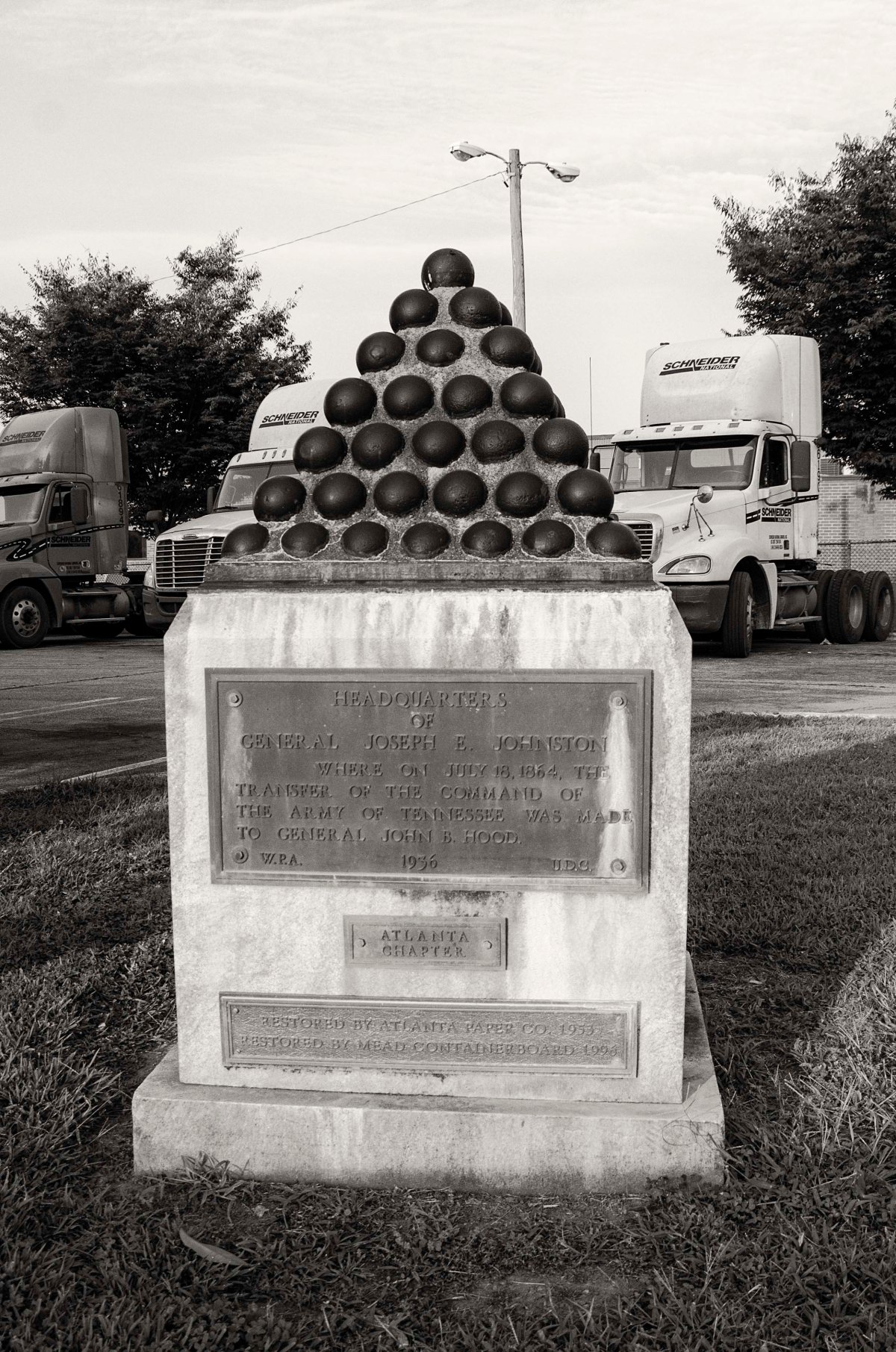
General Joseph E. Johnston is officially relieved of command of the Confederate Army of Tennessee. President Davis promote Lt. General John. B. Hood to be the new commander of the Army of Tennessee. Davis advised Johnston the he was relieved of command due to his inability to stop the Federals from reaching Atlanta and that he did not have confidence that he could prevent the Federals from capturing Atlanta and destroying the Army of Tennessee. Johnston was very well liked among his troops and many were in disbelief.
This change in command has come at a crucial time as the Federals have just crossed the Chattahoochee River. The Army of the Cumberland crosses at Pace’s Ferry and Power’s Ferry and are advancing toward Peachtree Creek. General McPherson’s Army of the Tennessee, has crossed the river at Roswell and has been moving south through Dunwoody toward the Augusta Railroad line near Decatur. They reach it on the 18th and destroy about four miles of it in between Stone Mountain and Decatur, in an attempt to disrupt the supplies, and possibly reinforcements, coming from the east. McPherson then turns west and moves towards Decatur.
Wheelers Cavalry had been skirmishing with the Federals approaching Peachtree Creek for several days, but today they burn the bridges over Peachtree Creek at Moore’s Mill, Howell’s Mill, and on Ridgewood Road. They then move south east to intercept McPherson’s Army of the Tennessee near Decatur.
The pieces are nearly in place for the first of two major battles to happen on the outskirts of Atlanta. Soon the two armies will clash in the Battle of Peachtree Creek and then two days later at the Battle of Atlanta.
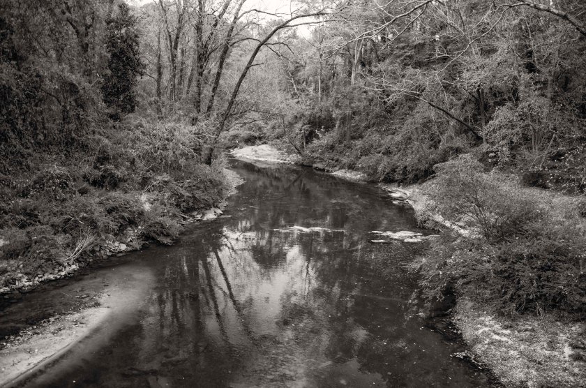
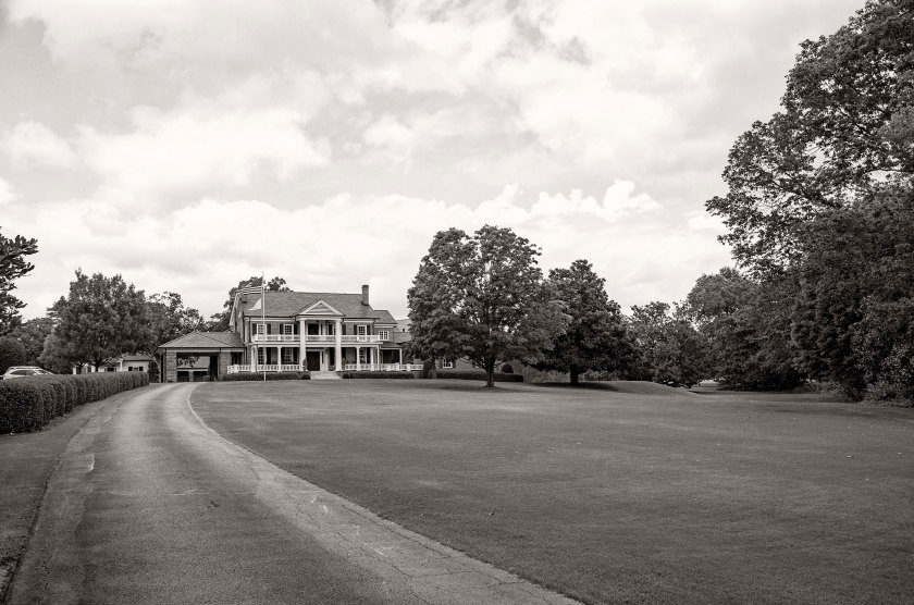
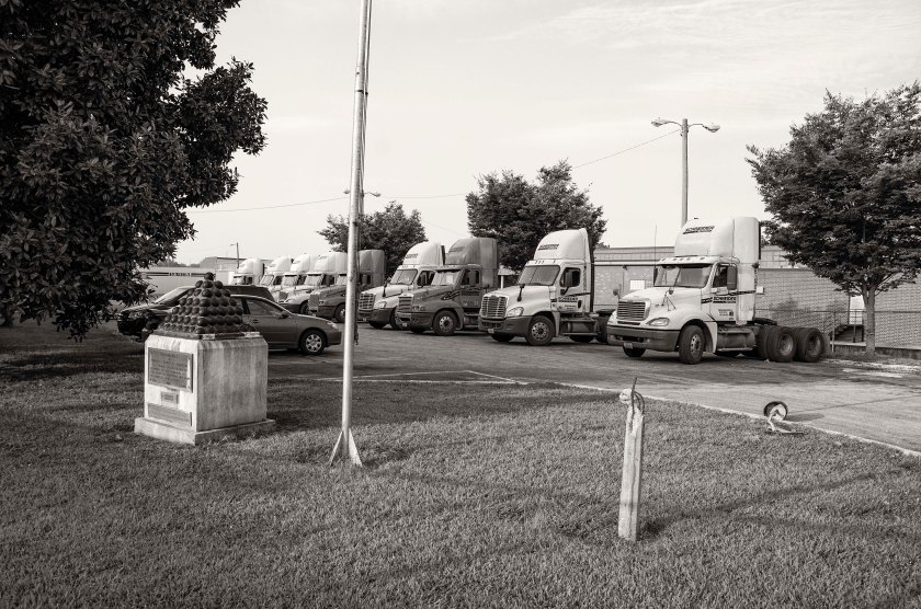
Peachtree Creek, once a strategic obstacle for the advancing Federals, now sits nestled between neighborhoods and park.Moore’s Mill at Peachtree Creek. The original wooden bridge would have been located to the left of the current bridge. After encountering the advancement of Federal troops, Confederate skirmishers were forced across the bridge and burned it in an attempt to stall the Federal advance.Another bridge across Peachtree Creek, here at Howell’s Mill, was burned by Confederate skirmishers in an attempt to slow down the Federals as they moved on Atlanta.As General McPherson’s men moved from Roswell they passed through Dunwoody where they split their columns to take advantage of multiple roads in an effort to move faster. Here along Johnson Ferry Road at Nancy Creek, Dodge’s 16th Corps, on the right of McPherson’s Army of the Tennessee(US), linked up with General Cox’s 3nd Division of the 23rd Corps, Army of the Ohio. They camped here along the creek for a night before proceeding to Decatur. Part of Dodge’s 16th Corps camped here at Ashford Dunwoody Road and Nancy Creek. Now a large athletic complex covers their camp.Logan’s 15th Corps and Blair’s 17th Corps moved down what is now N. Shallowford Road. They camped along Nancy Creek in the area of I-285 and N. Shallowford Road.Nestled in a small copse of trees off of Peachtree Road in Brookhaven, the Solomon Goodwin House is the oldest structure in Dekalb County and also the oldest inside the “Perimeter (I-285). The oldest portion was built in 1831 and expanded to it’s current size in the 1840’s. The home was a landmark on maps at the time and both Hascall’s and Cox’s Divisions of the 23rd Corps, Army of the Ohio, passed by here on their movement south. There are still dents in the mantel from rifle butts. Now the clubhouse for the Peachtree Golf Club, the Samuel House Plantation was a landmark for the advancing Federals. Cox’s 3rd Division of the General Schofield’s 23rd Corps, Army of the Ohio, camped here on the plantation grounds. General Schofield, along with General Sherman were accompanying the Division, made their Headquarters here.Browning’s Court House was another area landmark on McPherson’s route to Decatur. Originally located at the intersection of Lavista Road and Fellowship Road, it has been moved to property owned by the county in order to preserve the structure. Logan’s 15th Corps moved to this point to support elements of Garrard’s Cavalry as them moved to destroy the railroad tracks in nearby Stone Mountain.The railroad in Decatur looking east towards Stone Mountain and on to Augusta. This was McPherson’s goal. He was charged with destroying the railroad in order to prevent supplies and reinforcements from reaching Atlanta from the east.
Over the last several days and continuing into the next several days, General Sherman is resting his troops and changing their positions in preparation for an assault on Atlanta. He is trying to deceive General Johnston into believing the attack will come from the west. To do this, he has sent Stoneman’s Cavalry on a raid towards Newnan to destroy the Railroad that connects Atlanta with Alabama. Stoneman’s Cavalry cross the Chattahoochee near Campbelton and skirmish with Confederates along the way. They are unsuccessful and fall back to Villa Rica before returning to the Federal lines along the Chattahoochee. During this time, Sherman is shifting several Corps from his right flank to the left flank at the river crossing in Roswell. The Federal soldiers crossing at Roswell will be shifted to the east of Atlanta. While both armies rest from the rigors of the campaign, there is a great deal of fraternization between the soldiers stationed along the Chattahoochee. There are many documented accounts of trading, usually the Confederates trading tobacco for coffee, as well as other goods and small items. There are accounts of Regimental bands on both sides having competitions and serenading the troops on the opposite side of the river. For some soldiers, this is the first time the have been able to have a bath in weeks. Even General Sherman himself, takes a bath in the river.
For General Johnston, this is a time of uncertainty, President Davis has sent Braxton Bragg, former Commander of The Army of Tennessee, to ascertain the tactical situation in Atlanta and to find out what Johnston plans to do. Davis is considering replacing Johnston and is relying on advice from Bragg as to who the replacement of Johnston should be. This decision would have great bearing on the outcome of the campaign. They met at Johnston’s Headquarters which was established at the Dexter Niles house along the Atlanta road between the Chattahoochee river and the city.
Well preserved Federal earthworks near Roswell, Ga. These were part of the bridge head established by General McPherson’s Army of the Tennessee (US). These works were manned by the 2nd Division of the XV Army Corps.Stones,stacked by Federal soldiers fortifying their positions, are still in place 150 years later at their bridge head near Roswell.Remnants of a Federal trench located on a ridge overlooking the Chattahoochee river near Cochran Shoals. This site is located with an office park.After crossing the Chattahoochee at Powers Ferry, the IV AC (US), established a bridgehead on the high ground above the river. Northside Drive now runs along this same ridge and several home owners have the remains of Federal earthworks in their front yards.Remains of a Federal trench along Northside Drive, manned by the IV AC(US), after crossing the Chattahoochee River.Remnants of an artillery battery that was maned by elements of the IV Army Corps (US). Now located near the intersection of Northside Drive and River View Drive in the side yard of private residence.Site of the Cagle house where General O.O. Howard established his Headquarters and along with General Sherman and other officers, had a meeting to plan their next moves in the campaign. That meeting was depicted in the sketch below that appeared in Harper’s Weekly in September of 1864.Sketch of General Sherman and other officers at the Cagle house, this sketch appeared in a September issue of Harper’s Weekly.Site of the Dexter Niles house where General Johnston (CS) established his headquarters after retreating across the Chattahoochee River upon learning of Federal crossing north of his River Line position. It was here that he would be relieved of command and General John Bell Hood would be command of the Army of Tennessee.
After the first Federal crossing of the Chattahoochee at Sope Creek on the afternoon of the 8th, Garrard’s Cavalry crosses at Roswell. At dawn on the 9th, a Federal Battery provides covering fire as several companies of dismounted cavalry begin wading across the Chattahoochee at what is called the “Shallow Ford”. It was the ford used by the Hightower Trail which was a prehistoric trading route. They engage a small Confederate force across the river. The Confederates are out numbered and out gunned and they quickly retreat and some surrender. The Federals are armed with Spencer repeating rifles and are able to move and shoot quickly without stopping while they cross the river. The battery that is providing cover fire is the Chicago Board of Trade Battery. When Sherman learns of Garrard’s crossing of the river, he immediately dispatches Newton’s Division from its camp near Rottenwood Creek, to Roswell “double time”, to reenforce Garrard. He also sends Dodge’s Corps to reenforce Garrard and establish a strong bridgehead for subsequent crossings. A detachment of General McCook’s Cavalry, the 1st Tennesse Regiment (US), under the command of Colonel Brownlow, dismounted and crossed the river enforce wearing only their hats and carrying their rifle and cartridge box.
After receiving information about these crossings and size of the forces at each crossing, General Johnston orders the fall back from the River Line. The Confederate army begins to retreat from the River Line at dusk and in the early morning hours of the 10th, they are across the river and begin to burn the Railroad bridge and the wagon bridge next to it. They also take up their pontoon bridges and at Pace’s Ferry they cut the pontoon bridge loose hoping it will swing across the river or down stream where they can recover it. It becomes stuck and is recovered by the Federals, but not put into use.
General Johnston establishes his Headquarters 3 miles from Atlanta, at the abandoned Dexter Niles house. He orders that the river crossings at Pace’s Ferry and Turner’s Ferry, be heavily guarded.
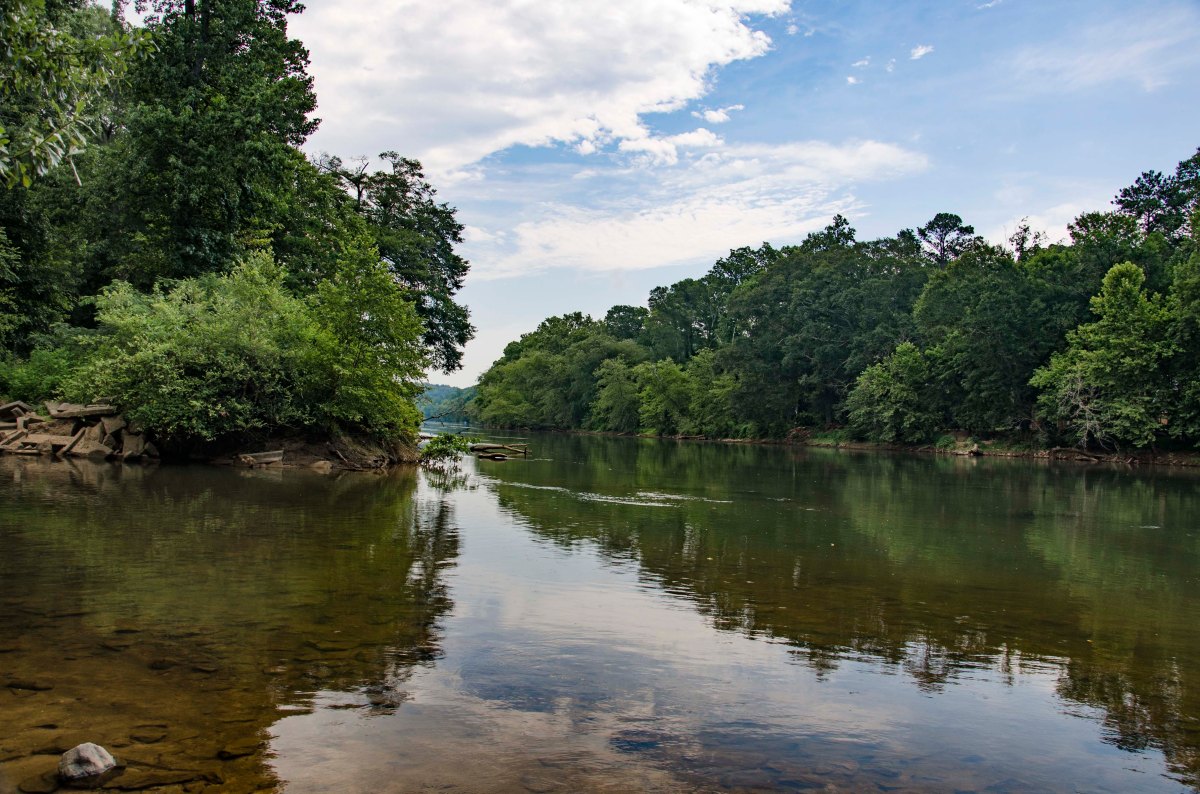
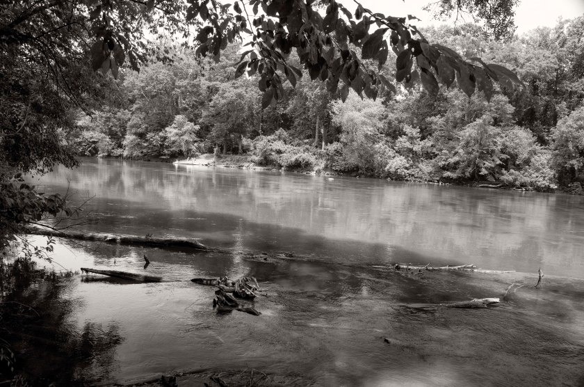
The first crossing of the Chattahoochee River by Federal troops happened here at the confluence of Sope Creek and the river. The neighborhood pool on the southern shore is the location of the Ferry landing where the Federal troops made their assault. “Shallow Ford” in Roswell was the site of the Federal crossing by several companies of Garrard’s Cavalry dismounted and with their new Spencer rifles and supporting fire from the Chicago Board of Trade Battery, they fought their way across the river.What is now a Cul-de-sac was once the location of the Chicago Board of Trade Battery that support Garrard’s crossing of the river at Shallow Ford.
Col. Brownlow and his dismounted Cavalry crossed the river just about Powers Ferry at Cochran’s Ford. They crossed wearing only their hats and carried their rifle and cartridge box.
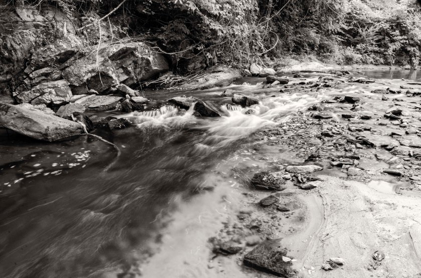
Rottenwood Creek: When General Sherman learned of Garrard’s crossing at Roswell he dispatched Newton’s Division double time to Roswell to reinforce Garrard. Newton’s Division was camped near the area of present day Cumberland Blvd, I-75 and I 285. They crossed Rottenwood Creek on a wooden bridge just above this small cascade.
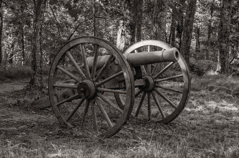
During the attack on Kennesaw Mountain the Federals set an artillery battery containing 24 guns in total. It was located on a low rise near the base of Big Kennesaw Mountain. These images are from the 24 gun battery which is protected by the National Park.
Just in side the tree line of this low rise near the base of Kennesaw Mountain is the Federal 24 gun battery.Remnants of one of the parapet walls at the 24 gun battery.The gun notch is still slightly visible in the remnants of this parapet wall.A view looking down the line of earthworks for the 24 gun battery. Four separate emplacements are visible along this line.Looking from the rear of the emplacement in the direction the gun would have faced.
With so many locations in connection with the battlefield at Kennesaw Mountain, I am going to make several more post over the next few days with more images. There were just too many to include in yesterdays post. Today’s images will focus on Pigeon Hill.
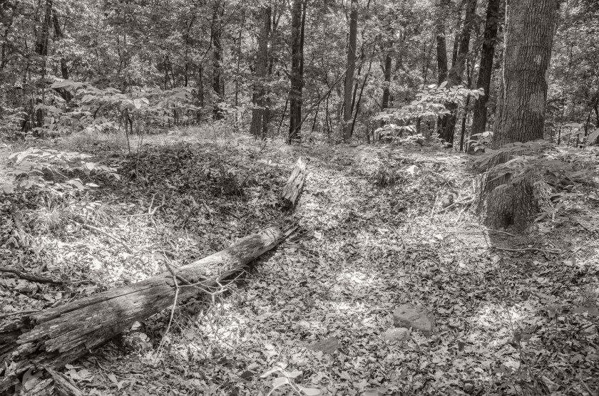
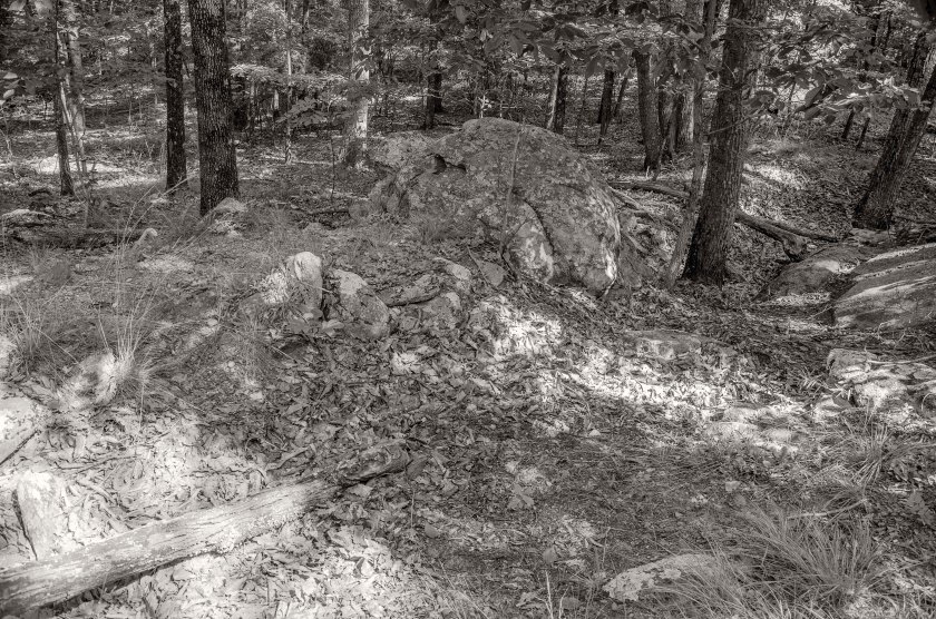
On the morning of June 27th, Federals under the command of General McPherson attacked the Confederate line in the area of Pigeon Hill and Little Kennesaw north east of Cheatham’s Hill. The Federals quickly overran some Confederate pickets and rifle pits located ahead of the main line, but were quickly stalled by the well entrenched Confederates of French’s Division, which held Little Kennesaw and Pigeon Hill. The Confederates well entrenched with plenty of large boulders and rocks used as cover in their earthworks. At one point the Confederates were even rolling boulders and large down on the attacking Federals. French’s Division also held the advantage of the higher ground thus forcing the Federals to attack up steep inclines that had been heavily covered with entanglements by the men of French’s Division. The attacking Federals were repulsed and forced to retreat to low valley between Little Kennesaw and Pigeon Hill where they were trapped by musket and cannon fire for hours. They were finally able to retreat back to their lines after darkness fell upon the battlefield.
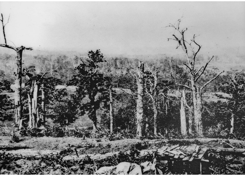
A monument to fallen Federals stands in a field near starting point of the Federal assault on Pigeon Hill. The hiking trail up to Pigeon Hill and Little Kennesaw follows the route that Federal soldiers took during the attack. Look to where the trail appears to end(but really turns left). You will the what are the remains of Confederate earthworks just as the attacking Federals would have seen.Remnants of Confederate Earthworks on Pigeon Hill. These are some of the first entrenchments that were encountered by the Federal assault.Remains of Confederate earthworks on Pigeon Hill near the spot where George Barnard made an image of the battlefield in the fall of 1864.A line of Confederate works on top of Pigeon Hill near the lower portion of Little Kennesaw. Notice the large boulders further down the line and the slope as goes do to the right where the Federals were trapped until nightfall.More Confederate works with large boulders included into the line.Looking down the slope the Federals tried to make an attack from. During the battle the Federals were forced to retreat further down this small valley until the could make it back to their lines under the cover of darkness.This is a period image captured by photographer George Barnard in the early fall of 1864 as he traveled to Atlanta to photograph the campaign.Here is the same location photographed by George Barnard only 150 years later. Notice the large oddly shaped stone in the foreground of each image.
On orders from General Sherman, General Schofield’s Army of the Ohio, was advancing down the Powder Springs Road in the direction of Marietta. Schofield was attempting to go around the left end of the Confederate flank. General Johnston recognized this threat and on the 21st he sent Hood from his right flank to the left in an attempt to neutralize the threat. In the late afternoon of the 22nd, Hood’s Corps met Schofied’s Army of the Ohio near the Kolb Farm. Hood initiated an attack without permission from his commander, General Johnston, and he did not bother to do any reconnaissance of the terrain or the force he was engaging. He unknowingly ordered an advance on a superior enemy force that was entrenched on the high ground. After suffering about 1000 casualties, Hood retreated and dug in. He was successful in stopping Schofield from turning the Confederate left flank, but was foolish in making his assault.
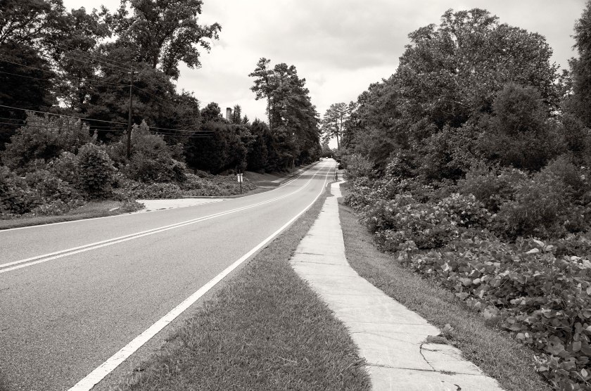
The Kolb Farm House. Owned by the Park Service, this restored period home is sometimes used as living quarters for park rangers. It was once a major landmark on the battlefield with its namesake. Looking west down the Powder Springs Road a period road still in use today. The Kolb House is across the intersection in the trees. The Federals and Confederates were positioned in lines that ran roughly North to South on both sides of the road. The Federals would have been attacking for the distance and moving toward the camera position. The Confederates would have been moving from the east (behind the camera) toward the Federals in the west.Much of the landscape has changed in the last 150 years, but during the Battle of Kolb’s Farm this area would have been part of the Federal line and saw a significant amount of action.A subdivision now sits where soldiers once stood. The Federal lines were on the hillside to the left of the frame.Cheatham Hill Road. The line of battle roughly follows this road and the Confederates attacked across the road from the right side of the frame towards the left.The McAdoo House, which sits behind the Kroger in a previous image, is one of the few remaining homes that survived the Battle of Kolb’s Farm and the Battle of Kennesaw Mountain. It sits atop a low ridge the Federals established their line along during the Battle of Kolb’s Farm. The Cheney House is a period home that survived the Civil War and is now home to apartments for “Senior Living”. General Schofield made his headquarters here during the Battle of Kolb’s Farm and throughout the remaining operations around Kennesaw Mountain. He occupied the home June 22 – June 30 and was visited here by General Sherman on the 23rd and the 25th of June.
The Confederates are entrenched on the Kennesaw Mountain line and have multiple artillery pieces to the top of Little Kennesaw and Big Kennesaw. It took 100 soldiers to move each cannon up the mountain. Skirmishing continues all along the line, Federal and Confederate Artillery Batteries begin dueling back and forth. General Sherman has ordered General Schofield’s Army of The Ohio to move from Lost Mountain, via the Sandtown Road, thus swinging the Federal right over Mud Creek and toward the south western portion of Kennesaw Mountain. On the evening of the 19th, Schofield reaches Nose’s Creek, about half way between Mud Creek and Kennesaw Mountain.
A cannon now sitting silently atop Big Kennesaw Mountain in the original earthworks. The park service has protected the artillery pieces and earthworks here with a split rail fence.Remnant of the period road that soldiers used to drag the cannons up to the top of Kennesaw Mountain. It took 100 soldiers to drag each cannon to the top.An artillery piece sits atop Little Kennesaw Mountain in what is called “Fort McBride”.Earthworks and cannon at Fort McBride, Little Kennesaw Mountain.Looking down the barrel of a big gun. Ft. McBride, Little Kennesaw Mountain.Part of Kennesaw Mountains extensive trail system snake behind the parapets and cannons where Confederate soldiers once fought bitterly against the attacking Union Army.
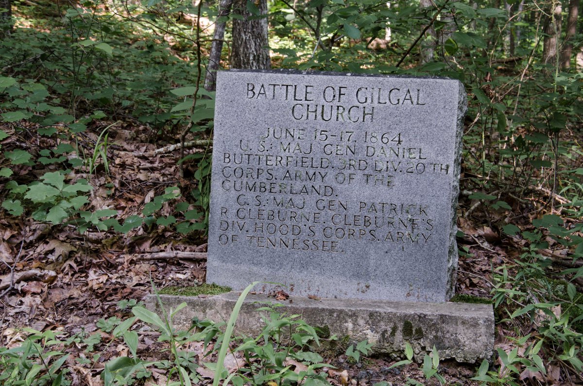
After the fighting at Gilgal Church on the 15th and continued fighting on the 16th, the Union Army has figured out that lines in the area form a salient and begin to pour in enfilading fire on the Confederates. Other Union forces move against the thin line of southern soldiers west of Gilgal Church towards Lost Mountain. Schofield’s XXIII Corps is now in a position to turn Johnston’s left flank, Schofield may or may not realize that he is in such an advantageous position, but Johnston does and orders Hardee’s Corp to pull back at dark, to the far side of Mud Creek and establish a new line. During this retrograde movement, a Union artillery shell explodes near Brigadier General Lucius Polk. He is the nephew of Lt. Gen. Leonidas Polk and only two days after the death of his Uncle, Lucius Polk is wounded and loses his leg.
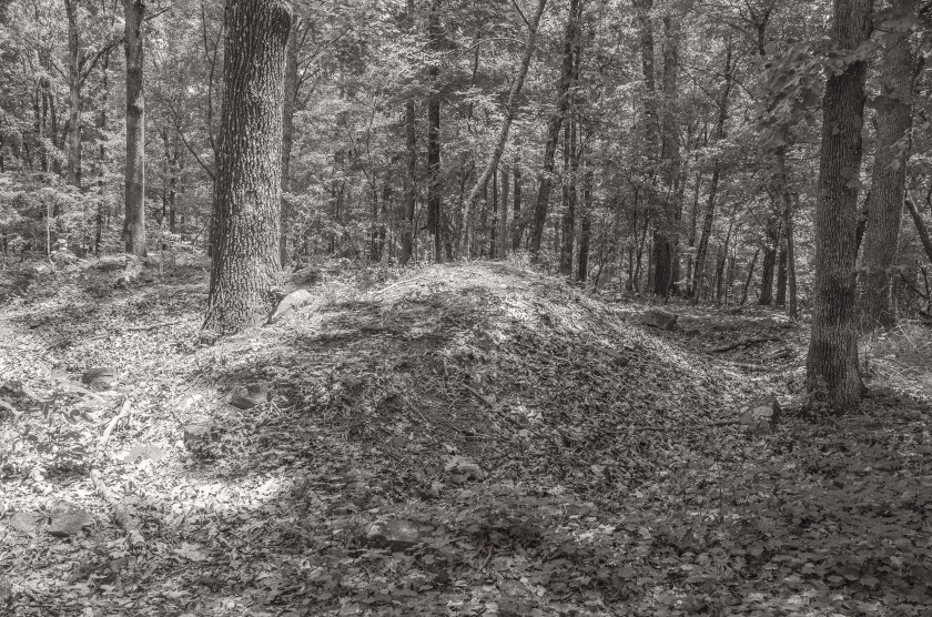
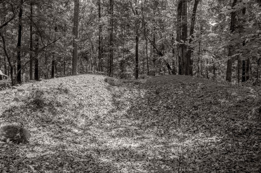
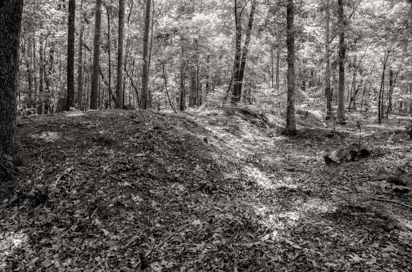
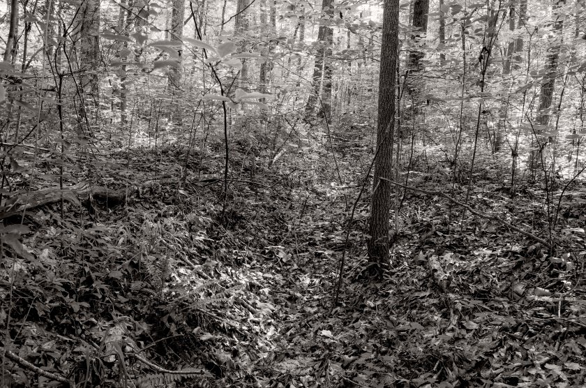
Recreation of what Confederate earthworks may have looked like. Remnants of Confederate earthworks at the site of the Battle of Gilgal Church.
On May 28th I photographed the area where the Battle of Dallas took place. This was a really great day. It was the 150th anniversary of the battle to the day. I was able to make images of some earthworks that were used in the battle. They were still deep enough to be defensible positions. The highlight of the day was photographing a historic home that was used as a Headquarters by General McPherson. It was also used as a field hospital. Today it is a law office. I went in the office to introduce myself and ask permission to photograph the house. They gave me permission and then we talked for awhile about the house and its history. She gave me a tour of the first floor and showed me the room used as an operating room. Then, she really surprised me, by bringing out a box containing human bone fragments. One was obviously from an amputated limb since it had been cleanly cut with a saw. She then told me about some of the strange things that happen in the house from time to time.
On the 29th I went to Pickett’s Mill to make images of the earthworks and key points of battle and the terrain. Since the park was closed on the actual anniversary of the battle, this was the first day I was able to get in there to photograph it. The lines here were occupied frm May 27th through June 6. I will be going back tomorrow to photograph the reenactment.