As Hood prepares for his first tactical engagement since taking command of the Confederate Army of Tennessee, he is hoping that General Thomas’s Army of the Cumberland has been unable to prepare any earthworks since crossing Peachtree Creek. Hood is also having to keep an eye on McPherson and Schofield as they advance from Decatur toward Atlanta. The attack is planned for 1:00pm, but for various reasons it does not commence until 4:00pm.
Hood has deployed Stewart’s Corps (formerly commanded by the late Lt. Gen. L. Polk) to his left. Stewart’s Corps consist of French’s Division on the far left connecting to the Western and Atlantic Railroad near Casey’s Hill in the current Crestlawn Cemetery and extending east and connecting to Walthall’s Division, which sits astride Howell Mill Road. Walthall’s right extends toward the east and connects with Loring’s Division between Howell Mill and Northside Drive. Hood had deployed Hardee’s Corps to the center. Hardee had placed Maney’s Division to the left of his line followed by Walker’s Division in the center and Bate’s Division to the right. Hardee held Cleburne’s Division in reserve. Hood, fearing an attack by McPherson on the east side of Atlanta, placed Cheatham on the far right of the Confederate line. Cheatham is commanding Hood’s former Corps. Hood’s plan is to attack “en echelon”. Starting with Bate’s Division on the right attacking first and then each subsequent Division attacking one after the other. This was done in an effort to turn the enemy flank and push them back to Peachtree Creek and the Chattahoochee River.
Thomas had most of his army across the creek by noon. Palmer’s XIV Corps had been placed on the right and had been able to entrench as they had been across the creek earlier. Hooker’s XX Corps was forming up in the center and Howard’s IV Corps was forming on the left. Newton’s Division of Howard’s Corps held the far left.
Late in the morning Hood received word from Wheeler, who commanded the cavalry attempting to hold the east side of Atlanta, that he was out numbered by McPherson and Schofiled who were moving toward the Atlanta from Decatur. Hood decided to shift his entire army to the east by a mile in order to support Wheeler should he need it. The orders were given and the movements were made, but through miscommunication and human error the shift to the right (east) was nearly two miles. This cost the Confederates time and delayed their attack until 4pm.
When the attack finally began, Bate’s Division was the first to move forward and should have been the first to make contact, but the terrain in their front had not been reconnoitered prior to the assault. Because of this they did not know where they were going and did not know where the enemy was. They ran into a heavy thicket and swampy area that greatly hindered their progress as they were attempting to find Newton’s Division.
By 4:30pm the “en echelon” advance had made its way down the line to Loring’s Division. In the area between present day Northside Drive and Walthall Street, Scott’s Brigade of Loring’s Division made one of the most successful assaults of the day. They captured the colors of the 33rd New Jersey as well as part of the regiment. They continued pressing their assault and nearly turn Geary’s flank, but the lack of support on either of Scott’s flanks, forced him to fall back.
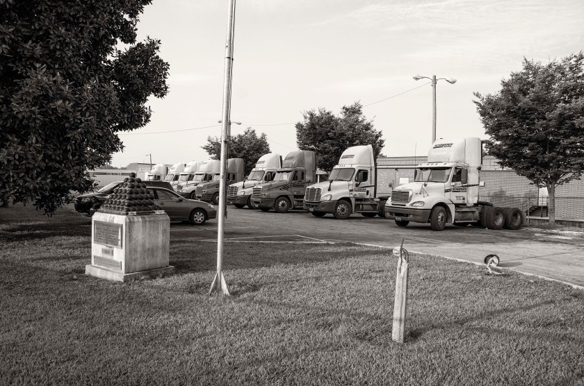
The day was filled with heavy, fierce fighting on both sides. By late afternoon, Loring believed he could exploit a gap in the Federal lines between Newton and Geary. He asked Hardee for reinforcements and as Hardee was about to send Cleburne’s Division to assist Loring, he received an order from Hood to send a Division to the east of the city to support Wheeler. Hardee sent Cleburne’s Division to Wheeler, thus preventing another push forward to the Federal lines. The day ended with many dead, dying and wounded still on the battlefield. The high priced neighborhoods of the area now stand in stark contrast to the harsh reality of the battle that took place there 152 years ago today.
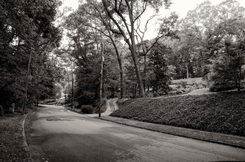
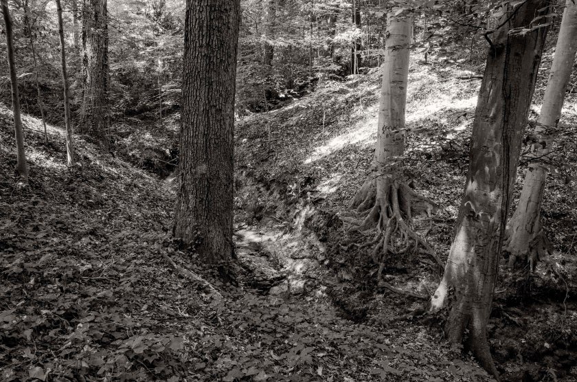
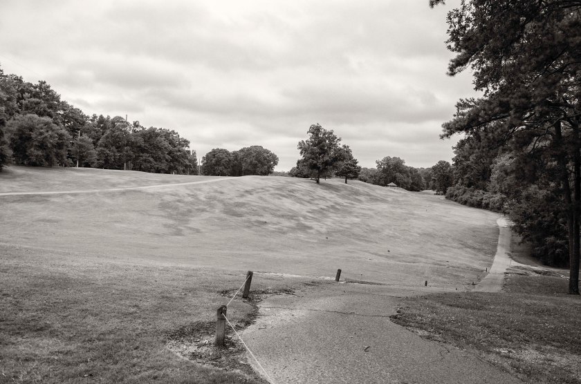
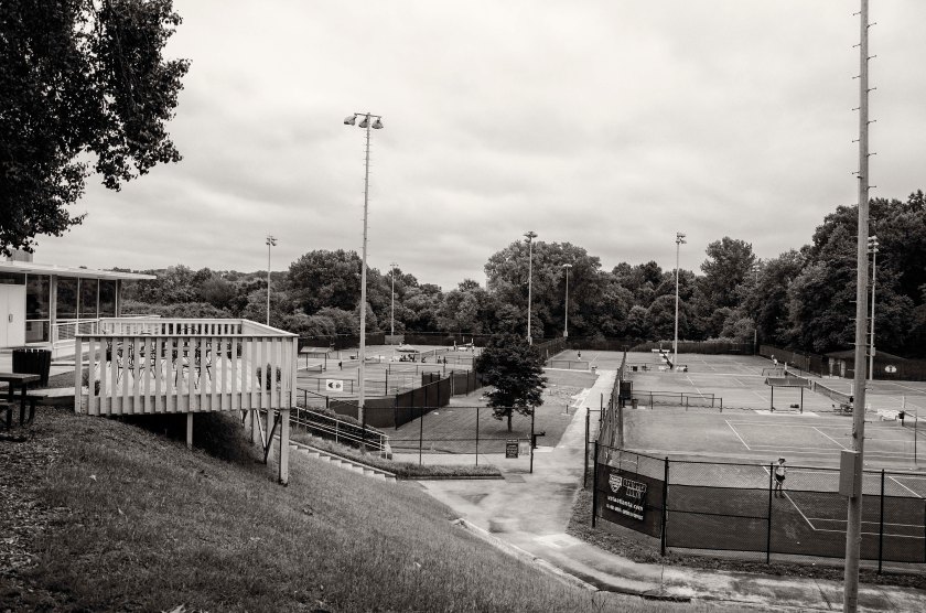
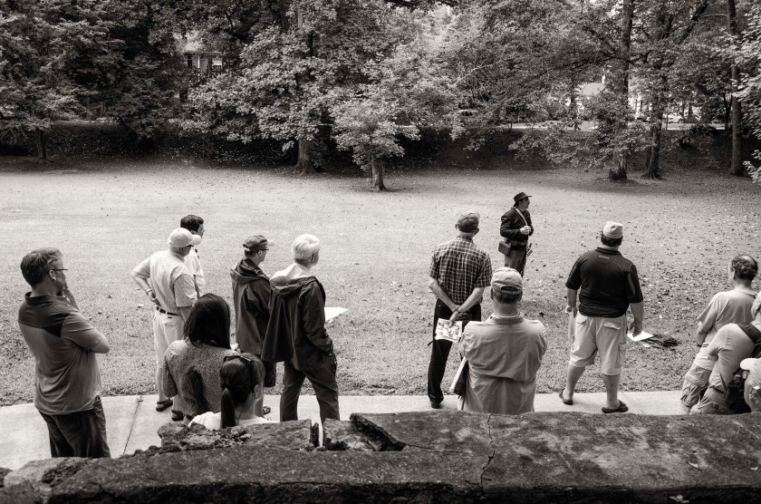
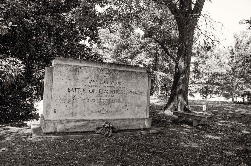
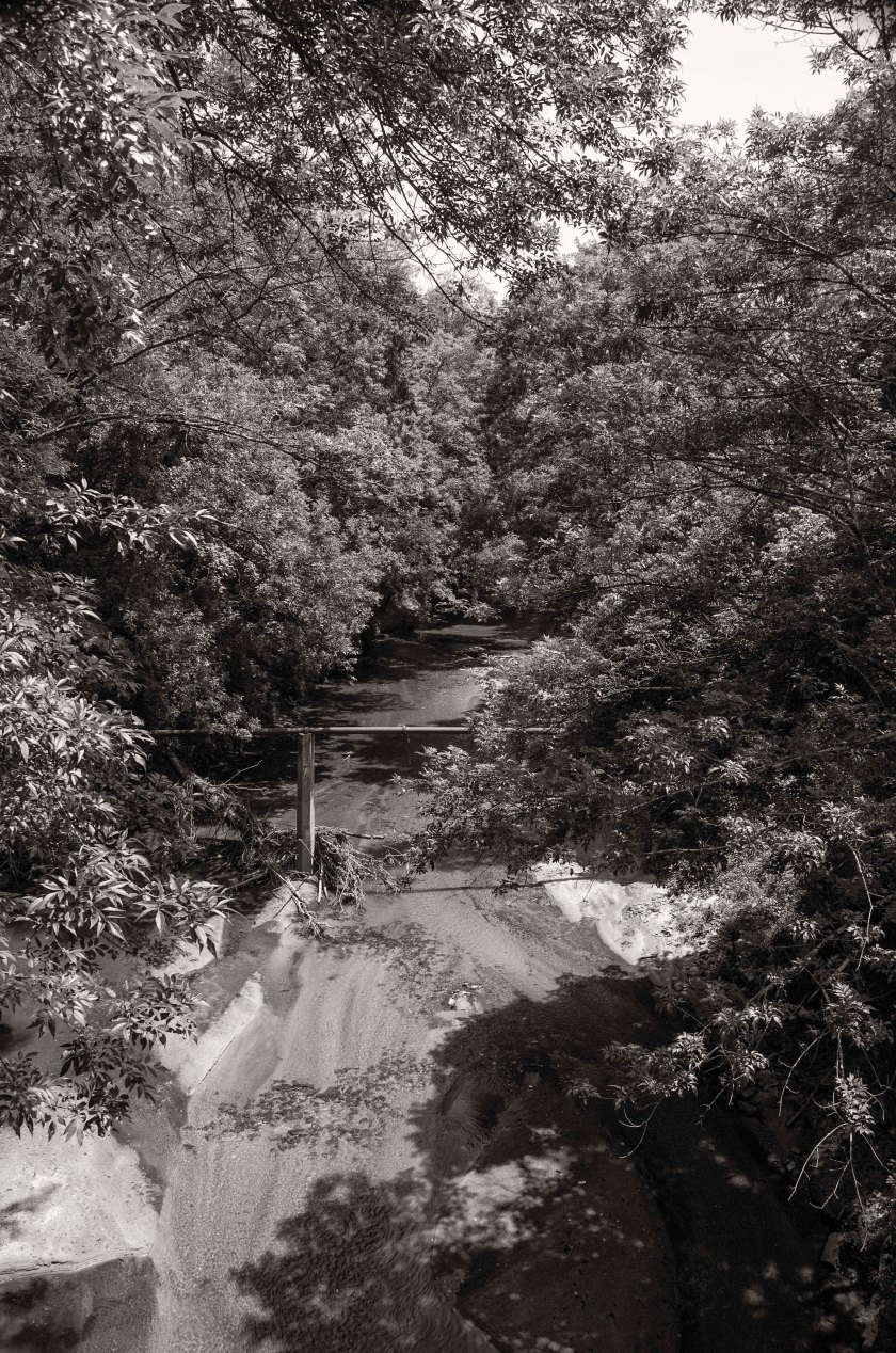
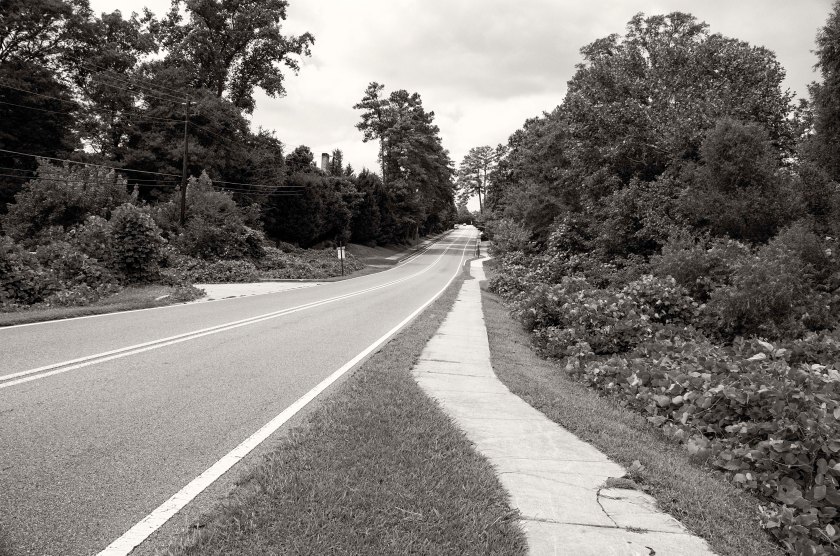
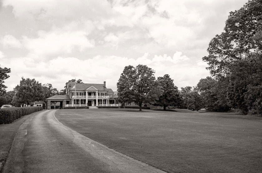
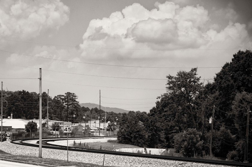
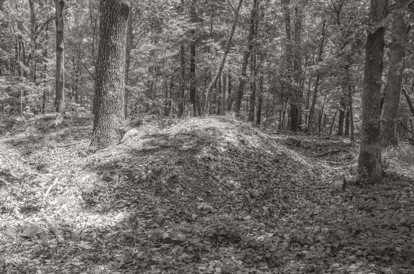
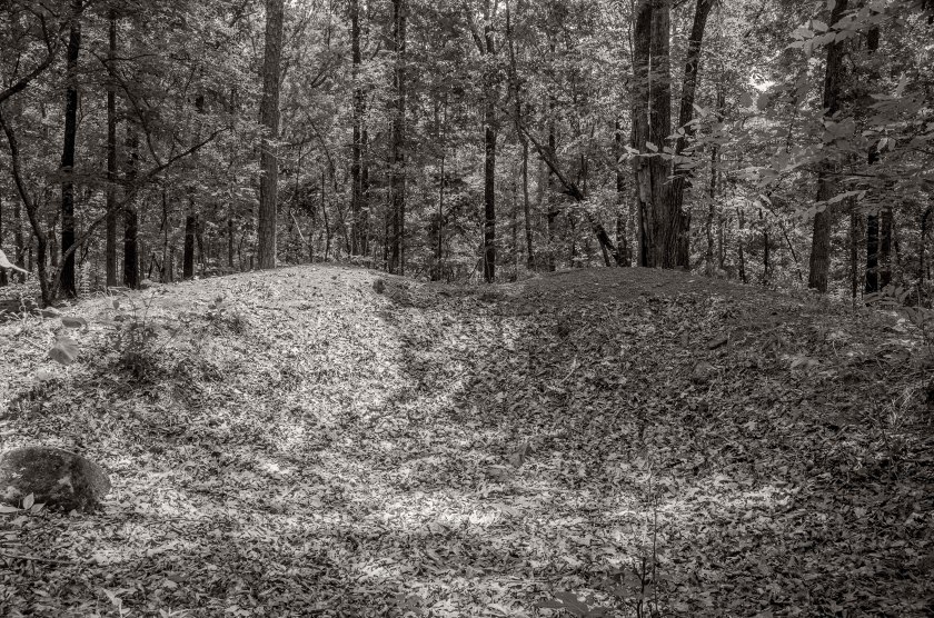
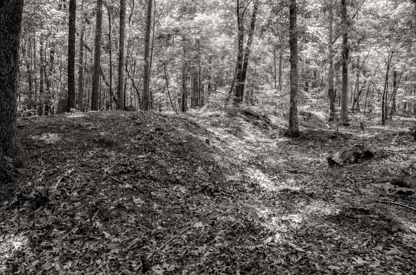
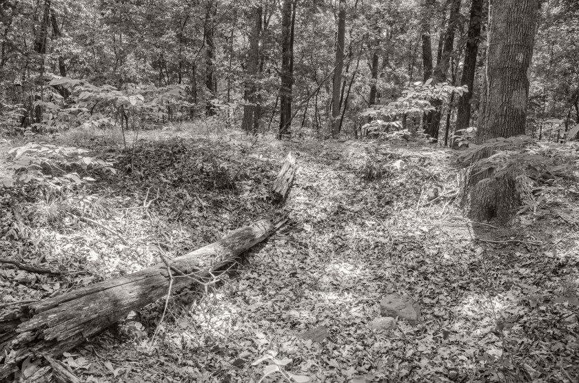
Knipe’s and Robinson’s Brigades of William’s Division of Hooker’s 20th Corps, were positioned along the high ground to the right of this image taken along Norfleet Rd. To the left of the image is a deep ravine that had to be traversed by the attacking Confederates. This area was the western most portion of the Federal line that came under direct assault during the Battle of Peachtree Creek.This deep ravine now sits between Norfleet Rd. to the right, where the Federals were positioned on high ground, and Springlake Dr. Reynold’s Brigade of Walthall’s Division of Stewart’s Corp(CS) attacked through this deep ravine and pushed forward attempting to push Knipe’s and Robinson’s Brigades back. After a failed second attempt under enfilading artillery fire and with only the support part of Selden’s Alabama Battery, Reynold’s was forced to withdraw from the assault.Near the intersection of Collier Road and Howell Mill, at the south western end of the ravine, the Selden’s Alabama Battery was placed in support of Reynold’s assault. While directing the placement of the battery Major William C. Preston was killed in action by Federal fire. Major Preston is the “Willie” Preston featured in Mary Chestnut’s “A Diary From Dixie”Bobby Jones Golf Course at the Bittsy Grant Tennis Center. The right of Geary’s Division of Hooker’s 20th Corps was positioned along the high ground of this ridge on the golf course. O’Neal’s Brigade of Wathall’s Division(CS) was on the right of Reynold’s Brigade and pushed through at shallower portion of the ravine and attempted to exploit a gap between Williams and Geary. Geary’s line was pushed back until his right met Williams left forming a re-entrant angle in the Federal line. O’Neal split the Brigade with half swinging left to attack Williams and the other half swinging right to turn Geary’s right flank. Fierce fighting ensued and with lack of numbers and artillery support, O’Neal eventually withdrew.Bittsy Grant Tennis Center. Looking toward the Confederate lines. O’Neal’s Brigade would have crossed this area in their assault on Geary’s and Williams lines.Tanyard Creek Park, a historian and reenactor gives a lecture to a tour group on the 150th anniversary of the Battle of Peachtree Creek. General Loring’s Division of Stewarts Corps(CS), came across this ground moving from the background toward the camera position to attack elements of Geary’s and Ward’s Divisions (US), which were positioned behind the camera on the high ground near present day Collier Rd.Tanyard Branch in Tanyard Branch Park. Heavy fighting ensued here as Loring’s Division(CS) pushed hard in their attack on elements of Geary’s and Ward’s Division’s(US).Eastern portion of Tanyard Creek Park. Portions of Featherston’s Brigade, Loring’s Division (CS), advanced through this area, crossing the creek (camera right),under heavy fire from Geary’s (US) artillery and moving towards the high ground along present day Collier Road. Ardmore Road looking toward Collier Road. The right of Featherston’s Brigade advanced down the slope for their trenches nearly a mile behind the camera position, to attack Coburn’s and Wood’s Brigades of Ward’s Divison (US). Featherston’s Brigade drove back the Federal skirmishers and pushed passed the barricades the skirmishers used to assault the main line. They gained some ground but were forced back to the abandoned barricades as they were counter attacked along their front and flank.28th St. at Wycliff Rd. looking toward’s Peachtree Street. 28th St. dead ends into Ardmore where the previous image was made. The Old Montgomery Ferry Road crossed through this spot and intersected Peachtree Road slightly south of Palisades Rd. Brig. General Clement H. Stevens (CS) was killed in action here as he ordered the withdraw of his Brigade. Steven’s Brigade was part of Walker’s Division of Hardee’s Corps.Battle of Peachtree Creek memorial. This memorial, shaded by Oaks and Magnolias, rest on a small knoll between Peachtree Road and Piedmont Hospital. Kimball’s Brigade of Newton’s Division, Howard’s 4th Corps (US) was positioned here on this high ground astride Peachtree Road. They were assaulted by Walker’s Divisions of Hardee’s Corps (CS).Dale Way Park now sits on the battlefield once crossed by Bate’s Division of Hardee’s Corps (CS). Bate’s Division was the far right of the Confederate assault on the Federal lines at Peachtree Creek. Bate’s was the first to move from his works to begin the assault with each successive Division move forward one after the other. Bate’s assault was delayed as the whole Confederate line had been shifted to the right by nearly two miles. Initially, the line was supposed to move only a mile to the right in order to be in position to reinforce Wheeler’s Cavalry east of Atlanta should McPherson and Schofield attack. Miscommunication lead to shift of two miles and as such, when Bate’s made his advance on two Brigades of Newton’s Division (US), he did so across terrain that had not been reconnoitered. Bate’s advance was slow due to heavy thickets and swampy areas in the Clear Creek Valley.WSB TV, West Peachtree St. near Inwood Cir. The Confederates outer defensive line of Atlanta was placed on the high ground here and extended westward along various hills and ridges to present day Crest Lawn Cemetery where it terminated at Casey’s Hill along the Western Atlantic Railroad. Walker and Bate’s Divisions both started their assault on the Federals from this defensive line. This view is looking south toward the Confederate line.West Peachtree at Inwood Cir. WSB TV. Looking north toward Federal Positions from the Confederates outer defensive line of Atlanta. Walker’s and Bate’s Divisions(CS) would have advanced down this slope crossing the area that is now Buford Hwy and I-85 and then moving up through what is now the Brookwood Hills neighborhood, to assault part of Newton’s Division (US) that were positioned along the high ground in the area of present day Brighton Road.
It is General Hood’s first full day in command of the Confederate Army of Tennessee. He is working to get a grip on the tactical situation and is making plans for a fight near Atlanta. He plans to attack the Federal Army of the Cumberland, commanded by General Thomas, after it crosses Peachtree Creek and before they can entrench. Once the Army of the Cumberland is pushed back to the Chattahoochee River and has surrendered or been crushed, he plans to turn the Confederate Army toward the east and attack the Federals east of Atlanta.
At General Sherman’s urging, General Thomas has sped up his southward movement and has the majority of the army across Peachtree Creek. Sherman has also ordered him to send Howard’s Corps to the east to reinforce Schofield and McPherson should the Confederate Army turn on them.
Unbeknownst to General Hood, McPherson is already in Decatur and has begun to destroy the railroad tracks and occupy the city. Garrard’s Cavalry has been sent as far east as he deems prudent to destroy as much of the railroad towards Augusta as he can. General Schofield an his Army of the Ohio are linking up with McPherson in Decatur.
Nearly continuous skirmishing takes place all along the Federal advance.
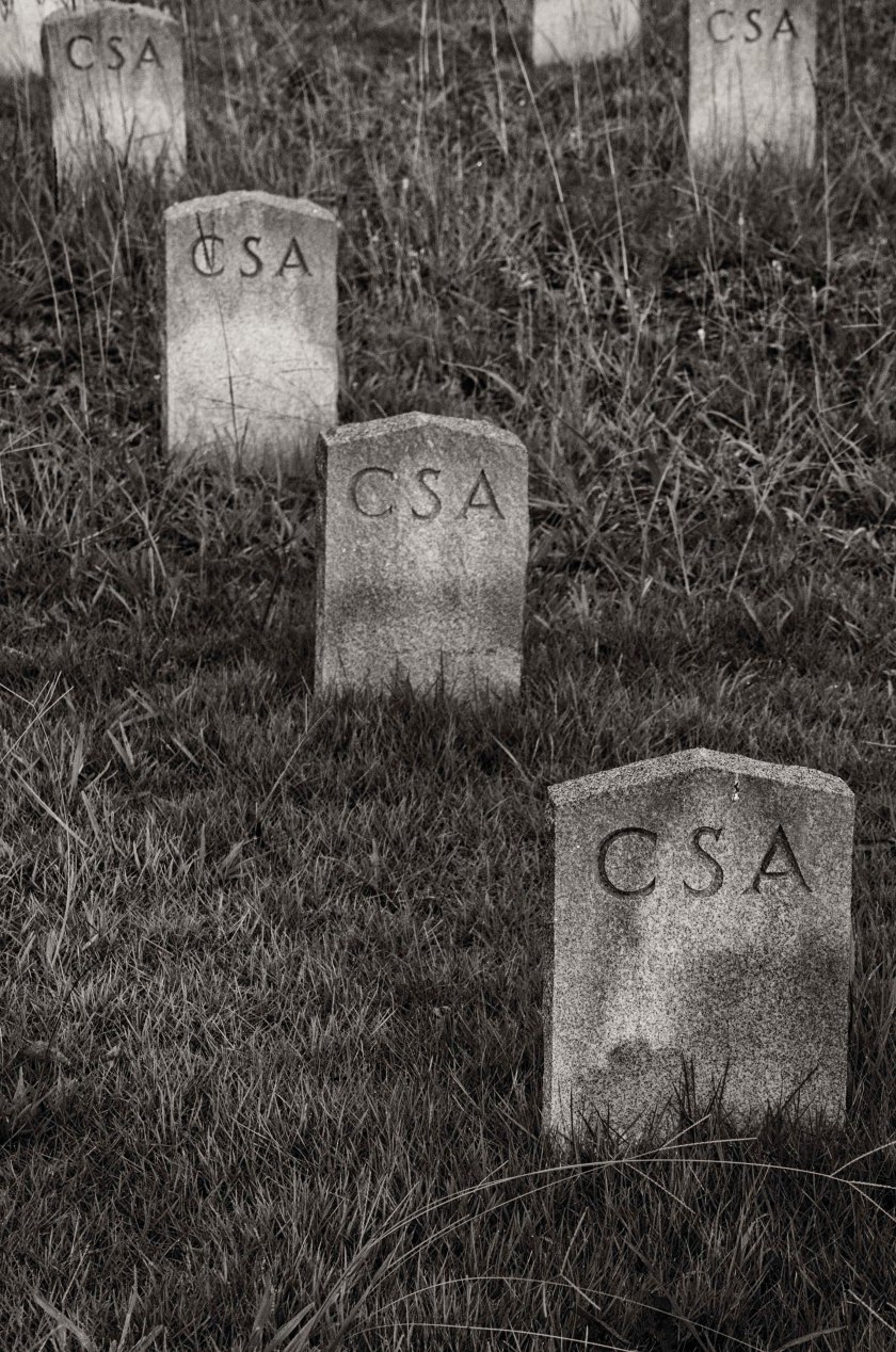
During the day of July 19th, General Geary’s 2nd Division of the 20th Corps, Army of the Cumberland (US), crossed Peachtree Creek in this area via foot bridges. They were support by a dozen pieces of artillery and heavy infantry support. Logs that had been prepared earlier were brought forward and several foot bridges were built under fire. The 3rd Brigade crossed under fire a seized the ridge south of the creek and held the bridgehead until the remaining two Brigades could cross. By daybreak on the 20th, two more bridges had been built with freshly cut wagon roads to bring supplies forward.Atlanta Memorial Park now sits in the area the Geary’s Division crossed under fire to establish their bridgehead. They would have crossed here from right to left and worked their way up to the low ridge line.Two Brigades of General Palmer’s 14th Corps, Army of the Cumberland(US), crossed Peachtree Creek about a half mile west of Howell’s Mill after two days of heavy skirmishing. On the night of the 19th, Two Brigades of General Baird’s 3rd Division of the 14th Corps, Army of the Cumberland(US), made a night crossing hear Peachtree Creek at the site of Howell’s Mill.Railroad tracks of Stone Mountain. Throughout the 18th and 19th of July 1864, Garrard’s Cavalry(US) along with General Lightburn’s 2nd Brigade, of the 2nd Division of the 15th Corps, Army of the Tennessee(US), worked diligently to destroy the railroad that lead west to Atlanta and east to Augusta. They destroyed several miles of tracks, 200 bales of cotton and the stores of the Quartermaster and Commissary that were supplying the Confederates in Atlanta.The Hamilton House, Stone Mountain. This structure was built in 1836 and was used as a hotel until the Civil War and was later used as a Hospital. Because of its use as a Hospital, it was saved from the destruction of the Federal troops.The Stillwell House, Stone Mountain. This structure built in 1820 served as a Confederate Hospital during the Civil War and has just recently opened as a the Stillwell House Bed and Breakfast.The Stone Mountain Cemetery contains many Confederate graves. 150 of them are unknown soldiers who died here in the local hospitals from their wounds of diseases. Some of the died skirmishing with Garrard’s Cavalry and Lightburn’s Brigade as they came to destroy the railroads.
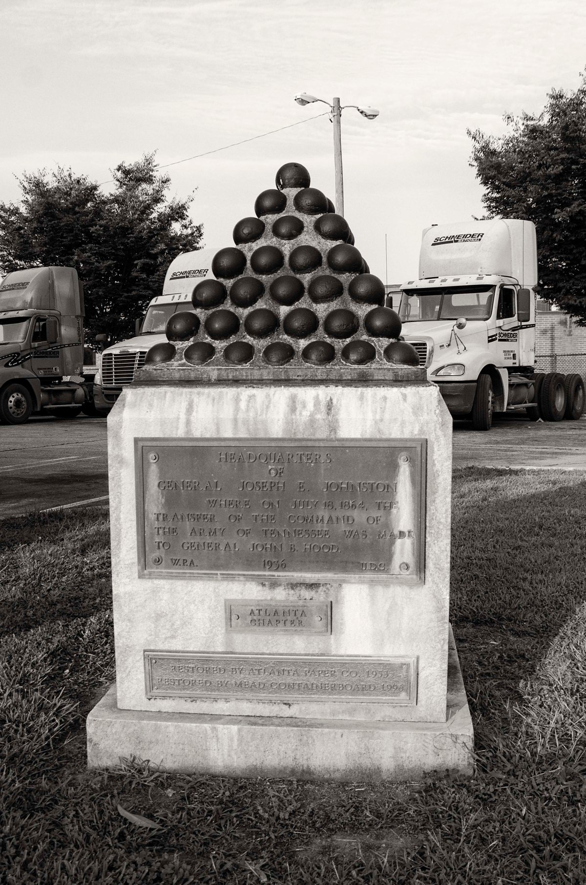
General Joseph E. Johnston is officially relieved of command of the Confederate Army of Tennessee. President Davis promote Lt. General John. B. Hood to be the new commander of the Army of Tennessee. Davis advised Johnston the he was relieved of command due to his inability to stop the Federals from reaching Atlanta and that he did not have confidence that he could prevent the Federals from capturing Atlanta and destroying the Army of Tennessee. Johnston was very well liked among his troops and many were in disbelief.
This change in command has come at a crucial time as the Federals have just crossed the Chattahoochee River. The Army of the Cumberland crosses at Pace’s Ferry and Power’s Ferry and are advancing toward Peachtree Creek. General McPherson’s Army of the Tennessee, has crossed the river at Roswell and has been moving south through Dunwoody toward the Augusta Railroad line near Decatur. They reach it on the 18th and destroy about four miles of it in between Stone Mountain and Decatur, in an attempt to disrupt the supplies, and possibly reinforcements, coming from the east. McPherson then turns west and moves towards Decatur.
Wheelers Cavalry had been skirmishing with the Federals approaching Peachtree Creek for several days, but today they burn the bridges over Peachtree Creek at Moore’s Mill, Howell’s Mill, and on Ridgewood Road. They then move south east to intercept McPherson’s Army of the Tennessee near Decatur.
The pieces are nearly in place for the first of two major battles to happen on the outskirts of Atlanta. Soon the two armies will clash in the Battle of Peachtree Creek and then two days later at the Battle of Atlanta.
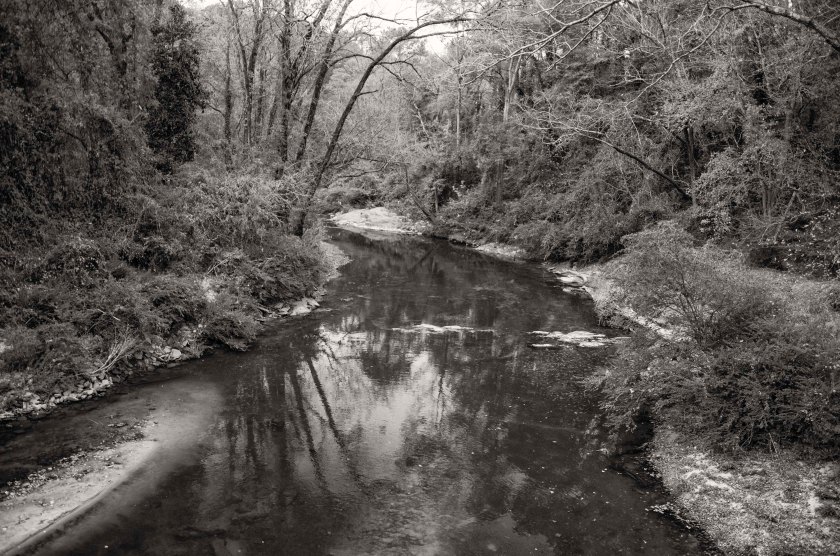
Peachtree Creek, once a strategic obstacle for the advancing Federals, now sits nestled between neighborhoods and park.Moore’s Mill at Peachtree Creek. The original wooden bridge would have been located to the left of the current bridge. After encountering the advancement of Federal troops, Confederate skirmishers were forced across the bridge and burned it in an attempt to stall the Federal advance.Another bridge across Peachtree Creek, here at Howell’s Mill, was burned by Confederate skirmishers in an attempt to slow down the Federals as they moved on Atlanta.As General McPherson’s men moved from Roswell they passed through Dunwoody where they split their columns to take advantage of multiple roads in an effort to move faster. Here along Johnson Ferry Road at Nancy Creek, Dodge’s 16th Corps, on the right of McPherson’s Army of the Tennessee(US), linked up with General Cox’s 3nd Division of the 23rd Corps, Army of the Ohio. They camped here along the creek for a night before proceeding to Decatur. Part of Dodge’s 16th Corps camped here at Ashford Dunwoody Road and Nancy Creek. Now a large athletic complex covers their camp.Logan’s 15th Corps and Blair’s 17th Corps moved down what is now N. Shallowford Road. They camped along Nancy Creek in the area of I-285 and N. Shallowford Road.Nestled in a small copse of trees off of Peachtree Road in Brookhaven, the Solomon Goodwin House is the oldest structure in Dekalb County and also the oldest inside the “Perimeter (I-285). The oldest portion was built in 1831 and expanded to it’s current size in the 1840’s. The home was a landmark on maps at the time and both Hascall’s and Cox’s Divisions of the 23rd Corps, Army of the Ohio, passed by here on their movement south. There are still dents in the mantel from rifle butts. Now the clubhouse for the Peachtree Golf Club, the Samuel House Plantation was a landmark for the advancing Federals. Cox’s 3rd Division of the General Schofield’s 23rd Corps, Army of the Ohio, camped here on the plantation grounds. General Schofield, along with General Sherman were accompanying the Division, made their Headquarters here.Browning’s Court House was another area landmark on McPherson’s route to Decatur. Originally located at the intersection of Lavista Road and Fellowship Road, it has been moved to property owned by the county in order to preserve the structure. Logan’s 15th Corps moved to this point to support elements of Garrard’s Cavalry as them moved to destroy the railroad tracks in nearby Stone Mountain.The railroad in Decatur looking east towards Stone Mountain and on to Augusta. This was McPherson’s goal. He was charged with destroying the railroad in order to prevent supplies and reinforcements from reaching Atlanta from the east.
Over the last several days and continuing into the next several days, General Sherman is resting his troops and changing their positions in preparation for an assault on Atlanta. He is trying to deceive General Johnston into believing the attack will come from the west. To do this, he has sent Stoneman’s Cavalry on a raid towards Newnan to destroy the Railroad that connects Atlanta with Alabama. Stoneman’s Cavalry cross the Chattahoochee near Campbelton and skirmish with Confederates along the way. They are unsuccessful and fall back to Villa Rica before returning to the Federal lines along the Chattahoochee. During this time, Sherman is shifting several Corps from his right flank to the left flank at the river crossing in Roswell. The Federal soldiers crossing at Roswell will be shifted to the east of Atlanta. While both armies rest from the rigors of the campaign, there is a great deal of fraternization between the soldiers stationed along the Chattahoochee. There are many documented accounts of trading, usually the Confederates trading tobacco for coffee, as well as other goods and small items. There are accounts of Regimental bands on both sides having competitions and serenading the troops on the opposite side of the river. For some soldiers, this is the first time the have been able to have a bath in weeks. Even General Sherman himself, takes a bath in the river.
For General Johnston, this is a time of uncertainty, President Davis has sent Braxton Bragg, former Commander of The Army of Tennessee, to ascertain the tactical situation in Atlanta and to find out what Johnston plans to do. Davis is considering replacing Johnston and is relying on advice from Bragg as to who the replacement of Johnston should be. This decision would have great bearing on the outcome of the campaign. They met at Johnston’s Headquarters which was established at the Dexter Niles house along the Atlanta road between the Chattahoochee river and the city.
Well preserved Federal earthworks near Roswell, Ga. These were part of the bridge head established by General McPherson’s Army of the Tennessee (US). These works were manned by the 2nd Division of the XV Army Corps.Stones,stacked by Federal soldiers fortifying their positions, are still in place 150 years later at their bridge head near Roswell.Remnants of a Federal trench located on a ridge overlooking the Chattahoochee river near Cochran Shoals. This site is located with an office park.After crossing the Chattahoochee at Powers Ferry, the IV AC (US), established a bridgehead on the high ground above the river. Northside Drive now runs along this same ridge and several home owners have the remains of Federal earthworks in their front yards.Remains of a Federal trench along Northside Drive, manned by the IV AC(US), after crossing the Chattahoochee River.Remnants of an artillery battery that was maned by elements of the IV Army Corps (US). Now located near the intersection of Northside Drive and River View Drive in the side yard of private residence.Site of the Cagle house where General O.O. Howard established his Headquarters and along with General Sherman and other officers, had a meeting to plan their next moves in the campaign. That meeting was depicted in the sketch below that appeared in Harper’s Weekly in September of 1864.Sketch of General Sherman and other officers at the Cagle house, this sketch appeared in a September issue of Harper’s Weekly.Site of the Dexter Niles house where General Johnston (CS) established his headquarters after retreating across the Chattahoochee River upon learning of Federal crossing north of his River Line position. It was here that he would be relieved of command and General John Bell Hood would be command of the Army of Tennessee.
After the first Federal crossing of the Chattahoochee at Sope Creek on the afternoon of the 8th, Garrard’s Cavalry crosses at Roswell. At dawn on the 9th, a Federal Battery provides covering fire as several companies of dismounted cavalry begin wading across the Chattahoochee at what is called the “Shallow Ford”. It was the ford used by the Hightower Trail which was a prehistoric trading route. They engage a small Confederate force across the river. The Confederates are out numbered and out gunned and they quickly retreat and some surrender. The Federals are armed with Spencer repeating rifles and are able to move and shoot quickly without stopping while they cross the river. The battery that is providing cover fire is the Chicago Board of Trade Battery. When Sherman learns of Garrard’s crossing of the river, he immediately dispatches Newton’s Division from its camp near Rottenwood Creek, to Roswell “double time”, to reenforce Garrard. He also sends Dodge’s Corps to reenforce Garrard and establish a strong bridgehead for subsequent crossings. A detachment of General McCook’s Cavalry, the 1st Tennesse Regiment (US), under the command of Colonel Brownlow, dismounted and crossed the river enforce wearing only their hats and carrying their rifle and cartridge box.
After receiving information about these crossings and size of the forces at each crossing, General Johnston orders the fall back from the River Line. The Confederate army begins to retreat from the River Line at dusk and in the early morning hours of the 10th, they are across the river and begin to burn the Railroad bridge and the wagon bridge next to it. They also take up their pontoon bridges and at Pace’s Ferry they cut the pontoon bridge loose hoping it will swing across the river or down stream where they can recover it. It becomes stuck and is recovered by the Federals, but not put into use.
General Johnston establishes his Headquarters 3 miles from Atlanta, at the abandoned Dexter Niles house. He orders that the river crossings at Pace’s Ferry and Turner’s Ferry, be heavily guarded.
The first crossing of the Chattahoochee River by Federal troops happened here at the confluence of Sope Creek and the river. The neighborhood pool on the southern shore is the location of the Ferry landing where the Federal troops made their assault. “Shallow Ford” in Roswell was the site of the Federal crossing by several companies of Garrard’s Cavalry dismounted and with their new Spencer rifles and supporting fire from the Chicago Board of Trade Battery, they fought their way across the river.What is now a Cul-de-sac was once the location of the Chicago Board of Trade Battery that support Garrard’s crossing of the river at Shallow Ford.
Col. Brownlow and his dismounted Cavalry crossed the river just about Powers Ferry at Cochran’s Ford. They crossed wearing only their hats and carried their rifle and cartridge box.
Rottenwood Creek: When General Sherman learned of Garrard’s crossing at Roswell he dispatched Newton’s Division double time to Roswell to reinforce Garrard. Newton’s Division was camped near the area of present day Cumberland Blvd, I-75 and I 285. They crossed Rottenwood Creek on a wooden bridge just above this small cascade.
General Johnston’s Army of Tennessee now occupies the River Line and they have the Chattahoochee River to their back and the Federals to their front. General Sherman is looking for another route across the river that would allow him to turn Johnston’s Flank and force him from the River Line. The images below are from the southern half of the river line.
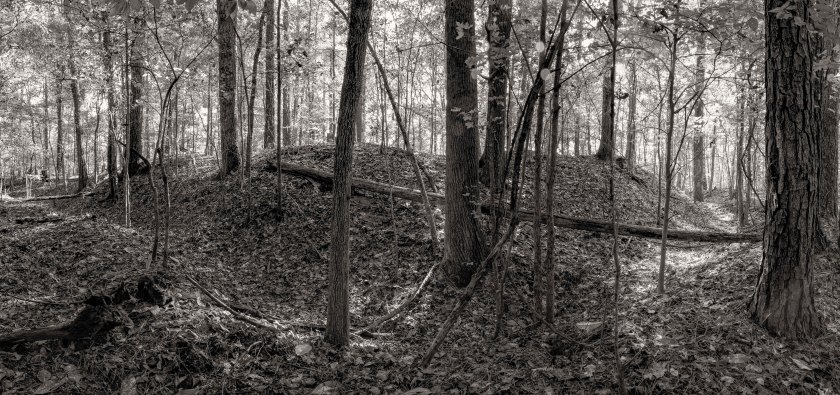
Remnants of a large artillery battery at the far south end of the River Line. General Hood’s forces held the is area which was the left of the Confederate line.A dead tree spans the remains of Confederate earthworks along the River Line.Several thousand feet of earthworks, including a Shoupade and large artillery battery are still in great condition and have survived the years of urban sprawl in Metro Atlanta.The inside of one of the Shoupades in what is known as the River Line Extension.Looking south on Oakdale road. They Confederate River Line followed the ridge line that Oakdale Road follows. In a few spots along the road you can still see remnants of Confederate works on the left as you drive south.Nickajack Creek and its valley separated the Confederate River Line from the Federal lines to the west.
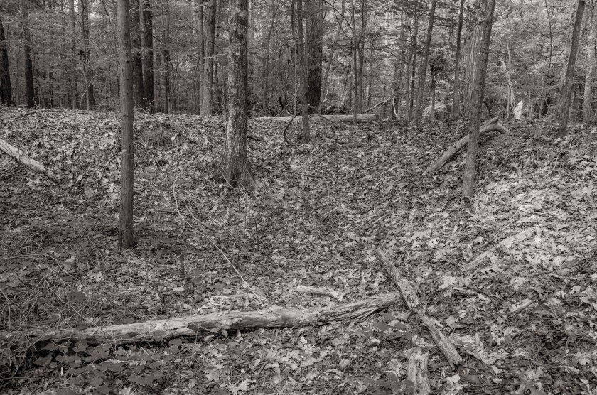
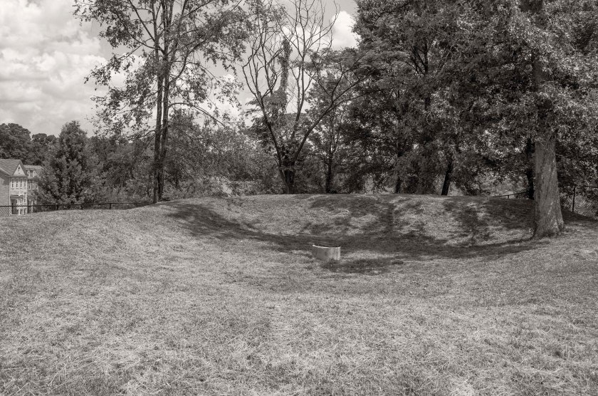
In the early morning hours, General Johnston and the Army of Tennessee, retreat from the Smyrna Line and fell back to the last line of previously prepared fortifications before the Chattahoochee River. Known as the River Line, it was conceived and constructed by Brigadier General Francis Asbury Shoup, Chief of Artillery for the Army of Tennessee. The River Line had a new style of fortification in the line, they were called a Shoupade. They were diamond shaped forts built with two of the angles sticking out ahead of the line. The Shoupades were placed anywhere from 60 to 175 yards apart depending on the terrain and were connected by earthworks that intersected the Shoupade roughly in the center. The angled section in front of the line from two adjoining Shoupades, allowed for a crossfire on an advancing enemy. Each Shoupade could hold 80 soldiers shoulder to shoulder. They were also constructed to withstand an extended artillery barrage. The Confederates occupied this line until the night of July the 9th, when the retreated across the river.
These images are from the northern half of the river line. Tomorrow I will post images from the southern half of the river line.
Looking at the inside of one of the best preserved of the remaining Shoupades. This one now sits hidden in the woods and covered with English Ivy just a stones through away from a major expressway.
Shoupade Park, Cobb County. Remnants of one of two Shoupades in the park. There are also remnants of an artillery battery.The second Shoupade at Shoupade park fenced off and covered with brush, but you can still see its size and shape.A child’s tree house now stands guard over the remains of a large Confederate artillery battery located near the northern end of the River Line.The crossed the Atlanta Road at this point. Atlanta road, the road passing from the left to right of the image, is a period road that is still in use today.The Confederates River Line crossed the railroad tracks here along the high ground at this railroad cut.River Line Park, Cobb County. The remains of a Shoupade are fenced off and still visible and protected in this park with ball fields and walking trails.
The Federal troops continue to chase the Confederates and soon, as they approached Smyrna, they begin to encounter resistance from Confederate Skirmishers. They were pushed back to their main lines and the Federals began to entrench. Elements of Howard’s and Palmer’s Corps of the Army of the Cumberland advanced on the portion of the Confederate Smyrna Line near Smyrna Camp Ground, roughly the center of the Confederate line. They were engaging seasoned troops of Cleburne’s Division and suffered heavy losses. The second portion of the attack was made by Dodge’s Corps of the Army of the Ohio, they attacked the Confederate Left near Ruff’s Mill. There was a salient in the Confederate line near this point that was their target. This is where Hood’s and Hardee’s Corps met. Elements of Dodge’s Corps pushed the skirmishers of Stevenson’s Division out of their rifle pits and back to their main works, but suffered heavy losses during the assault. These attacks gained no ground for the Federals and only confirmed that the Confederate army was still in the line enforce.
The main Federal advantage gained this day, was Blair’s Corps being able to work its way around and behind the Confederate left flank. At that point they were closer to Atlanta than the main body of the Confederate Army. Blair’s movement seriously threatened Johnston and in the late night hours of July 4th and early morning hours of July 5th, Johnston fell back from the Smyrna Line to the last line of defense west of the Chattahoochee River, known at Johnston’s River Line.
The Smyrna Market Village now occupies the former location of the Smyrna Camp Ground, which was used as a meeting site for the Methodist Church as well as other denominations.Looking north west at the recreation of an old train depot. The railroad tracks are just out of frame to the right and the Confederate line crossed the tracks in this general area. Smyrna Campground would have been to the left just out of the frame.Looking south along the railroad tracks that head into Atlanta. Notice the reconstructed depot to the right. The Confederate lines crossed the tracks in this general area. Looking north west from Smyrna up the railroad tracks that travel out of Marietta. Notice Kennesaw Mountain in the distance approximately five miles away.Looking from the Confederate line towards Kennesaw Mountain approximately 5 miles away. The Confederate line at Smyrna followed the low ridge line that the current Concord road follows and then takes a turn to form a salient angle that followed high ground along what is now N. Cooper Lake Road.Concord Road, the Confederate line followed this high ground. This is all that remains of Ruff’s Mill. Now on private property, this brick structure dating back before the civil war was spared by the Federal Troops as it was a grist mill they could use for food production.The Concord Covered Bridge was destroyed by the Federal troops on July 4th, 1864. It was rebuilt in the late 1870’s. The stacked stone pier in the middle of the bridge is all that remains of the original structure.
During the attack on Kennesaw Mountain the Federals set an artillery battery containing 24 guns in total. It was located on a low rise near the base of Big Kennesaw Mountain. These images are from the 24 gun battery which is protected by the National Park.
Just in side the tree line of this low rise near the base of Kennesaw Mountain is the Federal 24 gun battery.Remnants of one of the parapet walls at the 24 gun battery.The gun notch is still slightly visible in the remnants of this parapet wall.A view looking down the line of earthworks for the 24 gun battery. Four separate emplacements are visible along this line.Looking from the rear of the emplacement in the direction the gun would have faced.
With so many locations in connection with the battlefield at Kennesaw Mountain, I am going to make several more post over the next few days with more images. There were just too many to include in yesterdays post. Today’s images will focus on Pigeon Hill.
On the morning of June 27th, Federals under the command of General McPherson attacked the Confederate line in the area of Pigeon Hill and Little Kennesaw north east of Cheatham’s Hill. The Federals quickly overran some Confederate pickets and rifle pits located ahead of the main line, but were quickly stalled by the well entrenched Confederates of French’s Division, which held Little Kennesaw and Pigeon Hill. The Confederates well entrenched with plenty of large boulders and rocks used as cover in their earthworks. At one point the Confederates were even rolling boulders and large down on the attacking Federals. French’s Division also held the advantage of the higher ground thus forcing the Federals to attack up steep inclines that had been heavily covered with entanglements by the men of French’s Division. The attacking Federals were repulsed and forced to retreat to low valley between Little Kennesaw and Pigeon Hill where they were trapped by musket and cannon fire for hours. They were finally able to retreat back to their lines after darkness fell upon the battlefield.
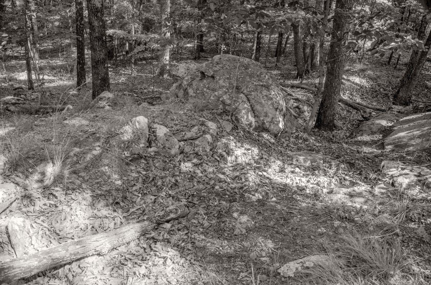
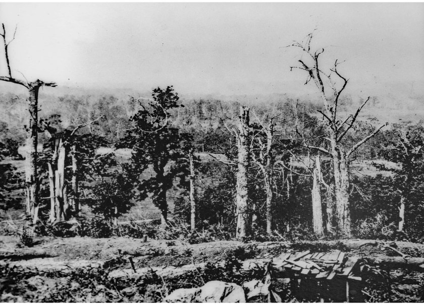
A monument to fallen Federals stands in a field near starting point of the Federal assault on Pigeon Hill. The hiking trail up to Pigeon Hill and Little Kennesaw follows the route that Federal soldiers took during the attack. Look to where the trail appears to end(but really turns left). You will the what are the remains of Confederate earthworks just as the attacking Federals would have seen.Remnants of Confederate Earthworks on Pigeon Hill. These are some of the first entrenchments that were encountered by the Federal assault.Remains of Confederate earthworks on Pigeon Hill near the spot where George Barnard made an image of the battlefield in the fall of 1864.A line of Confederate works on top of Pigeon Hill near the lower portion of Little Kennesaw. Notice the large boulders further down the line and the slope as goes do to the right where the Federals were trapped until nightfall.More Confederate works with large boulders included into the line.Looking down the slope the Federals tried to make an attack from. During the battle the Federals were forced to retreat further down this small valley until the could make it back to their lines under the cover of darkness.This is a period image captured by photographer George Barnard in the early fall of 1864 as he traveled to Atlanta to photograph the campaign.Here is the same location photographed by George Barnard only 150 years later. Notice the large oddly shaped stone in the foreground of each image.